
| Memorials | : | 0 |
| Location | : | Leonardville, Riley County, USA |
| Coordinate | : | 39.3568700, -96.8493600 |
frequently asked questions (FAQ):
-
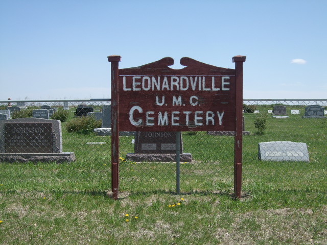
Where is Leonardville United Methodist Cemetery?
Leonardville United Methodist Cemetery is located at 10390 Crooked Creek Road Leonardville, Riley County ,Kansas ,USA.
-
Leonardville United Methodist Cemetery cemetery's updated grave count on graveviews.com?
0 memorials
-
Where are the coordinates of the Leonardville United Methodist Cemetery?
Latitude: 39.3568700
Longitude: -96.8493600
Nearby Cemetories:
1. Leonardville Cemetery
Leonardville, Riley County, USA
Coordinate: 39.3792000, -96.8589020
2. Fairview Cemetery
Riley, Riley County, USA
Coordinate: 39.3351300, -96.8291700
3. Walsburg Lutheran Cemetery
Leonardville, Riley County, USA
Coordinate: 39.3931100, -96.8133200
4. Mill Creek Cemetery
Riley, Riley County, USA
Coordinate: 39.3353004, -96.7742004
5. Riley Cemetery
Riley, Riley County, USA
Coordinate: 39.2882996, -96.8125000
6. Crooked Creek Cemetery
Randolph, Riley County, USA
Coordinate: 39.4369011, -96.8480988
7. Bala Cemetery
Bala, Riley County, USA
Coordinate: 39.3053017, -96.9341965
8. Lasita Cemetery
Leonardville, Riley County, USA
Coordinate: 39.4092900, -96.9422900
9. Hohman Cemetery
Manhattan, Riley County, USA
Coordinate: 39.3488300, -96.7188500
10. Pleasant Hill Cemetery
Leonardville, Riley County, USA
Coordinate: 39.4371210, -96.9426730
11. Ebenezer Cemetery
Green, Clay County, USA
Coordinate: 39.3866997, -96.9974976
12. Saint Johns Lutheran Cemetery
Winkler, Riley County, USA
Coordinate: 39.4813995, -96.8494034
13. Green Cemetery
Green, Clay County, USA
Coordinate: 39.4235992, -96.9882965
14. Teske Family Cemetery
Randolph, Riley County, USA
Coordinate: 39.4963830, -96.8294000
15. Gatesville Cemetery
Wakefield, Clay County, USA
Coordinate: 39.2721460, -97.0041380
16. Samuel Rolander Gravesite
Olsburg, Pottawatomie County, USA
Coordinate: 39.4507100, -96.6998400
17. May Day Cemetery
Center Township, Riley County, USA
Coordinate: 39.4958000, -96.9302979
18. Fancy Creek Cemetery
Green, Clay County, USA
Coordinate: 39.4668999, -96.9969025
19. Sedalia Cemetery
Manhattan, Riley County, USA
Coordinate: 39.2616950, -96.6839410
20. Broughton Cemetery
Clay Center, Clay County, USA
Coordinate: 39.3306007, -97.0535965
21. Timber Creek Cemetery
Wakefield, Clay County, USA
Coordinate: 39.2182999, -96.9805984
22. Fancy Creek Randolph Cemetery
Randolph, Riley County, USA
Coordinate: 39.5149994, -96.7572021
23. Clay County Poor Farm Cemetery
Clay Center, Clay County, USA
Coordinate: 39.3772700, -97.0727000
24. Carnahan Creek Cemetery
Olsburg, Pottawatomie County, USA
Coordinate: 39.3359337, -96.6255188