
| Memorials | : | 0 |
| Location | : | Leonardville, Riley County, USA |
| Coordinate | : | 39.4371210, -96.9426730 |
| Description | : | From Leonardville, take Barton Road, Highway 24, west four miles to Lasita Road, County 873. Turn right (north)and go five miles. The cemetery is at the southwest corner of the intersection of Lasita Road, County 873, and Green - Randolph Road, County 378. |
frequently asked questions (FAQ):
-
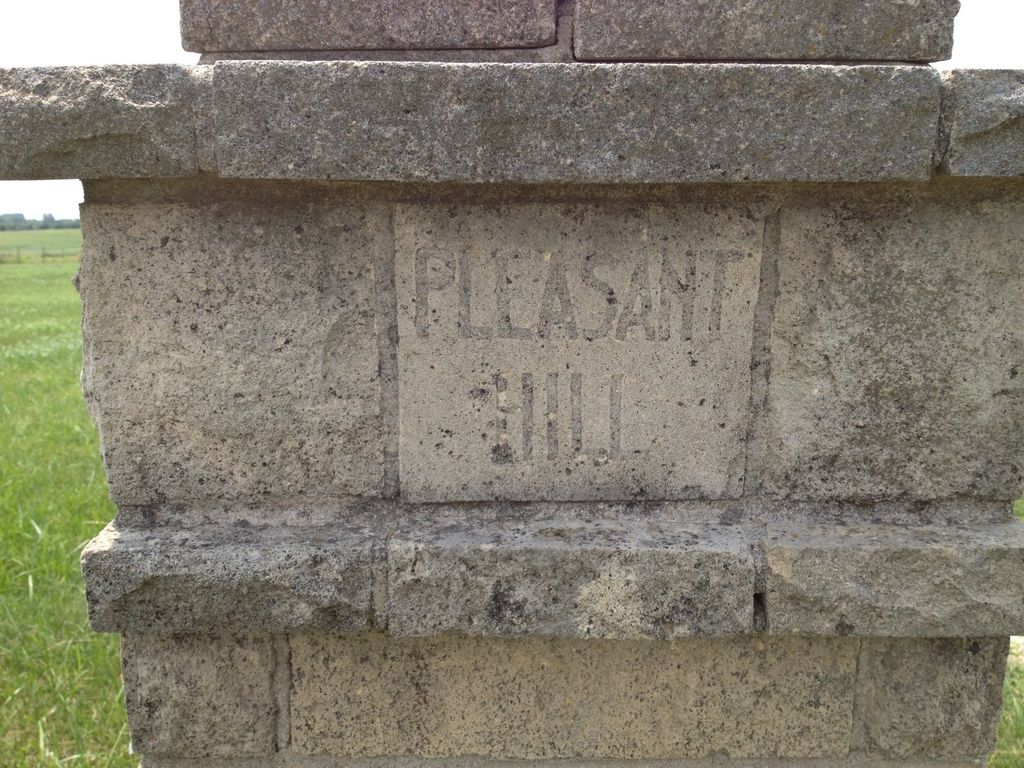
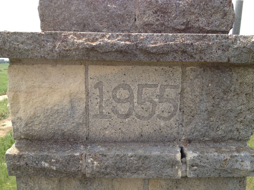
Where is Pleasant Hill Cemetery?
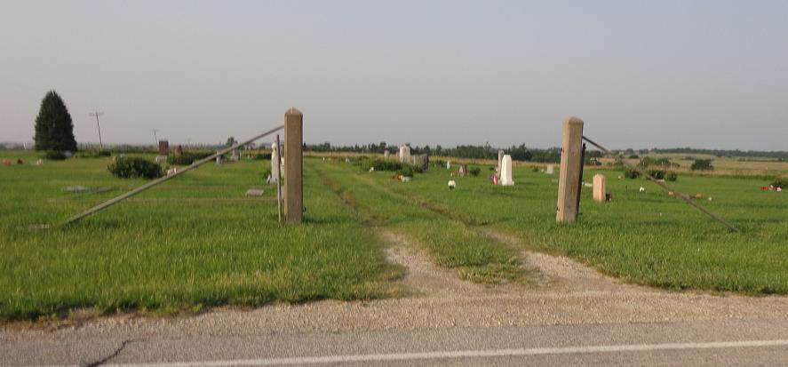
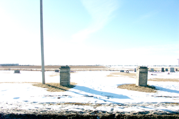
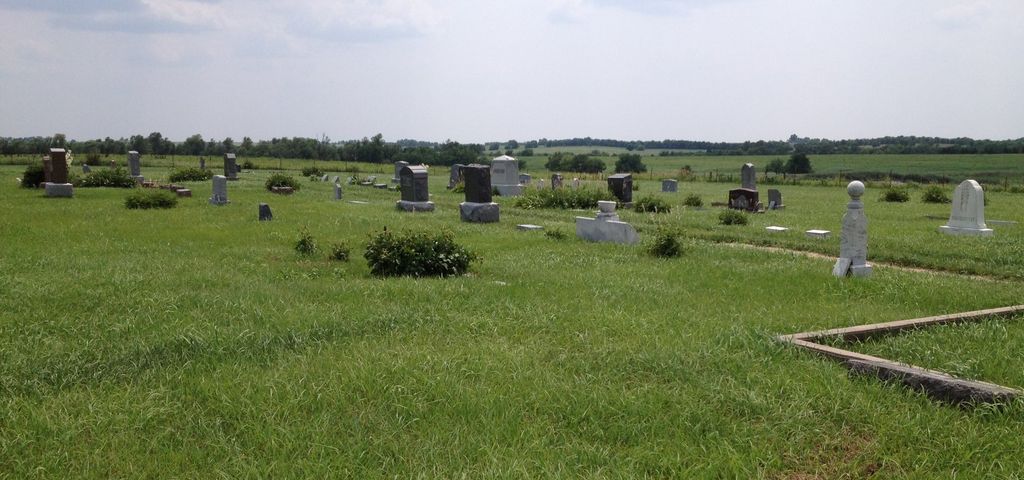
Pleasant Hill Cemetery is located at 17721 Green Randolph Road Leonardville, Riley County ,Kansas ,USA.
-
Pleasant Hill Cemetery cemetery's updated grave count on graveviews.com?
0 memorials
-
Where are the coordinates of the Pleasant Hill Cemetery?
Latitude: 39.4371210
Longitude: -96.9426730

Nearby Cemetories:
1. Lasita Cemetery
Leonardville, Riley County, USA
Coordinate: 39.4092900, -96.9422900
2. Green Cemetery
Green, Clay County, USA
Coordinate: 39.4235992, -96.9882965
3. Fancy Creek Cemetery
Green, Clay County, USA
Coordinate: 39.4668999, -96.9969025
4. May Day Cemetery
Center Township, Riley County, USA
Coordinate: 39.4958000, -96.9302979
5. Ebenezer Cemetery
Green, Clay County, USA
Coordinate: 39.3866997, -96.9974976
6. Crooked Creek Cemetery
Randolph, Riley County, USA
Coordinate: 39.4369011, -96.8480988
7. Brethren in Christ Cemetery
Clay County, USA
Coordinate: 39.4810982, -97.0344009
8. Saint Johns Lutheran Cemetery
Winkler, Riley County, USA
Coordinate: 39.4813995, -96.8494034
9. Leonardville Cemetery
Leonardville, Riley County, USA
Coordinate: 39.3792000, -96.8589020
10. Goshen Central Cemetery
Clay Center, Clay County, USA
Coordinate: 39.5099983, -97.0160980
11. Appleton Cemetery
Clay County, USA
Coordinate: 39.5250015, -96.9972000
12. Joseph Sender Family Cemetery
Clay County, USA
Coordinate: 39.5090600, -97.0348800
13. Teske Family Cemetery
Randolph, Riley County, USA
Coordinate: 39.4963830, -96.8294000
14. Leonardville United Methodist Cemetery
Leonardville, Riley County, USA
Coordinate: 39.3568700, -96.8493600
15. Hayes Cemetery
Clay County, USA
Coordinate: 39.4516983, -97.0811005
16. Walsburg Lutheran Cemetery
Leonardville, Riley County, USA
Coordinate: 39.3931100, -96.8133200
17. Clay County Poor Farm Cemetery
Clay Center, Clay County, USA
Coordinate: 39.3772700, -97.0727000
18. Idylwilde Cemetery
Clay Center, Clay County, USA
Coordinate: 39.5097900, -97.0713000
19. Zion Cemetery
Randolph, Riley County, USA
Coordinate: 39.5526139, -96.8853800
20. Bala Cemetery
Bala, Riley County, USA
Coordinate: 39.3053017, -96.9341965
21. Fairview Cemetery
Riley, Riley County, USA
Coordinate: 39.3351300, -96.8291700
22. Broughton Cemetery
Clay Center, Clay County, USA
Coordinate: 39.3306007, -97.0535965
23. Saint Peter and Saint Pauls Catholic Cemetery
Clay Center, Clay County, USA
Coordinate: 39.4005450, -97.1236680
24. Swedish Pleasant Hill Cemetery
Clay Center, Clay County, USA
Coordinate: 39.4735985, -97.1268997