
| Memorials | : | 0 |
| Location | : | Eastland County, USA |
| Coordinate | : | 32.1514015, -99.0883026 |
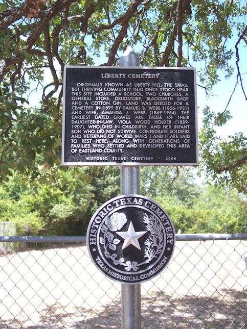
| Description | : | To get to the cemetery from Cisco take Hwy 206 sw 16 miles. Turn left (south) on FM 569. Go 4 miles to CR 376, turn right. The cemetery is about 1/10 mile west of the intersection. Land for the cemetery was deeded on March 4, 1899 by Samuel Blackwell Webb and his wife Amanda J. Holder Webb. The 1963 survey was done by their daughter Hettie Webb Lacy, and includes the names of those buried in unmarked graves. |
frequently asked questions (FAQ):
-
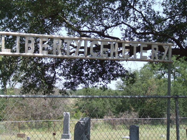
Where is Liberty Cemetery?
Liberty Cemetery is located at Eastland County ,Texas ,USA.
-
Liberty Cemetery cemetery's updated grave count on graveviews.com?
0 memorials
-
Where are the coordinates of the Liberty Cemetery?
Latitude: 32.1514015
Longitude: -99.0883026
Nearby Cemetories:
1. Salt Tank Cemetery
Rising Star, Eastland County, USA
Coordinate: 32.1569800, -99.0298600
2. Pioneer Cemetery
Pioneer, Eastland County, USA
Coordinate: 32.0993996, -99.0836029
3. Sabanno Cemetery
Sabanno, Eastland County, USA
Coordinate: 32.2075005, -99.0960999
4. Cross Plains Memorial Park
Cross Plains, Callahan County, USA
Coordinate: 32.1245850, -99.1706400
5. Wayside Cemetery
Eastland County, USA
Coordinate: 32.1991997, -99.0132980
6. Union Cemetery
Union Center, Eastland County, USA
Coordinate: 32.2141900, -99.0135140
7. Haskell Cemetery
Eastland County, USA
Coordinate: 32.2557983, -99.0963974
8. Old Cottonwood Cemetery
Cottonwood, Callahan County, USA
Coordinate: 32.2025380, -99.2033730
9. Cottonwood West Cemetery
Cottonwood, Callahan County, USA
Coordinate: 32.2024610, -99.2051700
10. Atwell Cemetery
Putnam, Callahan County, USA
Coordinate: 32.2572080, -99.1327020
11. Oglesby Cemetery
Callahan County, USA
Coordinate: 32.1781006, -99.2249985
12. Nimrod Cemetery
Cisco, Eastland County, USA
Coordinate: 32.2727000, -99.0533000
13. Rising Star Cemetery
Rising Star, Eastland County, USA
Coordinate: 32.1000850, -98.9538170
14. Caddo Peak Cemetery
Callahan County, USA
Coordinate: 32.1671982, -99.2363968
15. Dressy Cemetery
Cross Plains, Callahan County, USA
Coordinate: 32.1060982, -99.2311020
16. Blake Cemetery
Williams, Brown County, USA
Coordinate: 32.0292350, -99.0369860
17. Romney Lutheran Cemetery
Romney, Eastland County, USA
Coordinate: 32.2128010, -98.9514110
18. Cross Cut Cemetery
Cross Cut, Brown County, USA
Coordinate: 32.0228004, -99.1314011
19. Monroe Cemetery
Nimrod, Eastland County, USA
Coordinate: 32.2867310, -99.0677320
20. Romney Cemetery
Romney, Eastland County, USA
Coordinate: 32.2418830, -98.9585780
21. Pisgah Cemetery
Nimrod, Eastland County, USA
Coordinate: 32.3022003, -99.0447006
22. Scranton Cemetery
Scranton, Eastland County, USA
Coordinate: 32.3059420, -99.1157880
23. Lane Cemetery
Scranton, Eastland County, USA
Coordinate: 32.3088300, -99.0796900
24. Burnt Branch Cemetery
Cross Plains, Callahan County, USA
Coordinate: 32.1561012, -99.2769012