
| Memorials | : | 0 |
| Location | : | Staley, Randolph County, USA |
| Coordinate | : | 35.7878000, -79.5724000 |
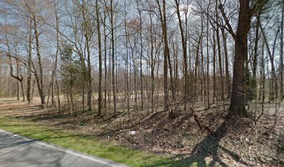
| Description | : | Brush Creek Settlement along Brush Creek west of Staley in Eastern Randolph County, North Carolina. The eastern side of the abandoned old Shady Grave Baptist Church Cemetery could possible be the logical location of the Lineberry Family Cemetery west of Staley. This is on the banks of the Brush Creek near the old John Staley school house and mill pound now gone. This location is just up the hill from the wagon road (now the Old Staley Road) that once forded Brush creek just west and below the double log cabin of the John Staley (German) and John Spoon... Read More |
frequently asked questions (FAQ):
-
Where is Lineberry Family Cemetery?
Lineberry Family Cemetery is located at Staley, Randolph County ,North Carolina ,USA.
-
Lineberry Family Cemetery cemetery's updated grave count on graveviews.com?
0 memorials
-
Where are the coordinates of the Lineberry Family Cemetery?
Latitude: 35.7878000
Longitude: -79.5724000
Nearby Cemetories:
1. Old Shady Grove Cemetery
Staley, Randolph County, USA
Coordinate: 35.7874985, -79.5725021
2. Shady Grove Baptist Church Cemetery
Staley, Randolph County, USA
Coordinate: 35.7853800, -79.5821020
3. Staley City Cemetery
Staley, Randolph County, USA
Coordinate: 35.7918300, -79.5507100
4. Olivers Chapel Cemetery
Staley, Randolph County, USA
Coordinate: 35.8060989, -79.5610962
5. Margarets Chapel Church Cemetery
Staley, Randolph County, USA
Coordinate: 35.8110940, -79.5648900
6. Hollys Chapel Pentecostal Holiness Church
Ramseur, Randolph County, USA
Coordinate: 35.7825600, -79.6048200
7. Mount Pleasant Baptist Church Cemetery
Staley, Randolph County, USA
Coordinate: 35.8144700, -79.5790000
8. McMasters Cemetery
Randolph County, USA
Coordinate: 35.8072370, -79.6021500
9. York Family Cemetery
Ramseur, Randolph County, USA
Coordinate: 35.7603000, -79.6108000
10. Marley Cemetery
Chatham County, USA
Coordinate: 35.7522011, -79.5430984
11. Bible Truth Church Cemetery
Ramseur, Randolph County, USA
Coordinate: 35.7485370, -79.6204580
12. Whites Chapel United Methodist Church Cemetery
Liberty, Randolph County, USA
Coordinate: 35.7850520, -79.6422990
13. Bethany United Methodist Church Cemetery #2
Liberty, Randolph County, USA
Coordinate: 35.8430060, -79.5948160
14. Rehobeth Methodist Church Cemetery
Ramseur, Randolph County, USA
Coordinate: 35.7288160, -79.5741310
15. Kildee Wesleyan Church Cemetery
Ramseur, Randolph County, USA
Coordinate: 35.7247960, -79.5741630
16. Fairview Cemetery
Liberty, Randolph County, USA
Coordinate: 35.8516998, -79.5761032
17. Caviness-Vestal Family Graveyard
Matthews Township, Chatham County, USA
Coordinate: 35.7271100, -79.5401700
18. Sandy Creek Primitive Baptist Church Cemetery
Liberty, Randolph County, USA
Coordinate: 35.8239020, -79.6406560
19. Hickory Grove Methodist Church Cemetery
Albright Township, Chatham County, USA
Coordinate: 35.8407560, -79.5217650
20. Patterson Grove Christian Church Cemetery
Ramseur, Randolph County, USA
Coordinate: 35.7743940, -79.6536550
21. Sandy Creek Baptist Church Cemetery
Liberty, Randolph County, USA
Coordinate: 35.8235550, -79.6429050
22. Amos Grove Cemetery
Liberty, Randolph County, USA
Coordinate: 35.8546982, -79.5871964
23. Saint Stephen Memorial Gardens
Liberty, Randolph County, USA
Coordinate: 35.8550750, -79.5877970
24. Friendship AME Church Cemetery
Ramseur, Randolph County, USA
Coordinate: 35.7463280, -79.6437970