
| Memorials | : | 2 |
| Location | : | Randolph County, USA |
| Coordinate | : | 35.8072370, -79.6021500 |
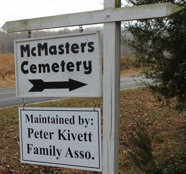
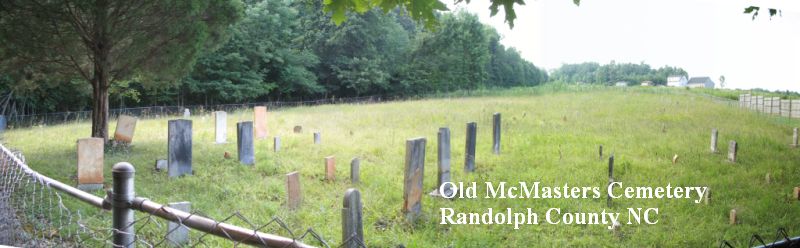
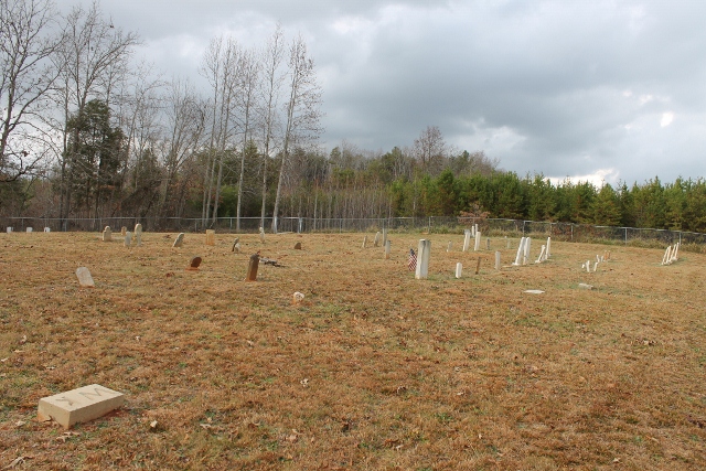
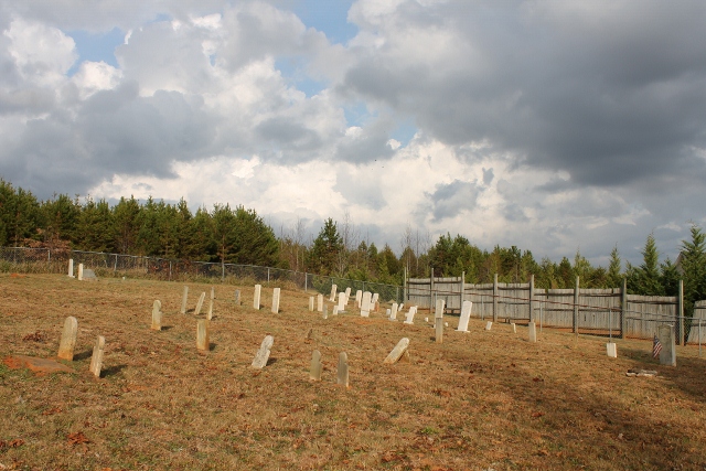
| Description | : | The McMasters Cemetery was established in 1787 and has been designated as a “Cultural Heritage Site” by the Randolph County Historic Preservation Commission on 26 March 3013. Directions: In Randolph County, south of Liberty, North Carolina west of Highway 49, west on Sandy Creek Church Road, then south to: 2435 Soapstone Mountain Road Staley (rural mail route), North Carolina 27355 |
frequently asked questions (FAQ):
-
Where is McMasters Cemetery?
McMasters Cemetery is located at Randolph County ,North Carolina ,USA.
-
McMasters Cemetery cemetery's updated grave count on graveviews.com?
2 memorials
-
Where are the coordinates of the McMasters Cemetery?
Latitude: 35.8072370
Longitude: -79.6021500


Nearby Cemetories:
1. Mount Pleasant Baptist Church Cemetery
Staley, Randolph County, USA
Coordinate: 35.8144700, -79.5790000
2. Hollys Chapel Pentecostal Holiness Church
Ramseur, Randolph County, USA
Coordinate: 35.7825600, -79.6048200
3. Shady Grove Baptist Church Cemetery
Staley, Randolph County, USA
Coordinate: 35.7853800, -79.5821020
4. Margarets Chapel Church Cemetery
Staley, Randolph County, USA
Coordinate: 35.8110940, -79.5648900
5. Lineberry Family Cemetery
Staley, Randolph County, USA
Coordinate: 35.7878000, -79.5724000
6. Old Shady Grove Cemetery
Staley, Randolph County, USA
Coordinate: 35.7874985, -79.5725021
7. Olivers Chapel Cemetery
Staley, Randolph County, USA
Coordinate: 35.8060989, -79.5610962
8. Sandy Creek Primitive Baptist Church Cemetery
Liberty, Randolph County, USA
Coordinate: 35.8239020, -79.6406560
9. Bethany United Methodist Church Cemetery #2
Liberty, Randolph County, USA
Coordinate: 35.8430060, -79.5948160
10. Sandy Creek Baptist Church Cemetery
Liberty, Randolph County, USA
Coordinate: 35.8235550, -79.6429050
11. Whites Chapel United Methodist Church Cemetery
Liberty, Randolph County, USA
Coordinate: 35.7850520, -79.6422990
12. Staley City Cemetery
Staley, Randolph County, USA
Coordinate: 35.7918300, -79.5507100
13. York Family Cemetery
Ramseur, Randolph County, USA
Coordinate: 35.7603000, -79.6108000
14. Amos Grove Cemetery
Liberty, Randolph County, USA
Coordinate: 35.8546982, -79.5871964
15. Fairview Cemetery
Liberty, Randolph County, USA
Coordinate: 35.8516998, -79.5761032
16. Saint Stephen Memorial Gardens
Liberty, Randolph County, USA
Coordinate: 35.8550750, -79.5877970
17. Melanchthon Lutheran Church Cemetery
Liberty, Randolph County, USA
Coordinate: 35.8451630, -79.6440640
18. Patterson Grove Christian Church Cemetery
Ramseur, Randolph County, USA
Coordinate: 35.7743940, -79.6536550
19. Bible Truth Church Cemetery
Ramseur, Randolph County, USA
Coordinate: 35.7485370, -79.6204580
20. Cool Springs Baptist Church Cemetery
Franklinville, Randolph County, USA
Coordinate: 35.8072420, -79.6805660
21. Friendship AME Church Cemetery
Ramseur, Randolph County, USA
Coordinate: 35.7463280, -79.6437970
22. Liberty Grove Methodist Church Cemetery
Liberty, Randolph County, USA
Coordinate: 35.8733140, -79.5709950
23. Marley Cemetery
Chatham County, USA
Coordinate: 35.7522011, -79.5430984
24. Hickory Grove Methodist Church Cemetery
Albright Township, Chatham County, USA
Coordinate: 35.8407560, -79.5217650