
| Memorials | : | 0 |
| Location | : | Pontiac, Livingston County, USA |
| Coordinate | : | 40.8323900, -88.6706500 |
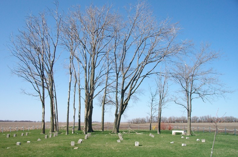
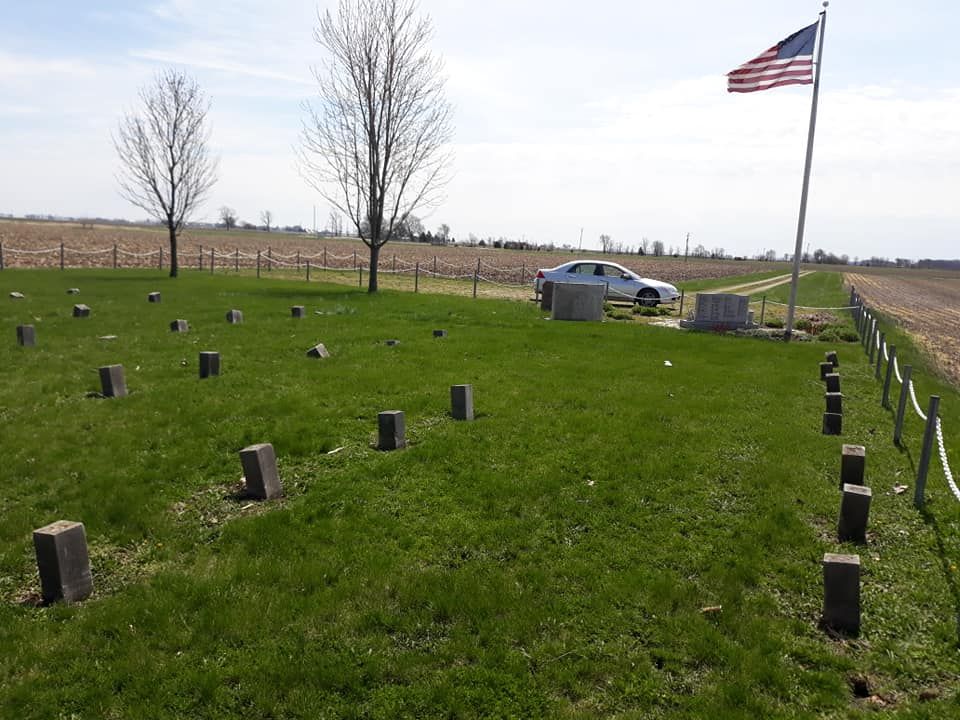
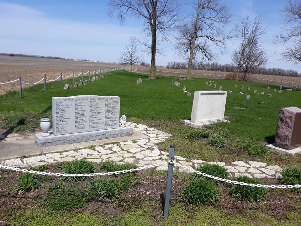
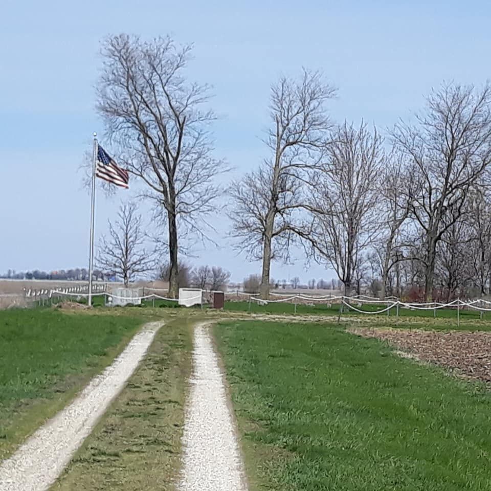
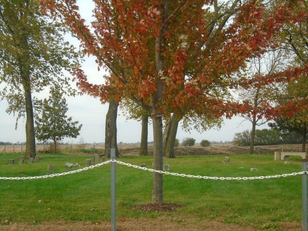
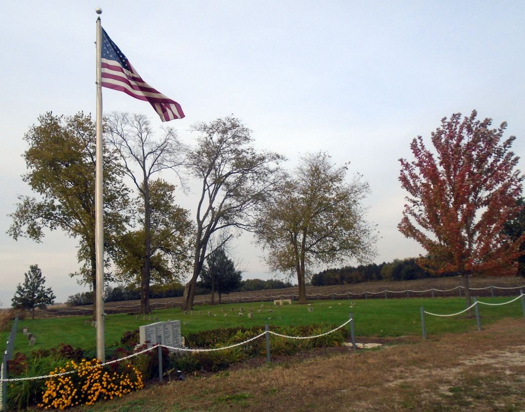
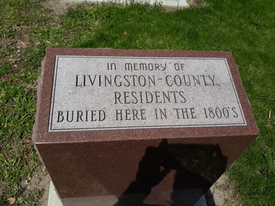
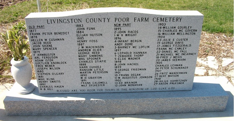
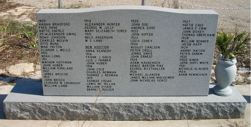
| Description | : | Located: at the end of a 1/4 mile gravel lane off 1400 N Road approximately 1/2 mile W of Old Rte 66 (1360 E Road) in Livingston County. There are county signs noting the cemetery. ******* Livingston County Poor Farm Cemetery - First burial in 1877 - Last burial in 1934 - Records of 123 people buried, only 2 remain unidentified - Restoration efforts began in 2004 - County investing about $7,500 to refurbish the area (Source: Poor Farm Cemetery now at peace; By Karen Walters - The Pantagraph - Monday, October 23, 2006) |
frequently asked questions (FAQ):
-
Where is Livingston County Poor Farm Cemetery?
Livingston County Poor Farm Cemetery is located at 1400 N Road Livingston County Pontiac, Livingston County ,Illinois ,USA.
-
Livingston County Poor Farm Cemetery cemetery's updated grave count on graveviews.com?
0 memorials
-
Where are the coordinates of the Livingston County Poor Farm Cemetery?
Latitude: 40.8323900
Longitude: -88.6706500
Nearby Cemetories:
1. South Side Cemetery
Pontiac, Livingston County, USA
Coordinate: 40.8758011, -88.6260986
2. Rooks Creek Cemetery
Pontiac, Livingston County, USA
Coordinate: 40.8733101, -88.7217255
3. Houder Cemetery
Pontiac, Livingston County, USA
Coordinate: 40.8502998, -88.5847015
4. Payne Cemetery
Livingston County, USA
Coordinate: 40.7648125, -88.6764069
5. Saint Marys Cemetery
Pontiac, Livingston County, USA
Coordinate: 40.8768997, -88.5943985
6. Calvary Cemetery
Livingston County, USA
Coordinate: 40.7571983, -88.6797028
7. Patty Cemetery
Pontiac, Livingston County, USA
Coordinate: 40.8450012, -88.5682983
8. McMillan Cemetery
Livingston County, USA
Coordinate: 40.9093900, -88.6919000
9. Walden Farm Cemetery
Livingston County, USA
Coordinate: 40.8871994, -88.7517014
10. Pike Township Cemetery
Graymont, Livingston County, USA
Coordinate: 40.8069458, -88.7755585
11. Rowe Cemetery
Pontiac, Livingston County, USA
Coordinate: 40.9143982, -88.6960983
12. Chenoa Cemetery
Chenoa, McLean County, USA
Coordinate: 40.7427788, -88.7008286
13. Weston Cemetery
Weston, McLean County, USA
Coordinate: 40.7466011, -88.6140976
14. Pennington Farm Cemetery
Pontiac, Livingston County, USA
Coordinate: 40.9317550, -88.6710170
15. Johnson Cemetery
Livingston County, USA
Coordinate: 40.9132996, -88.7528000
16. Corbin's Cemetery
Pontiac, Livingston County, USA
Coordinate: 40.9230890, -88.7378440
17. Memorial Park Cemetery
Pontiac, Livingston County, USA
Coordinate: 40.9358300, -88.5891700
18. Avoca Cemetery
Fairbury, Livingston County, USA
Coordinate: 40.8064003, -88.5096970
19. Saint Josephs Cemetery
Flanagan, Livingston County, USA
Coordinate: 40.8567009, -88.8386002
20. Swygert Cemetery
Livingston County, USA
Coordinate: 40.9108330, -88.5336110
21. Zooks Cemetery
Cornell, Livingston County, USA
Coordinate: 40.9606018, -88.7341995
22. Dunkard Cemetery
Cornell, Livingston County, USA
Coordinate: 40.9608002, -88.7341995
23. Waldo Cemetery
Flanagan, Livingston County, USA
Coordinate: 40.8062096, -88.8485794
24. Earp Cemetery
Cornell, Livingston County, USA
Coordinate: 40.9510994, -88.7780991