
| Memorials | : | 0 |
| Location | : | Ullin, Pulaski County, USA |
| Coordinate | : | 37.2878270, -89.0764250 |
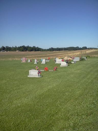
| Description | : | Small cemetery located on the north side of Normandy Road just east of intersection with Long Reach Road. There are no signs. |
frequently asked questions (FAQ):
-
Where is Long Reach Cemetery?
Long Reach Cemetery is located at Normandy Road just east of Long Reach Road Ullin, Pulaski County ,Illinois , 62992USA.
-
Long Reach Cemetery cemetery's updated grave count on graveviews.com?
0 memorials
-
Where are the coordinates of the Long Reach Cemetery?
Latitude: 37.2878270
Longitude: -89.0764250
Nearby Cemetories:
1. Cypress Grove Cemetery
Perks, Pulaski County, USA
Coordinate: 37.3096730, -89.0812990
2. Cache Chapel Cemetery
Ullin, Pulaski County, USA
Coordinate: 37.2747340, -89.1113110
3. Price Cemetery
Olmsted, Pulaski County, USA
Coordinate: 37.2425460, -89.0816570
4. Weese Cemetery
Pulaski County, USA
Coordinate: 37.2425003, -89.0821991
5. Forestview Cemetery
New Grand Chain, Pulaski County, USA
Coordinate: 37.2686005, -89.0231018
6. New Hope Cemetery
Pulaski County, USA
Coordinate: 37.2557983, -89.1324997
7. Luther Chapel Cemetery
Cypress, Johnson County, USA
Coordinate: 37.3372660, -89.0373170
8. Grand Chain Masonic Cemetery
New Grand Chain, Pulaski County, USA
Coordinate: 37.2538184, -89.0166971
9. Saint Catherine's Catholic Cemetery
Grand Chain, Pulaski County, USA
Coordinate: 37.2554610, -89.0141120
10. Mount Zion Cumberland Presbyterian Cemetery
Dongola, Union County, USA
Coordinate: 37.3407280, -89.1189400
11. Mount Olive Cemetery
Dongola, Union County, USA
Coordinate: 37.3507250, -89.0950330
12. Butter Ridge Cemetery
Ullin, Pulaski County, USA
Coordinate: 37.2891998, -89.1619034
13. Bethlehem Cemetery
Olmsted, Pulaski County, USA
Coordinate: 37.2192001, -89.0841980
14. Mount Zion Cemetery
Olmsted, Pulaski County, USA
Coordinate: 37.2266998, -89.1185989
15. West Eden Cemetery
Johnson County, USA
Coordinate: 37.3272018, -88.9982986
16. Sheffer Cemetery
Dongola, Union County, USA
Coordinate: 37.3492012, -89.1296997
17. Waters Cemetery
Pulaski County, USA
Coordinate: 37.2230988, -89.0274963
18. Eastwood Cemetery
Pulaski County, USA
Coordinate: 37.2350006, -89.1457977
19. Bethany Church Cemetery
Dongola, Union County, USA
Coordinate: 37.3615460, -89.0449350
20. German Reformed Cemetery
Wetaug, Pulaski County, USA
Coordinate: 37.3225037, -89.1674994
21. Cypress Cemetery
Cypress, Johnson County, USA
Coordinate: 37.3533300, -89.0177800
22. Smith Family Cemetery
Olmsted, Pulaski County, USA
Coordinate: 37.2058170, -89.1005200
23. Concord Cemetery
Olmsted, Pulaski County, USA
Coordinate: 37.2092018, -89.1192017
24. Calvin Cemetery
Pulaski County, USA
Coordinate: 37.2010994, -89.0594025