
| Memorials | : | 1 |
| Location | : | Dongola, Union County, USA |
| Coordinate | : | 37.3407280, -89.1189400 |
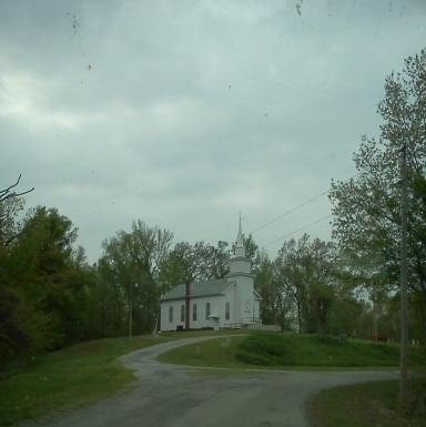
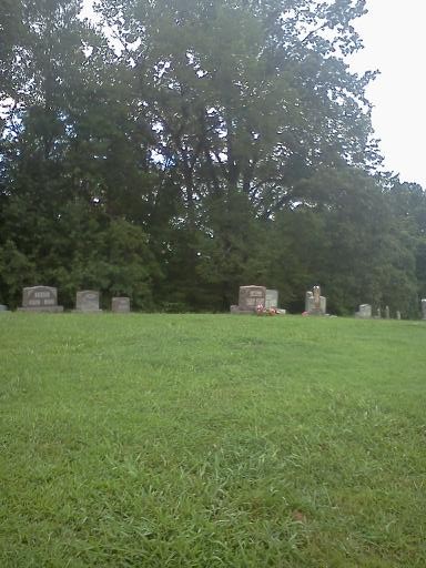
| Description | : | Mt. Zion Cumberland Presbyterian Church and Cemetery are located southeast of Dongola on Mt. Zion Road in rural Union County near the Union-Pulaski county line. Mt. Zion Cumberland Presbyterian Church is still an active church, but I have been told the cemetery is now closed to burials as all plots have been taken. |
frequently asked questions (FAQ):
-
Where is Mount Zion Cumberland Presbyterian Cemetery?
Mount Zion Cumberland Presbyterian Cemetery is located at Mount Zion Road Dongola, Union County ,Illinois , 62926USA.
-
Mount Zion Cumberland Presbyterian Cemetery cemetery's updated grave count on graveviews.com?
1 memorials
-
Where are the coordinates of the Mount Zion Cumberland Presbyterian Cemetery?
Latitude: 37.3407280
Longitude: -89.1189400
Nearby Cemetories:
1. Sheffer Cemetery
Dongola, Union County, USA
Coordinate: 37.3492012, -89.1296997
2. Mount Olive Cemetery
Dongola, Union County, USA
Coordinate: 37.3507250, -89.0950330
3. Hinkle Cemetery
Dongola, Union County, USA
Coordinate: 37.3807983, -89.1294022
4. German Reformed Cemetery
Wetaug, Pulaski County, USA
Coordinate: 37.3225037, -89.1674994
5. Cypress Grove Cemetery
Perks, Pulaski County, USA
Coordinate: 37.3096730, -89.0812990
6. Mount Pisgah Church Cemetery
Wetaug, Pulaski County, USA
Coordinate: 37.3343240, -89.1781460
7. American Legion Cemetery
Dongola, Union County, USA
Coordinate: 37.3689003, -89.1671982
8. Christian Chapel Cemetery
Dongola, Union County, USA
Coordinate: 37.3881760, -89.1310960
9. Friendship Cemetery
Dongola, Union County, USA
Coordinate: 37.3842300, -89.0891600
10. Butter Ridge Cemetery
Ullin, Pulaski County, USA
Coordinate: 37.2891998, -89.1619034
11. Bethany Church Cemetery
Dongola, Union County, USA
Coordinate: 37.3615460, -89.0449350
12. Long Reach Cemetery
Ullin, Pulaski County, USA
Coordinate: 37.2878270, -89.0764250
13. Luther Chapel Cemetery
Cypress, Johnson County, USA
Coordinate: 37.3372660, -89.0373170
14. Cache Chapel Cemetery
Ullin, Pulaski County, USA
Coordinate: 37.2747340, -89.1113110
15. Leyerle Cemetery
Dongola, Union County, USA
Coordinate: 37.4035060, -89.1825910
16. Cypress Cemetery
Cypress, Johnson County, USA
Coordinate: 37.3533300, -89.0177800
17. Mount Zion Cemetery
Union County, USA
Coordinate: 37.4110985, -89.0653000
18. New Hope Cemetery
Pulaski County, USA
Coordinate: 37.2557983, -89.1324997
19. Union Cemetery
Dongola, Union County, USA
Coordinate: 37.3899994, -89.2071991
20. Ullin Cemetery
Ullin, Pulaski County, USA
Coordinate: 37.2717171, -89.1939674
21. West Side Cemetery
Ullin, Pulaski County, USA
Coordinate: 37.2716030, -89.1952400
22. Mount Pisgah Cemetery
Cypress, Johnson County, USA
Coordinate: 37.4000015, -89.0242004
23. Church Of God Cemetery
Cypress, Johnson County, USA
Coordinate: 37.3857400, -89.0111700
24. West Eden Cemetery
Johnson County, USA
Coordinate: 37.3272018, -88.9982986