
| Memorials | : | 0 |
| Location | : | Long Sutton, South Somerset District, England |
| Coordinate | : | 51.0302700, -2.7612300 |
frequently asked questions (FAQ):
-
Where is Long Sutton Friends Burial Ground?
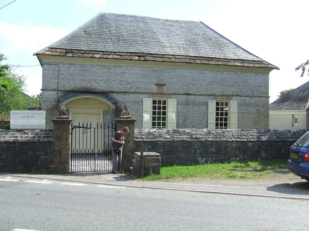
Long Sutton Friends Burial Ground is located at Langport Road, Long Sutton Long Sutton, South Somerset District ,Somerset , TA10 9NEEngland.
-
Long Sutton Friends Burial Ground cemetery's updated grave count on graveviews.com?
0 memorials
-
Where are the coordinates of the Long Sutton Friends Burial Ground?
Latitude: 51.0302700
Longitude: -2.7612300
Nearby Cemetories:
1. Holy Trinity Churchyard
Long Sutton, South Somerset District, England
Coordinate: 51.0246110, -2.7577940
2. Christ Church Cemetery
Long Load, South Somerset District, England
Coordinate: 51.0054700, -2.7639100
3. St John the Baptist Churchyard
Pitney, South Somerset District, England
Coordinate: 51.0532200, -2.7937320
4. St. Peter and St. Paul's Churchyard
Muchelney, South Somerset District, England
Coordinate: 51.0207389, -2.8154595
5. Blessed Virgin Mary Churchyard
Huish Episcopi, South Somerset District, England
Coordinate: 51.0362250, -2.8182410
6. All Saints Churchyard
Langport, South Somerset District, England
Coordinate: 51.0369970, -2.8254530
7. Langport Cemetery
Langport, South Somerset District, England
Coordinate: 51.0426200, -2.8244600
8. All Saints Churchyard
Kingsdon, South Somerset District, England
Coordinate: 51.0330100, -2.6918330
9. Low Ham Church in the Field
High Ham, South Somerset District, England
Coordinate: 51.0583449, -2.8155268
10. Holy Trinity Churchyard
Ash, South Somerset District, England
Coordinate: 50.9834250, -2.7528400
11. Ash Parish Cemetery
Ash, South Somerset District, England
Coordinate: 50.9833540, -2.7538380
12. St. Martin's Churchyard
Kingsbury Episcopi, South Somerset District, England
Coordinate: 50.9863950, -2.8043130
13. Ilchester County Gaol Cemetery
Ilchester, South Somerset District, England
Coordinate: 51.0023060, -2.6833610
14. St Andrew Churchyard
Ilchester, South Somerset District, England
Coordinate: 51.0056950, -2.6804910
15. St. Catherine's Churchyard
Drayton, South Somerset District, England
Coordinate: 51.0191860, -2.8494960
16. St Mary Major Churchyard
Ilchester, South Somerset District, England
Coordinate: 51.0010030, -2.6818120
17. High Ham Cemetery
High Ham, South Somerset District, England
Coordinate: 51.0739931, -2.8216351
18. Ilchester Gallows Field Cemetery
Ilchester, South Somerset District, England
Coordinate: 50.9996250, -2.6831080
19. Church of the Virgin Mary
Charlton Mackrell, South Somerset District, England
Coordinate: 51.0524210, -2.6743894
20. St. Andrew's Churchyard
High Ham, South Somerset District, England
Coordinate: 51.0760320, -2.8218400
21. Saint Andrew Churchyard
Compton Dundon, South Somerset District, England
Coordinate: 51.0897330, -2.7442800
22. All Saints Churchyard
Martock, South Somerset District, England
Coordinate: 50.9692420, -2.7687860
23. Ilchester Parish Cemetery
Ilchester, South Somerset District, England
Coordinate: 50.9993670, -2.6721280
24. St. Peter & St. Paul's Churchyard
Charlton Adam, South Somerset District, England
Coordinate: 51.0552350, -2.6647930