
| Memorials | : | 15 |
| Location | : | Muchelney, South Somerset District, England |
| Coordinate | : | 51.0207389, -2.8154595 |
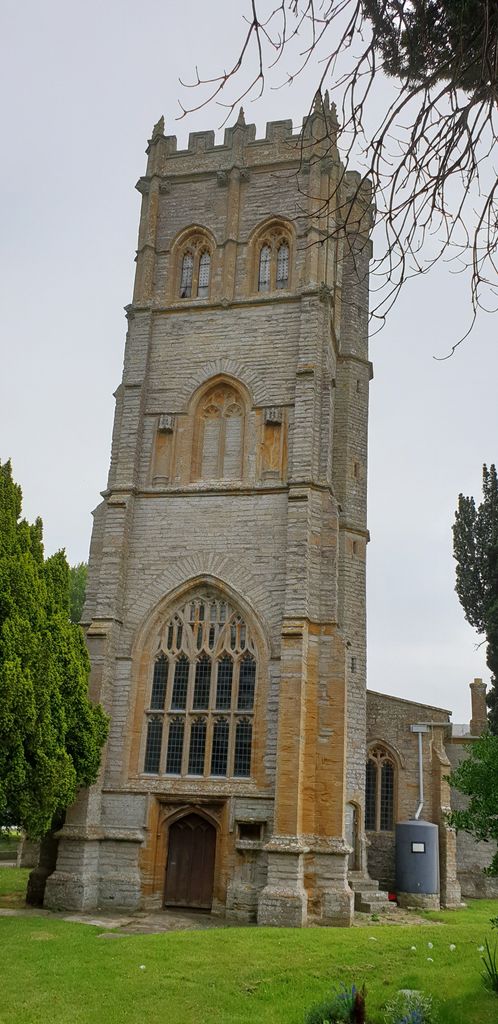
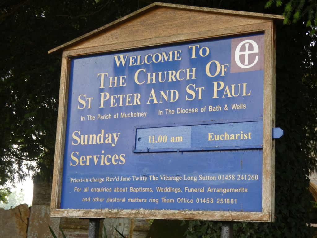
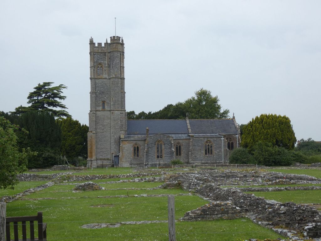
| Description | : | 15th century Muchelney Church of St. Peter & St. Paul. One of the most striking features is the panelled roof with 17th century paintings, extending the entire length of the nave. The painting is on wooden panels, each panel with a figure of an angel. Some of the angels are bare-breasted, which makes you wonder how the ceiling escaped the attention of Puritan iconoclasts! The partially nude angels are thought to be a symbol of innocent purity. The angels are set against a background of blue sky, with cherubs floating amid clouds. There are stars at each end and a... Read More |
frequently asked questions (FAQ):
-
Where is St. Peter and St. Paul's Churchyard?
St. Peter and St. Paul's Churchyard is located at Law Lane Muchelney, South Somerset District ,Somerset , TA10 0DQEngland.
-
St. Peter and St. Paul's Churchyard cemetery's updated grave count on graveviews.com?
15 memorials
-
Where are the coordinates of the St. Peter and St. Paul's Churchyard?
Latitude: 51.0207389
Longitude: -2.8154595
Nearby Cemetories:
1. Blessed Virgin Mary Churchyard
Huish Episcopi, South Somerset District, England
Coordinate: 51.0362250, -2.8182410
2. All Saints Churchyard
Langport, South Somerset District, England
Coordinate: 51.0369970, -2.8254530
3. St. Catherine's Churchyard
Drayton, South Somerset District, England
Coordinate: 51.0191860, -2.8494960
4. Langport Cemetery
Langport, South Somerset District, England
Coordinate: 51.0426200, -2.8244600
5. Curry Rivel Cemetery
Curry Rivel, South Somerset District, England
Coordinate: 51.0257667, -2.8676226
6. St. Andrew's Churchyard
Curry Rivel, South Somerset District, England
Coordinate: 51.0246570, -2.8687410
7. St. Martin's Churchyard
Kingsbury Episcopi, South Somerset District, England
Coordinate: 50.9863950, -2.8043130
8. St John the Baptist Churchyard
Pitney, South Somerset District, England
Coordinate: 51.0532200, -2.7937320
9. Long Sutton Friends Burial Ground
Long Sutton, South Somerset District, England
Coordinate: 51.0302700, -2.7612300
10. Christ Church Cemetery
Long Load, South Somerset District, England
Coordinate: 51.0054700, -2.7639100
11. Holy Trinity Churchyard
Long Sutton, South Somerset District, England
Coordinate: 51.0246110, -2.7577940
12. Low Ham Church in the Field
High Ham, South Somerset District, England
Coordinate: 51.0583449, -2.8155268
13. Saint Andrew's Churchyard
Aller, South Somerset District, England
Coordinate: 51.0554000, -2.8627000
14. St. James the Less Churchyard
Hambridge, South Somerset District, England
Coordinate: 50.9849380, -2.8669180
15. High Ham Cemetery
High Ham, South Somerset District, England
Coordinate: 51.0739931, -2.8216351
16. Ash Parish Cemetery
Ash, South Somerset District, England
Coordinate: 50.9833540, -2.7538380
17. Holy Trinity Churchyard
Ash, South Somerset District, England
Coordinate: 50.9834250, -2.7528400
18. St. Catherine's Churchyard
Fivehead, South Somerset District, England
Coordinate: 51.0083009, -2.9000973
19. St. Andrew's Churchyard
High Ham, South Somerset District, England
Coordinate: 51.0760320, -2.8218400
20. St James Churchyard
Kingsbury Episcopi, South Somerset District, England
Coordinate: 50.9646420, -2.8106370
21. All Saints Churchyard
Martock, South Somerset District, England
Coordinate: 50.9692420, -2.7687860
22. All Saints Churchyard
Isle Brewers, South Somerset District, England
Coordinate: 50.9854450, -2.9000040
23. United Reform Churchyard
Martock, South Somerset District, England
Coordinate: 50.9609320, -2.7735020
24. All Saints Church Original Location
Isle Brewers, South Somerset District, England
Coordinate: 50.9879000, -2.9081000