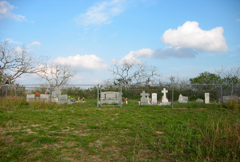
| Memorials | : | 0 |
| Location | : | Brooks County, USA |
| Coordinate | : | 26.8896999, -98.2093964 |
| Description | : | Shown on most historical maps as “Longoria Cemetery”, the cemetery is also known as “The Eugenio Longoria Cemetery” to distinguish it from the other Longoria cemeteries in the immediate area, all of which are on lands belonging to descendants of Ponciano Longoria and Maria Rita Villarreal. The cemetery is located about 5 miles west of Rachal just off FM 755; it is about one-half mile west of the picnic area on the highway and about 150 feet south of FM 755, hidden from view from the highway by a dense grove of old mesquite trees and brush. The cemetery is... Read More |
frequently asked questions (FAQ):
-
Where is Longoria Cemetery?
Longoria Cemetery is located at Brooks County ,Texas ,USA.
-
Longoria Cemetery cemetery's updated grave count on graveviews.com?
0 memorials
-
Where are the coordinates of the Longoria Cemetery?
Latitude: 26.8896999
Longitude: -98.2093964
Nearby Cemetories:
1. Santa Rita Ranch Cemetery
Rachal, Brooks County, USA
Coordinate: 26.8843800, -98.2130140
2. Juan Longoria Family Cemetery
Rachal, Brooks County, USA
Coordinate: 26.8857000, -98.2038900
3. Florencio Rodriguez Family Cemetery
Rachal, Brooks County, USA
Coordinate: 26.8933800, -98.2171300
4. Saul Trevino Cemetery
Rachal, Brooks County, USA
Coordinate: 26.8882500, -98.2193200
5. Ruben Trevino Family Cemetery
Rachal, Brooks County, USA
Coordinate: 26.8900300, -98.2200200
6. Transito Villarreal Family Cemetery
Rachal, Brooks County, USA
Coordinate: 26.8904900, -98.1972000
7. Servando Villarreal Family Cemetery
Rachal, Brooks County, USA
Coordinate: 26.8904800, -98.1971300
8. San Mateo Cemetery
Brooks County, USA
Coordinate: 26.8894030, -98.1964580
9. Vallerreno Cemetery
Brooks County, USA
Coordinate: 26.9025002, -98.2193985
10. Enrique Villarreal Family Cemetery
Rachal, Brooks County, USA
Coordinate: 26.8911900, -98.2273400
11. Jacobo Villarreal Family Cemetery
Rachal, Brooks County, USA
Coordinate: 26.8940000, -98.2364100
12. Jose Maria Longoria Gravesite
Rachal, Brooks County, USA
Coordinate: 26.9201000, -98.2531800
13. La Mesa Cemetery
Brooks County, USA
Coordinate: 26.8661003, -98.2617035
14. Francisco Perez Cemetery
Brooks County, USA
Coordinate: 26.9192009, -98.2688980
15. San Luis Cemetery
Encino, Brooks County, USA
Coordinate: 26.9339310, -98.1501820
16. Ramirez Cemetery
Encino, Brooks County, USA
Coordinate: 26.9390600, -98.1514200
17. Huerta Family Cemetery
Encino, Brooks County, USA
Coordinate: 26.9341990, -98.1439590
18. Benavides Family Cemetery
Encino, Brooks County, USA
Coordinate: 26.9352320, -98.1409450
19. Benavidez Cemetery
Encino, Brooks County, USA
Coordinate: 26.9350280, -98.1402860
20. Villarreal Cemetery
Encino, Brooks County, USA
Coordinate: 26.9338854, -98.1333556
21. El Lucero Cemetery
Encino, Brooks County, USA
Coordinate: 26.9339008, -98.0986023
22. Rancho Nuevo Cemetery
Brooks County, USA
Coordinate: 26.9377995, -98.3255997
23. Perez Cemetery
Brooks County, USA
Coordinate: 27.0835991, -98.3019028
24. Perez Cemetery #01
Brooks County, USA
Coordinate: 27.1525002, -98.0736008

