| Memorials | : | 0 |
| Location | : | Rachal, Brooks County, USA |
| Coordinate | : | 26.8904900, -98.1972000 |
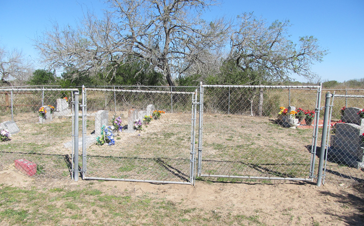
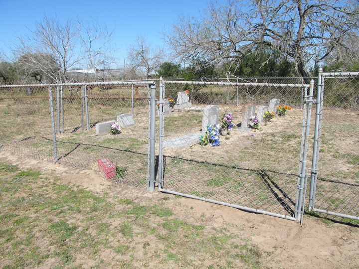
| Description | : | The Transito Villarreal Family cemetery is contiguous with the Servando Villarreal Family cemetery, with the property line running between the two cemeteries. Transito and Servando were first cousins, and their inherited lands adjoined each other. Each contributed their own land to create the side-by-side cemeteries. |
frequently asked questions (FAQ):
-
Where is Transito Villarreal Family Cemetery?
Transito Villarreal Family Cemetery is located at about 5 miles west of Rachal, Brooks County ,Texas ,USA.
-
Transito Villarreal Family Cemetery cemetery's updated grave count on graveviews.com?
0 memorials
-
Where are the coordinates of the Transito Villarreal Family Cemetery?
Latitude: 26.8904900
Longitude: -98.1972000
Nearby Cemetories:
1. Servando Villarreal Family Cemetery
Rachal, Brooks County, USA
Coordinate: 26.8904800, -98.1971300
2. San Mateo Cemetery
Brooks County, USA
Coordinate: 26.8894030, -98.1964580
3. Juan Longoria Family Cemetery
Rachal, Brooks County, USA
Coordinate: 26.8857000, -98.2038900
4. Longoria Cemetery
Brooks County, USA
Coordinate: 26.8896999, -98.2093964
5. Santa Rita Ranch Cemetery
Rachal, Brooks County, USA
Coordinate: 26.8843800, -98.2130140
6. Florencio Rodriguez Family Cemetery
Rachal, Brooks County, USA
Coordinate: 26.8933800, -98.2171300
7. Saul Trevino Cemetery
Rachal, Brooks County, USA
Coordinate: 26.8882500, -98.2193200
8. Ruben Trevino Family Cemetery
Rachal, Brooks County, USA
Coordinate: 26.8900300, -98.2200200
9. Vallerreno Cemetery
Brooks County, USA
Coordinate: 26.9025002, -98.2193985
10. Enrique Villarreal Family Cemetery
Rachal, Brooks County, USA
Coordinate: 26.8911900, -98.2273400
11. Jacobo Villarreal Family Cemetery
Rachal, Brooks County, USA
Coordinate: 26.8940000, -98.2364100
12. Jose Maria Longoria Gravesite
Rachal, Brooks County, USA
Coordinate: 26.9201000, -98.2531800
13. San Luis Cemetery
Encino, Brooks County, USA
Coordinate: 26.9339310, -98.1501820
14. La Mesa Cemetery
Brooks County, USA
Coordinate: 26.8661003, -98.2617035
15. Ramirez Cemetery
Encino, Brooks County, USA
Coordinate: 26.9390600, -98.1514200
16. Huerta Family Cemetery
Encino, Brooks County, USA
Coordinate: 26.9341990, -98.1439590
17. Benavides Family Cemetery
Encino, Brooks County, USA
Coordinate: 26.9352320, -98.1409450
18. Benavidez Cemetery
Encino, Brooks County, USA
Coordinate: 26.9350280, -98.1402860
19. Francisco Perez Cemetery
Brooks County, USA
Coordinate: 26.9192009, -98.2688980
20. Villarreal Cemetery
Encino, Brooks County, USA
Coordinate: 26.9338854, -98.1333556
21. El Lucero Cemetery
Encino, Brooks County, USA
Coordinate: 26.9339008, -98.0986023
22. Rancho Nuevo Cemetery
Brooks County, USA
Coordinate: 26.9377995, -98.3255997
23. Perez Cemetery
Brooks County, USA
Coordinate: 27.0835991, -98.3019028
24. Perez Cemetery #01
Brooks County, USA
Coordinate: 27.1525002, -98.0736008


