
| Memorials | : | 38 |
| Location | : | Jefferson County, USA |
| Coordinate | : | 36.0933300, -83.5808700 |
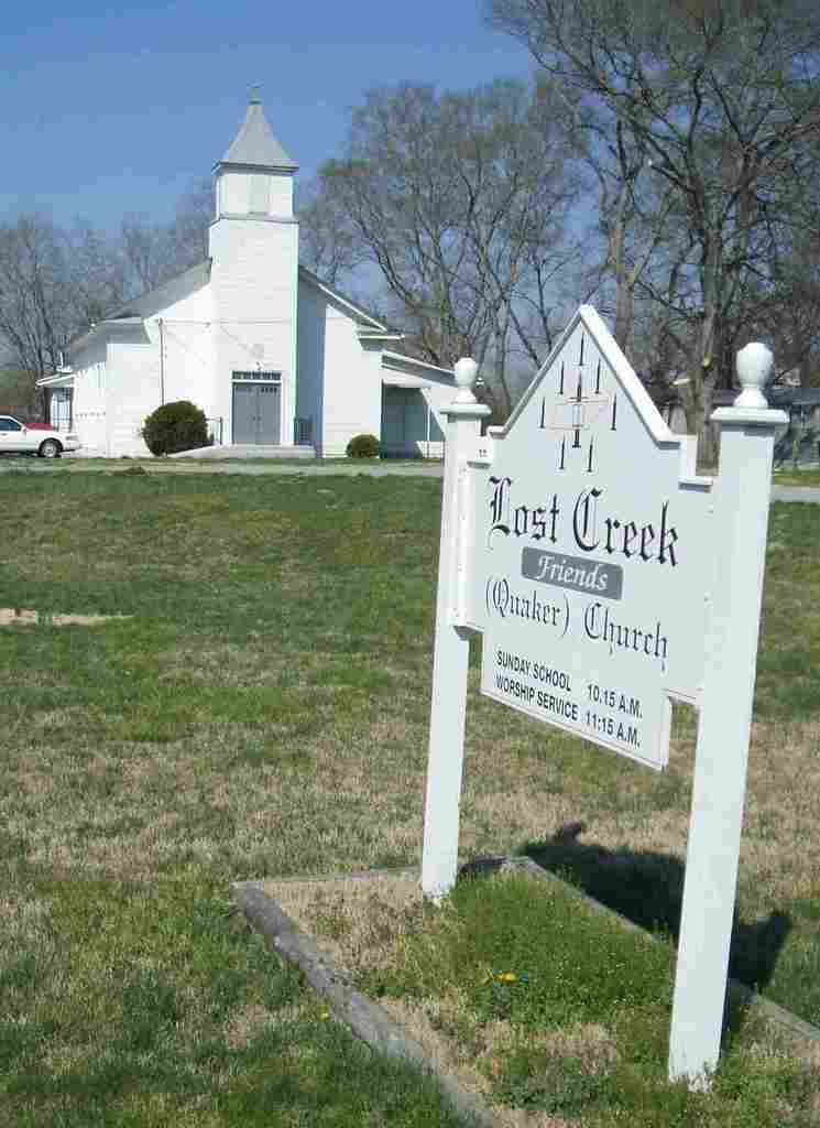
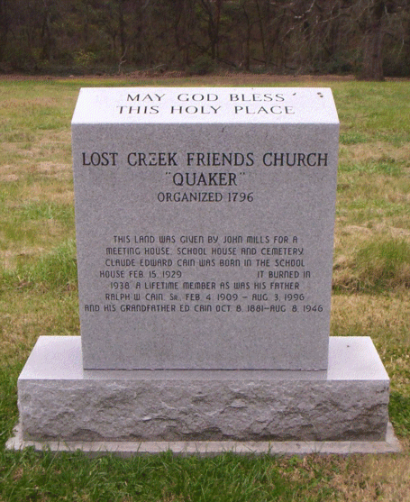
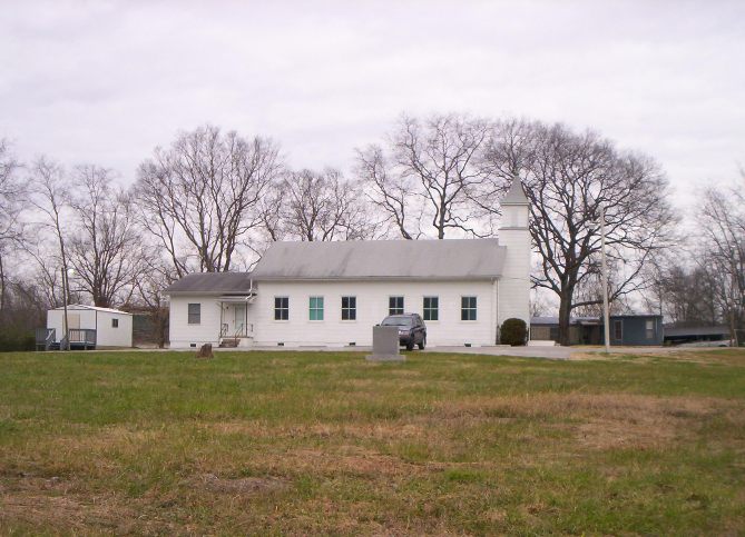
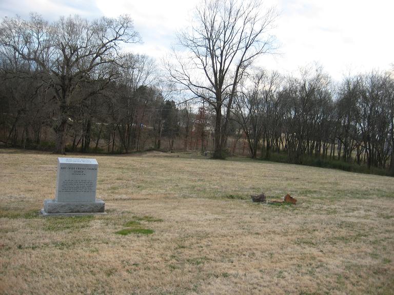
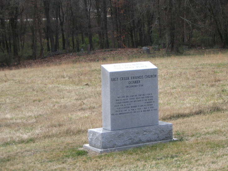
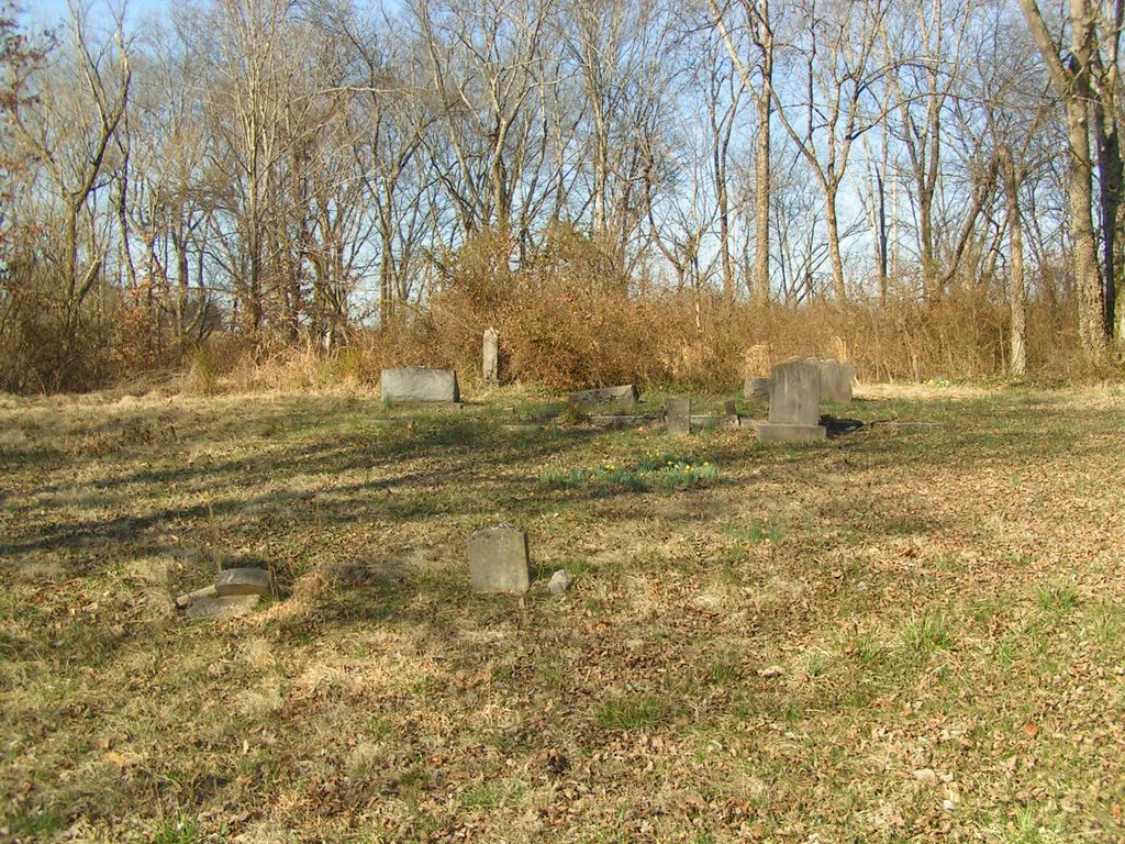
| Description | : | =================================================== Lost Creek Monthly Meeting & FBG History This area, now known as Lost Creek Monthly Meeting, about two miles west of New Market, was first inhabited about 1784, the area was referred to as "the waters of the Holston River". In 1797 The Society of Friends "set off" (established) the Lost Creek Monthly Meeting. The Lost Creek Friends Burial Ground (FBG) beginning would have also been about the same time, but is not known. Furthermore the Society of Friends did not use grave markers until the early to mid 1800's. The progress of Lost Creek prior to 1797: 1. Voluntary... Read More |
frequently asked questions (FAQ):
-
Where is Lost Creek Friends Burial Ground?
Lost Creek Friends Burial Ground is located at Route 11 East & Friends Station Road Jefferson County ,Tennessee , 37820USA.
-
Lost Creek Friends Burial Ground cemetery's updated grave count on graveviews.com?
38 memorials
-
Where are the coordinates of the Lost Creek Friends Burial Ground?
Latitude: 36.0933300
Longitude: -83.5808700
Nearby Cemetories:
1. Friends Station Cemetery
New Market, Jefferson County, USA
Coordinate: 36.0919600, -83.5786700
2. Old Methodist Cemetery
New Market, Jefferson County, USA
Coordinate: 36.0958330, -83.5588890
3. Young's Memorial AME Zion Church Cemetery
New Market, Jefferson County, USA
Coordinate: 36.0957985, -83.5582962
4. New Market Cemetery
New Market, Jefferson County, USA
Coordinate: 36.0966988, -83.5472031
5. Nance's Grove Church Cemetery
New Market, Jefferson County, USA
Coordinate: 36.1225000, -83.5977800
6. Pleasant Grove-Fielden Cemetery
New Market, Jefferson County, USA
Coordinate: 36.1276016, -83.5646973
7. Hodges Cemetery
Jefferson County, USA
Coordinate: 36.0802994, -83.6232986
8. Friendship Missionary Baptist Church Cemetery
New Market, Jefferson County, USA
Coordinate: 36.1252530, -83.5564370
9. McBee Cemetery
Jefferson County, USA
Coordinate: 36.0985985, -83.6335983
10. McBee Cemetery
Jefferson County, USA
Coordinate: 36.1175003, -83.6252975
11. Vance Cemetery
New Market, Jefferson County, USA
Coordinate: 36.0628014, -83.6196976
12. Beaver Creek Baptist Church Cemetery
Strawberry Plains, Jefferson County, USA
Coordinate: 36.0912070, -83.6371200
13. Rocky Valley Cemetery
Rocky Valley, Jefferson County, USA
Coordinate: 36.0602989, -83.5333023
14. Blue Springs Church of God Cemetery
Jefferson County, USA
Coordinate: 36.0621986, -83.6369019
15. Roderick Cemetery
Jefferson County, USA
Coordinate: 36.0513992, -83.6286011
16. Oakes Cemetery
Jefferson County, USA
Coordinate: 36.0471992, -83.6231003
17. Nance Cemetery
Jefferson County, USA
Coordinate: 36.1306000, -83.6363983
18. Vance Cemetery
Strawberry Plains, Jefferson County, USA
Coordinate: 36.1006012, -83.6544037
19. Bradshaw Cemetery
Jefferson County, USA
Coordinate: 36.0738983, -83.6530991
20. Haworth Cemetery
Jefferson County, USA
Coordinate: 36.1567001, -83.5960999
21. Carter Cemetery
Jefferson County, USA
Coordinate: 36.0484900, -83.5217900
22. McCampbell Chapel Cemetery
Dandridge, Jefferson County, USA
Coordinate: 36.0264015, -83.5792007
23. Ballinger Cemetery
Jefferson County, USA
Coordinate: 36.1605988, -83.5777969
24. Duncum Cemetery
Jefferson County, USA
Coordinate: 36.1164017, -83.6594009