| Memorials | : | 8 |
| Location | : | Plum Branch, McCormick County, USA |
| Coordinate | : | 33.8421670, -82.1432180 |
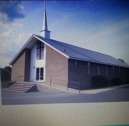
| Description | : | This church is known as Lower Mt. Moriah Baptist Church in Plum Branch, SC. There are two Mt. Moriah Baptist Churches in McCormick County so they are separated by Lower and Upper.So when adding a memorial make sure you have the right church. |
frequently asked questions (FAQ):
-
Where is Lower Mount Moriah Baptist Church Cemetery?
Lower Mount Moriah Baptist Church Cemetery is located at Key Road Plum Branch, McCormick County ,South Carolina , 29845USA.
-
Lower Mount Moriah Baptist Church Cemetery cemetery's updated grave count on graveviews.com?
5 memorials
-
Where are the coordinates of the Lower Mount Moriah Baptist Church Cemetery?
Latitude: 33.8421670
Longitude: -82.1432180
Nearby Cemetories:
1. Rehoboth Baptist Church Cemetery
Plum Branch, McCormick County, USA
Coordinate: 33.8410988, -82.1468964
2. Wine Creek Cemetery
McCormick County, USA
Coordinate: 33.8399600, -82.1380600
3. Burkhalter - Gilchrist Family Cemetery
Plum Branch, McCormick County, USA
Coordinate: 33.8212970, -82.1537310
4. Talbert Cemetery 2
McCormick County, USA
Coordinate: 33.8449700, -82.1761500
5. Spencer-Cochran Cemetery
Edgefield County, USA
Coordinate: 33.8555984, -82.1130981
6. Cochran Cemetery
Edgefield County, USA
Coordinate: 33.8556777, -82.1128943
7. Talbert Wam
McCormick County, USA
Coordinate: 33.8477500, -82.1830600
8. Cedar Springs Church Cemetery
Parksville, McCormick County, USA
Coordinate: 33.8103893, -82.1572955
9. Cochran Church Cemetery
Edgefield County, USA
Coordinate: 33.8297200, -82.1049100
10. Holmes Cemetery
Edgefield County, USA
Coordinate: 33.8060989, -82.1211014
11. Wood Family Cemetery
Edgefield, Edgefield County, USA
Coordinate: 33.8035000, -82.1273330
12. McDaniel
Edgefield, Edgefield County, USA
Coordinate: 33.8003830, -82.1251000
13. Cedar Spring Baptist Church Cemetery
McCormick County, USA
Coordinate: 33.8576820, -82.1934710
14. Key Cemetery
McCormick County, USA
Coordinate: 33.7926900, -82.1508500
15. Liberty Spring Cemetery
Edgefield County, USA
Coordinate: 33.8750000, -82.0914001
16. Seigler Family Cemetery
Edgefield, Edgefield County, USA
Coordinate: 33.8991500, -82.1420300
17. Moss Cemetery
Edgefield County, USA
Coordinate: 33.8149986, -82.0819016
18. Calliham Cemetery
McCormick County, USA
Coordinate: 33.7825200, -82.1631400
19. Barker
Edgefield, Edgefield County, USA
Coordinate: 33.8815500, -82.0832300
20. Glanton
Edgefield, Edgefield County, USA
Coordinate: 33.7795830, -82.1267500
21. Price Cemetery
Edgefield, Edgefield County, USA
Coordinate: 33.8748330, -82.0711670
22. Summerall Cemetery
McCormick County, USA
Coordinate: 33.7818600, -82.1838100
23. Shady Grove Cemetery
Edgefield, Edgefield County, USA
Coordinate: 33.7738830, -82.1241670
24. Settle Cemetery
Edgefield, Edgefield County, USA
Coordinate: 33.9041330, -82.0981170

