
| Memorials | : | 6 |
| Location | : | Rudolph, Haywood County, USA |
| Coordinate | : | 35.7257390, -89.2638560 |
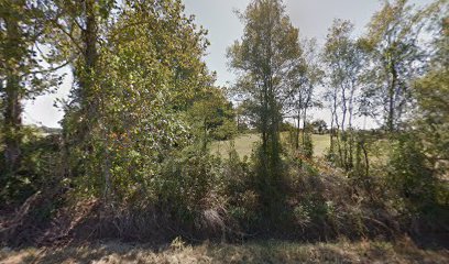
| Description | : | From the intersection of Rudolph Rd. & TN-54, north of Brownsville, travel northwest on Rudolph Rd. for 4.4 mi.; turning east (right) onto Sulphur Springs Rd., going 0.1 mi.; turning south (right) into this large 'deeded' cemetery, as notated on USGS topo maps. Located on the south side of Sulphur Springs Road about 0.1 mile east of its juncture with Rudolph Road in northern Haywood County. The cemetery is on Sulphur Springs Road and the current church & congregation, Sulphur Springs Baptist Church, are now located at on 1230 East Jefferson St., in Brownsville. The original church... Read More |
frequently asked questions (FAQ):
-
Where is Lower Salem Missionary Baptist Church Cemetery?
Lower Salem Missionary Baptist Church Cemetery is located at 2777 Sulphur Springs Road Rudolph, Haywood County ,Tennessee ,USA.
-
Lower Salem Missionary Baptist Church Cemetery cemetery's updated grave count on graveviews.com?
5 memorials
-
Where are the coordinates of the Lower Salem Missionary Baptist Church Cemetery?
Latitude: 35.7257390
Longitude: -89.2638560
Nearby Cemetories:
1. Zion United Methodist Church Cemetery
Brownsville, Haywood County, USA
Coordinate: 35.7033320, -89.2443350
2. Zion Methodist Church Cemetery
Rudolph, Haywood County, USA
Coordinate: 35.7033005, -89.2442017
3. Moody Cemetery
Frog Jump, Crockett County, USA
Coordinate: 35.7716110, -89.2607500
4. Jennings Cemetery
Alamo, Crockett County, USA
Coordinate: 35.7684510, -89.2401620
5. White Cemetery
Johnsons Grove, Crockett County, USA
Coordinate: 35.7740020, -89.2676850
6. Hickory Grove Church Cemetery
Christmasville, Haywood County, USA
Coordinate: 35.6827150, -89.2934500
7. Branch Cemetery
Frog Jump, Crockett County, USA
Coordinate: 35.7727540, -89.2383390
8. Poston-Wyse Cemetery
Johnsons Grove, Crockett County, USA
Coordinate: 35.7769700, -89.2775020
9. Johnson Family Cemetery
Johnsons Grove, Crockett County, USA
Coordinate: 35.7554260, -89.2085790
10. Chapel Hill Missionary Baptist Church Cemetery
Shaw, Haywood County, USA
Coordinate: 35.7219570, -89.3363660
11. Hughes Cemetery
Johnsons Grove, Crockett County, USA
Coordinate: 35.7708960, -89.2150330
12. Frank Varner Cemetery
Johnsons Grove, Crockett County, USA
Coordinate: 35.7638070, -89.2057050
13. Lea Family Cemetery
Shaw, Haywood County, USA
Coordinate: 35.7128660, -89.3398910
14. Castellaw Cemetery
Johnsons Grove, Crockett County, USA
Coordinate: 35.7597900, -89.1964710
15. Byars Family Cemetery
Tibbs, Haywood County, USA
Coordinate: 35.6947460, -89.3430000
16. Harrison Cemetery
Maury City, Crockett County, USA
Coordinate: 35.7977000, -89.2498330
17. Buford Family Cemetery
Alamo, Crockett County, USA
Coordinate: 35.7612160, -89.1850940
18. Manning Cemetery
Maury City, Crockett County, USA
Coordinate: 35.7949240, -89.2246940
19. Liberty Cemetery
Johnsons Grove, Crockett County, USA
Coordinate: 35.7635540, -89.1823900
20. Old Hickory Cemetery
Maury City, Crockett County, USA
Coordinate: 35.7949780, -89.2246320
21. Old Liberty Cemetery
Johnsons Grove, Crockett County, USA
Coordinate: 35.7645470, -89.1824440
22. John Taylor Cemetery
Belle Eagle, Haywood County, USA
Coordinate: 35.6612000, -89.2124000
23. Graham Family Graveyard
Maury City, Crockett County, USA
Coordinate: 35.8005420, -89.2389300
24. Hess Memorial Gardens
Belle Eagle, Haywood County, USA
Coordinate: 35.6522330, -89.2280190