
| Memorials | : | 1 |
| Location | : | Wildcat, Lewis County, USA |
| Coordinate | : | 38.7591370, -80.4449440 |
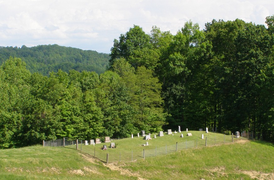
| Description | : | This cemetery is located in southern Lewis County, WV near the villages of Bablin and Wildcat. To get there, take the Ireland-Wildcat road off of US Route 19 in Ireland, proceed five miles exactly, to a gravel road that goes off to the right. This road is now named Rhododendron Drive. This is the second gravel road past the Elijah Chapel. Go up this winding hill road 0.6 mile to the farm house of Mr. Carl Lowther. Please ask for permission to cross his land. During dry weather a person could drive up the winding dirt path and mowed pasture.... Read More |
frequently asked questions (FAQ):
-
Where is Lowther Cemetery?
Lowther Cemetery is located at Wildcat, Lewis County ,West Virginia ,USA.
-
Lowther Cemetery cemetery's updated grave count on graveviews.com?
1 memorials
-
Where are the coordinates of the Lowther Cemetery?
Latitude: 38.7591370
Longitude: -80.4449440
Nearby Cemetories:
1. Green Hill Cemetery
Hettie, Braxton County, USA
Coordinate: 38.7630170, -80.4827000
2. Pickens Cemetery
Duffy, Lewis County, USA
Coordinate: 38.7921982, -80.4475021
3. Kincaid Cemetery
Duffy, Lewis County, USA
Coordinate: 38.7858390, -80.4185540
4. McCray Cemetery
Ireland, Lewis County, USA
Coordinate: 38.7963700, -80.4533280
5. Hevener Family Cemetery
Roanoke, Lewis County, USA
Coordinate: 38.8077460, -80.4250480
6. McCutcheon Chapel Cemetery
Ireland, Lewis County, USA
Coordinate: 38.8115200, -80.4373460
7. Wilson Cemetery
Ireland, Lewis County, USA
Coordinate: 38.8083550, -80.4753040
8. Radabaugh Cemetery
Hacker Valley, Webster County, USA
Coordinate: 38.7064000, -80.4217000
9. Reger Farm Cemetery
Ireland, Lewis County, USA
Coordinate: 38.8150030, -80.4563910
10. Lunceford-Mollohan Cemetery
Caress, Braxton County, USA
Coordinate: 38.7075590, -80.4773140
11. Krafft Cemetery
Braxton County, USA
Coordinate: 38.7238998, -80.5057983
12. Cogar Cemetery
Braxton County, USA
Coordinate: 38.7058330, -80.4802780
13. Gibson Cemetery
Braxton County, USA
Coordinate: 38.7332993, -80.5156021
14. Pleasant Hill Church Cemetery
Gregory, Braxton County, USA
Coordinate: 38.7615670, -80.5231860
15. Pleasant Hill Cemetery
Exchange, Braxton County, USA
Coordinate: 38.7613500, -80.5233000
16. Chestnut Grove Cemetery
Hacker Valley, Webster County, USA
Coordinate: 38.6978000, -80.4431000
17. Gregory Cemetery
Gregory, Braxton County, USA
Coordinate: 38.7522450, -80.5271600
18. Heaston Cemetery
Kanawha Head, Upshur County, USA
Coordinate: 38.7969100, -80.3776400
19. Falls Run Cemetery
Falls Mill, Braxton County, USA
Coordinate: 38.7796270, -80.5238310
20. Brown Cemetery
Rock Cave, Upshur County, USA
Coordinate: 38.8065600, -80.3857820
21. Kniceley Cemetery
Braxton County, USA
Coordinate: 38.7150002, -80.5132980
22. Cow Run School Cemetery
Rock Cave, Upshur County, USA
Coordinate: 38.8094090, -80.3816080
23. Bennett Cemetery
Upshur County, USA
Coordinate: 38.7749063, -80.3555116
24. Fisher Cemetery
Falls Mill, Braxton County, USA
Coordinate: 38.7282982, -80.5291977