
| Memorials | : | 0 |
| Location | : | Tucker, Anderson County, USA |
| Coordinate | : | 31.6588993, -95.7375031 |
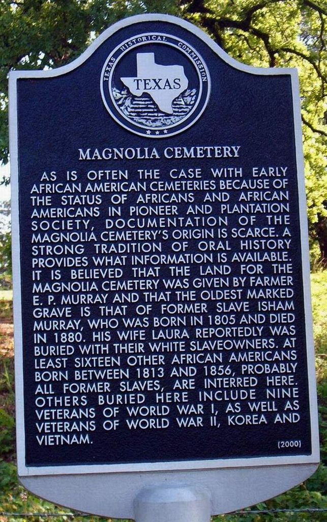
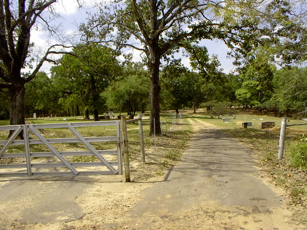
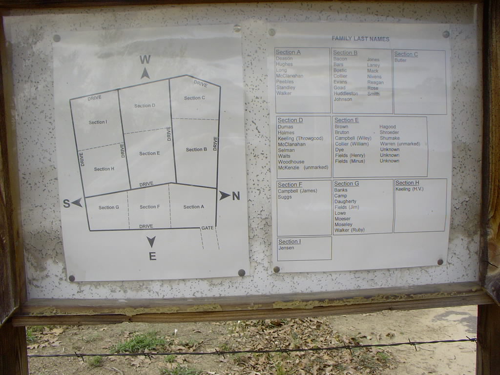
| Description | : | Located on Texas State Highway 294, 10 mile northwest of Elkhart, southwest of Palestine, near Tucker, just about a mile from Highway 84. Magnolia is an old cemetery with separate burial sections for African-Americans and whites. |
frequently asked questions (FAQ):
-
Where is Magnolia Cemetery?
Magnolia Cemetery is located at Tucker, Anderson County ,Texas ,USA.
-
Magnolia Cemetery cemetery's updated grave count on graveviews.com?
0 memorials
-
Where are the coordinates of the Magnolia Cemetery?
Latitude: 31.6588993
Longitude: -95.7375031

Nearby Cemetories:
1. Bacon Cemetery #01
Anderson County, USA
Coordinate: 31.6613998, -95.7303009
2. Texas Methodist Conference Center Cemetery
Elkhart, Anderson County, USA
Coordinate: 31.6484780, -95.6780370
3. Crist-Calloway Cemetery
Harmony, Anderson County, USA
Coordinate: 31.7188570, -95.7583390
4. Parker Cemetery
Anderson County, USA
Coordinate: 31.6077995, -95.6917038
5. Our Acre Cemetery
Elkhart, Anderson County, USA
Coordinate: 31.6466750, -95.6605490
6. Cedar Creek Cemetery
Palestine, Anderson County, USA
Coordinate: 31.6457996, -95.6605988
7. Halick Cemetery
Palestine, Anderson County, USA
Coordinate: 31.7015170, -95.6767560
8. McDaniel Family Cemetery
Butler, Freestone County, USA
Coordinate: 31.6446870, -95.8336540
9. Davis Cemetery
Palestine, Anderson County, USA
Coordinate: 31.5930996, -95.6669006
10. Mount Zion Cemetery
Palestine, Anderson County, USA
Coordinate: 31.7408400, -95.7949100
11. Myrtle Springs Cemetery
Elkhart, Anderson County, USA
Coordinate: 31.5806560, -95.6733180
12. Fort Houston Cemetery
Palestine, Anderson County, USA
Coordinate: 31.7271996, -95.6519012
13. Bluff Spring Cemetery
Elkhart, Anderson County, USA
Coordinate: 31.5726940, -95.6774980
14. Broyles Chapel Cemetery
Palestine, Anderson County, USA
Coordinate: 31.7632160, -95.7189850
15. Beulah Cemetery
Palestine, Anderson County, USA
Coordinate: 31.6909640, -95.6075720
16. Pleasant Springs Cemetery
Palestine, Anderson County, USA
Coordinate: 31.7250004, -95.6256027
17. McMeans Cemetery
Anderson County, USA
Coordinate: 31.7608662, -95.6684265
18. Perry Starr Cemetery
Anderson County, USA
Coordinate: 31.6693993, -95.5952988
19. Hubbard Cemetery
Palestine, Anderson County, USA
Coordinate: 31.7002850, -95.6020850
20. Lone Star Cemetery
Freestone County, USA
Coordinate: 31.6769880, -95.8830870
21. Mayes Cemetery
Freestone County, USA
Coordinate: 31.6758000, -95.8833000
22. Thomas Starr Cemetery
Anderson County, USA
Coordinate: 31.6660995, -95.5843964
23. Starr Cemetery
Elkhart, Anderson County, USA
Coordinate: 31.6661620, -95.5842350
24. Douthit Cemetery
Elkhart, Anderson County, USA
Coordinate: 31.6756001, -95.5841980