
| Memorials | : | 0 |
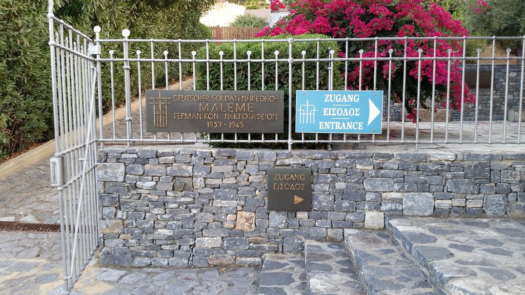
| Location | : | Maleme, Regional unit of Chania, Greece |
| Coordinate | : | 35.5220150, 23.8310340 |
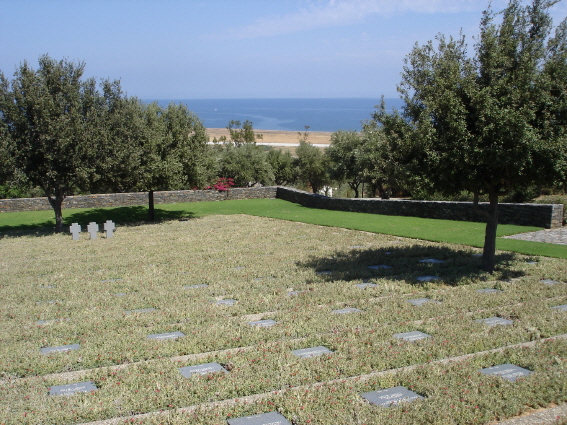
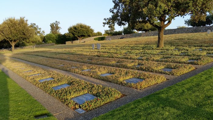
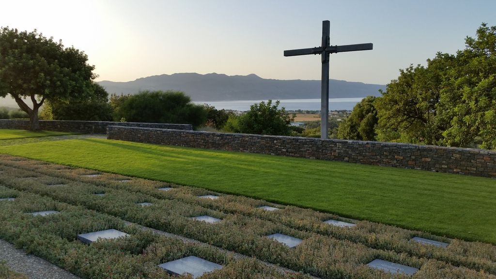
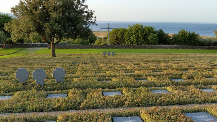
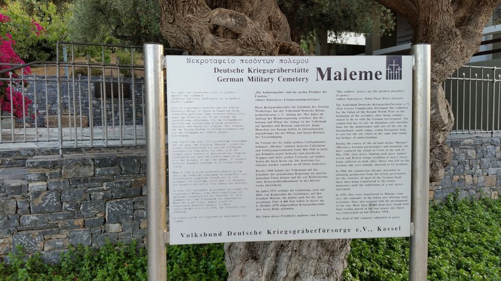
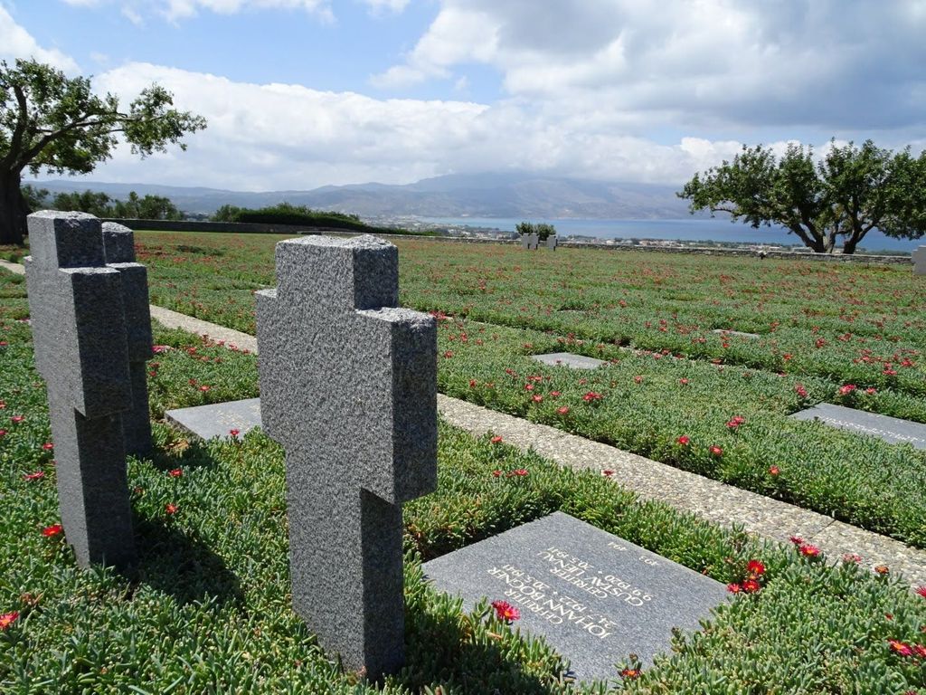
| Description | : | Maleme is best known as a landing site for German paratroopers invading Crete in 1941, at the start of the Battle of Crete (Operation Mercury) during World War II. The paratroopers captured the airstrip that was located just outside the town; once captured, this airstrip allowed the Germans to airlift in the reinforcements needed to capture the rest of the island. Many of the paratroopers lost their lives in the attack and are buried in the German war cemetery located on a hill above Maleme. There is an Royal Air Force (RAF) Memorial to the airmen of 30 and 33 Squadrons... Read More |
frequently asked questions (FAQ):
-
Where is Maleme German War Cemetery?
Maleme German War Cemetery is located at Maleme, Regional unit of Chania ,Crete ,Greece.
-
Maleme German War Cemetery cemetery's updated grave count on graveviews.com?
0 memorials
-
Where are the coordinates of the Maleme German War Cemetery?
Latitude: 35.5220150
Longitude: 23.8310340
Nearby Cemetories:
1. Galatas Cemetery (Κοιμητήριο Γαλατά)
Galatas, Regional unit of Chania, Greece
Coordinate: 35.4925080, 23.9664820
2. Vamvakopoulo Cemetery
Chania, Regional unit of Chania, Greece
Coordinate: 35.5001900, 23.9879800
3. Perivolia cemetery
Perivolia, Regional unit of Chania, Greece
Coordinate: 35.4807100, 23.9882500
4. Αγία Άννα
Meskla, Regional unit of Chania, Greece
Coordinate: 35.4098706, 23.9565538
5. Chania St. Luke Cemetery
Chania, Regional unit of Chania, Greece
Coordinate: 35.5064300, 24.0202300
6. Chania Holy Bright Cemetery
Chania, Regional unit of Chania, Greece
Coordinate: 35.5156300, 24.0448400
7. Suda Bay War Cemetery
Chania, Regional unit of Chania, Greece
Coordinate: 35.5000800, 24.0612100
8. Kounoupidhiana cemetery
Kounoupidhiana, Regional unit of Chania, Greece
Coordinate: 35.5391500, 24.0847500
9. Argoulide Cemetery
Chania, Regional unit of Chania, Greece
Coordinate: 35.5281250, 24.0998570
10. Chorafakia cemetery
Chorafakia, Regional unit of Chania, Greece
Coordinate: 35.5582900, 24.0980800
11. Saint Onoufrios Church
Alonai, Regional unit of Rethymno, Greece
Coordinate: 35.2395697, 24.3431465
12. Νεκροταφείο Βενερατου
Veneraton, Regional unit of Heraklion, Greece
Coordinate: 35.1975168, 25.0406244
13. Nea Alikarnassos
Nea Alikarnassos, Regional unit of Heraklion, Greece
Coordinate: 35.3341000, 25.1633300
14. Churchyard
Gerakas, Regional unit of Laconia, Greece
Coordinate: 36.7455760, 23.0547690
15. Kechrianika Cemetery
Kekhrianika, Regional unit of Laconia, Greece
Coordinate: 36.4967658, 22.3923652
16. Ios Municipal Cemetery
Ios, Regional unit of Thira, Greece
Coordinate: 36.7215667, 25.2854214
17. Holy Trinity Cemetery
Regional unit of Laconia, Greece
Coordinate: 37.0833330, 22.3500000
18. Municipal Cemetery of Kalamata
Kalamata, Regional unit of Messenia, Greece
Coordinate: 37.0434910, 22.1197042
19. Karyes Cemetery
Sparta, Regional unit of Laconia, Greece
Coordinate: 37.2947510, 22.4999688
20. Tolon Cemetery
Tolon, Regional unit of Argolis, Greece
Coordinate: 37.5189000, 22.8560500
21. Jubilee Park Cemetery
Uitenhage, Nelson Mandela Bay Metropolitan Municipality, South Africa
Coordinate: 33.7590830, 25.3820000
22. Arkadiko Cemetery
Arkadiko, Regional unit of Argolis, Greece
Coordinate: 37.5948500, 22.9480800
23. Κοιμητήριο Σταθμού (Εκκλησάκι Αγίων Πάντων)
Skala, Regional unit of Messenia, Greece
Coordinate: 37.1958010, 21.9996910
24. Community Cemetery Skala
Skala, Regional unit of Messenia, Greece
Coordinate: 37.1959193, 21.9998022