
| Memorials | : | 1 |
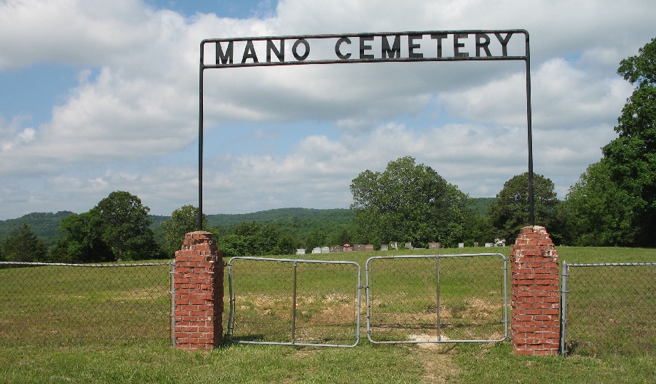
| Location | : | Mano, Barry County, USA |
| Coordinate | : | 36.5850100, -93.7004200 |
| Description | : | Directions: Just north of Mano, west side of Hwy M, near Rock Creek. It is the only cemetery on M and you can't miss it. Directions: From Mano take M north. From the north get to the intersection of 76 and M and take M south, if you make it all the way to Mano you somehow missed it. |
frequently asked questions (FAQ):
-
Where is Mano Cemetery?
Mano Cemetery is located at Mano, Barry County ,Missouri ,USA.
-
Mano Cemetery cemetery's updated grave count on graveviews.com?
1 memorials
-
Where are the coordinates of the Mano Cemetery?
Latitude: 36.5850100
Longitude: -93.7004200
Nearby Cemetories:
1. Brock School Cemetery
Shell Knob, Barry County, USA
Coordinate: 36.5935400, -93.6497700
2. Old Easley Cemetery
Golden, Barry County, USA
Coordinate: 36.5465110, -93.6807390
3. Viney Creek Cemetery
Golden, Barry County, USA
Coordinate: 36.5532200, -93.6654830
4. Viney Cemetery
Emerald Beach, Barry County, USA
Coordinate: 36.5531006, -93.6650009
5. Easley Cemetery
Eagle Rock, Barry County, USA
Coordinate: 36.5497017, -93.7363968
6. Painter Cemetery
Shell Knob, Barry County, USA
Coordinate: 36.6114197, -93.6336899
7. Farwell Cemetery
Eagle Rock, Barry County, USA
Coordinate: 36.5258000, -93.7286000
8. Mikeman Cemetery
Shell Knob, Barry County, USA
Coordinate: 36.6368294, -93.6428833
9. Roach Cemetery
Eagle Rock, Barry County, USA
Coordinate: 36.5149994, -93.7063980
10. Epperly Memorial Cemetery
Shell Knob, Barry County, USA
Coordinate: 36.6306000, -93.6318970
11. Old Haddock Cemetery
Eagle Rock, Barry County, USA
Coordinate: 36.5222500, -93.7473667
12. Munsey Cemetery
Eagle Rock, Barry County, USA
Coordinate: 36.5574989, -93.7891998
13. Lake Park Memorial Gardens
Shell Knob, Barry County, USA
Coordinate: 36.5915600, -93.6030000
14. Whittington Cemetery
Cassville, Barry County, USA
Coordinate: 36.5606180, -93.7934250
15. Wills Cemetery
Shell Knob, Barry County, USA
Coordinate: 36.6388600, -93.6152200
16. Viola Cemetery
Barry County, USA
Coordinate: 36.5774841, -93.5900192
17. Pierce Cemetery
Shell Knob, Barry County, USA
Coordinate: 36.6744003, -93.7127991
18. Oak Hill Cemetery
Eureka Springs, Carroll County, USA
Coordinate: 36.4928017, -93.6903000
19. Bowsher Cemetery
Bates Corner, Barry County, USA
Coordinate: 36.6391373, -93.8008804
20. McGuire Cemetery
Shell Knob, Barry County, USA
Coordinate: 36.5317001, -93.5982971
21. Holiday Island Memorial Garden
Eureka Springs, Carroll County, USA
Coordinate: 36.4920750, -93.7386220
22. Presbyterian Church and Cemetery
Holiday Island, Carroll County, USA
Coordinate: 36.4907200, -93.7409700
23. Liberty Cemetery
Golden, Barry County, USA
Coordinate: 36.5000333, -93.6333500
24. Mineral Springs Cemetery
Mineral Spring, Barry County, USA
Coordinate: 36.6709700, -93.7751900