
| Memorials | : | 2 |
| Location | : | Mansfield, Iron County, USA |
| Coordinate | : | 46.1134700, -88.2178200 |
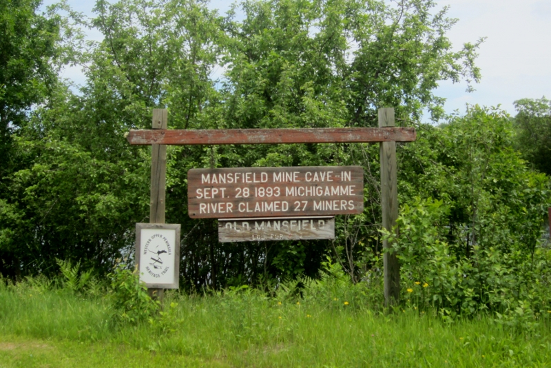
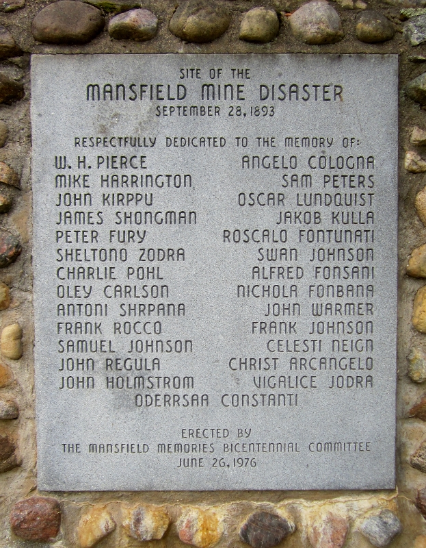
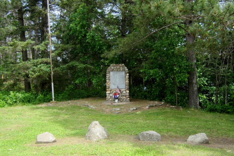
| Description | : | The Mansfield Mine extracted high grade Bessemer ore that ran underneath the Michigamme River. There were six levels of the mine at the time of the accident. The upper levels, once mined, were left with beams and ore piles that would support the weight of the levels above it as well as the floor of the Michigamme River. On September 28, 1893, the beams of the fifth level broke, which caused levels 1 - 5 to crash, allowing the River to flood those upper levels. The lowest level, level 6, was still solid with ore. ... Read More |
frequently asked questions (FAQ):
-
Where is Mansfield Mine Memorial?
Mansfield Mine Memorial is located at Stream Rd. Mansfield, Iron County ,Michigan , 49920USA.
-
Mansfield Mine Memorial cemetery's updated grave count on graveviews.com?
2 memorials
-
Where are the coordinates of the Mansfield Mine Memorial?
Latitude: 46.1134700
Longitude: -88.2178200
Nearby Cemetories:
1. Evergreen Memorial Cemetery
Crystal Falls, Iron County, USA
Coordinate: 46.1005620, -88.3124540
2. Rosehill East Cemetery
Mansfield, Iron County, USA
Coordinate: 46.0735589, -88.1243176
3. Channing Cemetery
Channing, Dickinson County, USA
Coordinate: 46.1302986, -88.0839005
4. Woodlawn Cemetery
Florence, Florence County, USA
Coordinate: 45.9235992, -88.2343979
5. Commonwealth Cemetery
Commonwealth, Florence County, USA
Coordinate: 45.9144000, -88.2494000
6. Hematite Cemetery
Amasa, Iron County, USA
Coordinate: 46.2356520, -88.4636600
7. Indian Cemetery
Crystal Falls, Iron County, USA
Coordinate: 46.0389230, -88.5104410
8. Bates Township Cemetery
Mapleton, Iron County, USA
Coordinate: 46.1201629, -88.5664721
9. Carmelite Monastery Cemetery
Iron Mountain, Dickinson County, USA
Coordinate: 45.8659220, -88.0634740
10. Stambaugh Cemetery
Iron River, Iron County, USA
Coordinate: 46.0774994, -88.6286011
11. Iron River Cemetery
Iron River, Iron County, USA
Coordinate: 46.1027985, -88.6358032
12. Stambaugh Cemetery
Stambaugh, Iron County, USA
Coordinate: 46.0492670, -88.6409150
13. Felch Cemetery
Felch, Dickinson County, USA
Coordinate: 45.9925000, -87.8152770
14. Whispering Pines Cemetery
Ralph, Dickinson County, USA
Coordinate: 46.1091995, -87.7716980
15. Resthaven Cemetery
Iron River, Iron County, USA
Coordinate: 46.0964012, -88.6772003
16. Iron Mountain Cemetery Park
Iron Mountain, Dickinson County, USA
Coordinate: 45.8063880, -88.0652770
17. Dickinson County Memorial Gardens
Iron Mountain, Dickinson County, USA
Coordinate: 45.8061110, -88.0333330
18. Republic Cemetery
Republic, Marquette County, USA
Coordinate: 46.4075000, -87.9675000
19. Quinnesec Cemetery
Quinnesec, Dickinson County, USA
Coordinate: 45.8036003, -88.0042038
20. Tipler Cemetery
Tipler, Florence County, USA
Coordinate: 45.9252100, -88.6334000
21. Martin Cemetery
Tipler, Florence County, USA
Coordinate: 45.9502983, -88.6549988
22. Aurora Cemetery
Aurora, Florence County, USA
Coordinate: 45.7671640, -88.1554990
23. Saint Anthony Cemetery
Niagara, Marinette County, USA
Coordinate: 45.7846985, -87.9997025
24. Foster City Cemetery
Foster City, Dickinson County, USA
Coordinate: 45.9635870, -87.7285240