
| Memorials | : | 1163 |
| Location | : | Iron River, Iron County, USA |
| Coordinate | : | 46.0774994, -88.6286011 |
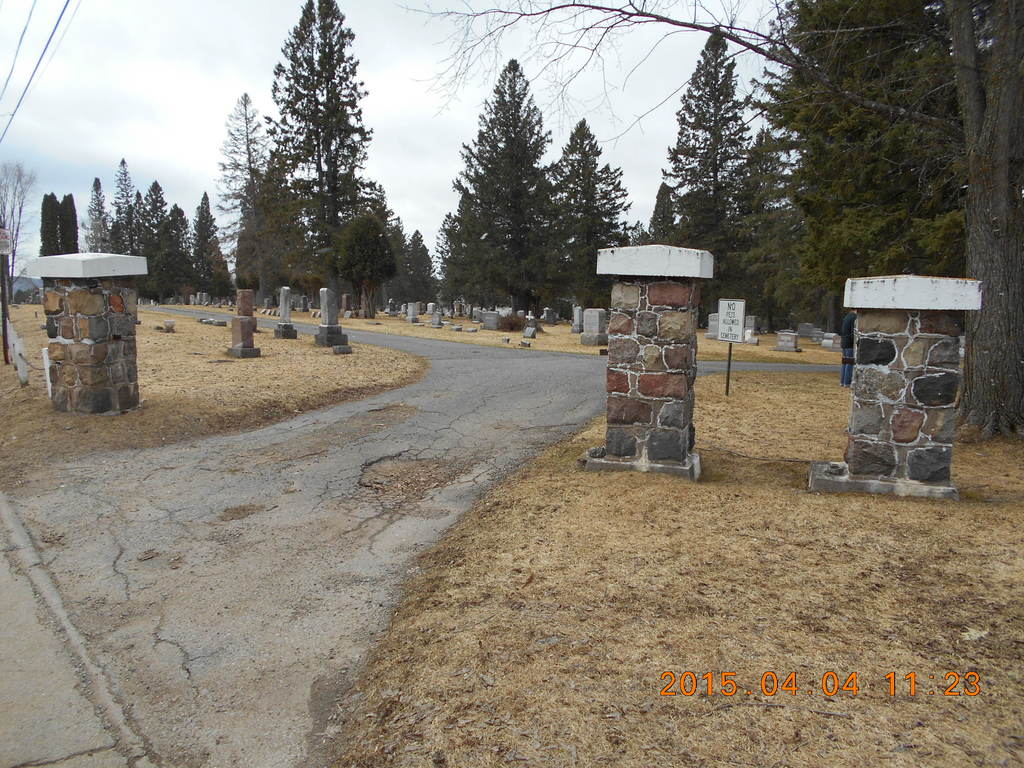
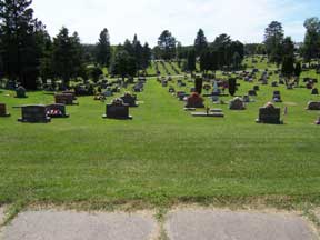
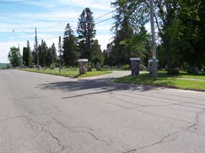
| Description | : | In 2000 the city of Stambaugh was dissolved and incorporated into the adjacent city of Iron River. Although Stambaugh can still be found on some maps, in actuality the city no longer exists. All the names of the streets which matched names of streets in Iron River were changed. This cemetery serves the former city of Stambaugh plus Caspian, Gaastra and Stambaugh Twp. The first burial was made in July of 1904. A century later all burial spaces in the cemetery are nearly full, and property is owned on M-189 near the Stambaugh Township Hall which will be... Read More |
frequently asked questions (FAQ):
-
Where is Stambaugh Cemetery?
Stambaugh Cemetery is located at Iron River, Iron County ,Michigan ,USA.
-
Stambaugh Cemetery cemetery's updated grave count on graveviews.com?
1161 memorials
-
Where are the coordinates of the Stambaugh Cemetery?
Latitude: 46.0774994
Longitude: -88.6286011
Nearby Cemetories:
1. Iron River Cemetery
Iron River, Iron County, USA
Coordinate: 46.1027985, -88.6358032
2. Stambaugh Cemetery
Stambaugh, Iron County, USA
Coordinate: 46.0492670, -88.6409150
3. Resthaven Cemetery
Iron River, Iron County, USA
Coordinate: 46.0964012, -88.6772003
4. Bates Township Cemetery
Mapleton, Iron County, USA
Coordinate: 46.1201629, -88.5664721
5. Indian Cemetery
Crystal Falls, Iron County, USA
Coordinate: 46.0389230, -88.5104410
6. Rosehill Cemetery
Beechwood, Iron County, USA
Coordinate: 46.1568985, -88.7617035
7. Martin Cemetery
Tipler, Florence County, USA
Coordinate: 45.9502983, -88.6549988
8. Tipler Cemetery
Tipler, Florence County, USA
Coordinate: 45.9252100, -88.6334000
9. Lakeview Cemetery
Alvin, Forest County, USA
Coordinate: 45.9831009, -88.8341980
10. Hematite Cemetery
Amasa, Iron County, USA
Coordinate: 46.2356520, -88.4636600
11. Evergreen Memorial Cemetery
Crystal Falls, Iron County, USA
Coordinate: 46.1005620, -88.3124540
12. Long Lake Cemetery
Long Lake, Florence County, USA
Coordinate: 45.8532982, -88.6575012
13. Mansfield Mine Memorial
Mansfield, Iron County, USA
Coordinate: 46.1134700, -88.2178200
14. Commonwealth Cemetery
Commonwealth, Florence County, USA
Coordinate: 45.9144000, -88.2494000
15. Phelps Cemetery
Phelps, Vilas County, USA
Coordinate: 46.0646000, -89.0795000
16. Woodlawn Cemetery
Florence, Florence County, USA
Coordinate: 45.9235992, -88.2343979
17. Volkmann Cemetery
Phelps, Vilas County, USA
Coordinate: 46.0544900, -89.0928900
18. Katakikon Indian Village Cemetery
Watersmeet, Gogebic County, USA
Coordinate: 46.1513889, -89.0850000
19. Forest Home Cemetery
Newald, Forest County, USA
Coordinate: 45.7520800, -88.6962000
20. Schuett Burial Site
Fence, Florence County, USA
Coordinate: 45.7655000, -88.4400100
21. Rosehill East Cemetery
Mansfield, Iron County, USA
Coordinate: 46.0735589, -88.1243176
22. Hillside Cemetery
Fence, Florence County, USA
Coordinate: 45.7366982, -88.4246979
23. Channing Cemetery
Channing, Dickinson County, USA
Coordinate: 46.1302986, -88.0839005
24. Land O' Lakes Bible Church Cemetery
Land O' Lakes, Vilas County, USA
Coordinate: 46.1334490, -89.2068600