
| Memorials | : | 1 |
| Location | : | Mayne Corners, Huron County, Canada |
| Coordinate | : | 43.8328550, -81.0164450 |
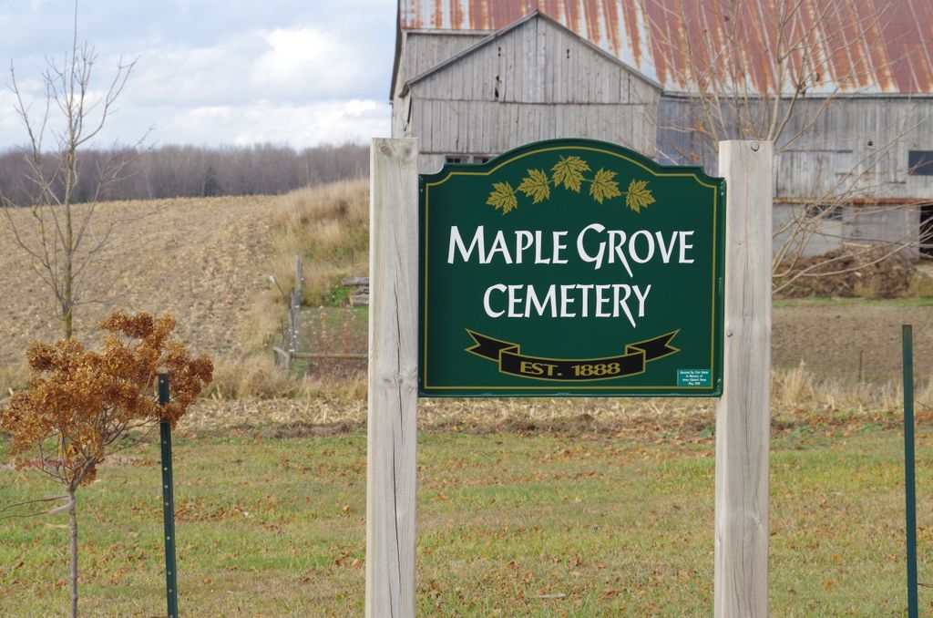
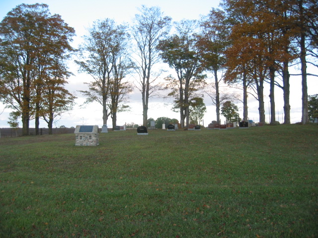
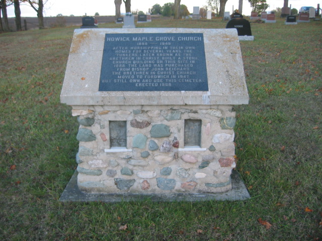
| Description | : | Maple Grove Brethren in Christ Cemetery 45302-45700 Creamery Road, Howick, Huron, Ontario, Canada ON N0G 1V0 The cemetery is located on what was formerly the 2nd Concession of Howick Township. The cemetery is located in Huron County, north of Mayne Corners (Perth County). |
frequently asked questions (FAQ):
-
Where is Maple Grove Brethren in Christ Cemetery?
Maple Grove Brethren in Christ Cemetery is located at Mayne Corners, Huron County ,Ontario ,Canada.
-
Maple Grove Brethren in Christ Cemetery cemetery's updated grave count on graveviews.com?
1 memorials
-
Where are the coordinates of the Maple Grove Brethren in Christ Cemetery?
Latitude: 43.8328550
Longitude: -81.0164450

Nearby Cemetories:
1. Howick Baptist Church
Howick Township, Huron County, Canada
Coordinate: 43.8335260, -81.0102190
2. Mayne Methodist Cemetery
Wallace Township, Perth County, Canada
Coordinate: 43.8137170, -81.0197710
3. Trinity Lutheran Cemetery
Kurtzville, Perth County, Canada
Coordinate: 43.8092810, -81.0067280
4. Kurtzville Mennonite Cemetery
Kurtzville, Perth County, Canada
Coordinate: 43.8060710, -80.9992470
5. Emmanuel United Cemetery
Kurtzville, Perth County, Canada
Coordinate: 43.8055290, -80.9987430
6. Fordwich Presbyterian Cemetery
Fordwich, Huron County, Canada
Coordinate: 43.8644160, -81.0298360
7. Sotheran Cemetery
Fordwich, Huron County, Canada
Coordinate: 43.8667380, -81.0407413
8. Brotherston Mennonite Cemetery
Brotherston, Perth County, Canada
Coordinate: 43.8194800, -80.9626290
9. Fordwich Cemetery
Fordwich, Huron County, Canada
Coordinate: 43.8733590, -81.0355490
10. Salem South Pioneer Cemetery
Minto, Wellington County, Canada
Coordinate: 43.8417600, -80.9432000
11. Old Hunter Methodist Cemetery
Howick Township, Huron County, Canada
Coordinate: 43.8814120, -81.0721270
12. Redgrave Cemetery
Howick Township, Huron County, Canada
Coordinate: 43.8933390, -80.9841470
13. Augusta Evangelical Cemetery
Wallace Township, Perth County, Canada
Coordinate: 43.7741600, -80.9711300
14. Saint Paul's Anglican Cemetery
Gowanstown, Perth County, Canada
Coordinate: 43.7850200, -80.9463200
15. Zion United Church Cemetery
Wallace Township, Perth County, Canada
Coordinate: 43.8028790, -80.9231570
16. Saint Paul's Lutheran Cemetery
Gowanstown, Perth County, Canada
Coordinate: 43.7808700, -80.9363010
17. Gorrie Public Cemetery
Gorrie, Huron County, Canada
Coordinate: 43.8693900, -81.1135200
18. Woodlawn Pioneer Cemetery
Listowel, Perth County, Canada
Coordinate: 43.7484360, -80.9926700
19. Molesworth Cemetery
Huron County, Canada
Coordinate: 43.8050600, -81.1318900
20. Cedarvale Conservative Mennonite Cemetery
Minto, Wellington County, Canada
Coordinate: 43.9136800, -80.9522600
21. Wroxeter Cemetery
Wroxeter, Huron County, Canada
Coordinate: 43.8738910, -81.1393880
22. Wroxeter Anglican Cemetery
Wroxeter, Huron County, Canada
Coordinate: 43.8647300, -81.1460400
23. Wroxeter Presbyterian Cemetery
Wroxeter, Huron County, Canada
Coordinate: 43.8646130, -81.1461730
24. Palmerston Cemetery
Palmerston, Wellington County, Canada
Coordinate: 43.8316800, -80.8683000