
| Memorials | : | 1 |
| Location | : | Wroxeter, Huron County, Canada |
| Coordinate | : | 43.8646130, -81.1461730 |
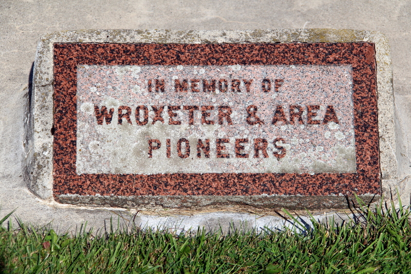
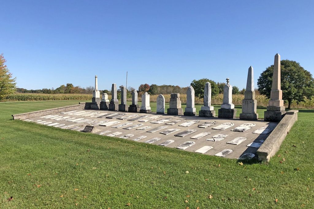
| Description | : | Queen and Church Sts. The Wroxeter Presbyterian Cemetery and the Wroxeter Anglican Cemetery are located a block apart and are a good place to learn about the area’s early pioneers by reading the headstones of early pioneers in the area. The Wroxeter Presbyterian Cemetery, the larger of the two, was closed in the 1960’s and many of the graves were re-interred at Wroxeter Public Cemetery when the township took over in the 1960’s. In 1986 the Howick Township Council applied for a government funding to clean out and rebuild the cemetery. |
frequently asked questions (FAQ):
-
Where is Wroxeter Presbyterian Cemetery?
Wroxeter Presbyterian Cemetery is located at Wroxeter, Huron County ,Ontario ,Canada.
-
Wroxeter Presbyterian Cemetery cemetery's updated grave count on graveviews.com?
1 memorials
-
Where are the coordinates of the Wroxeter Presbyterian Cemetery?
Latitude: 43.8646130
Longitude: -81.1461730
Nearby Cemetories:
1. Wroxeter Anglican Cemetery
Wroxeter, Huron County, Canada
Coordinate: 43.8647300, -81.1460400
2. Wroxeter Cemetery
Wroxeter, Huron County, Canada
Coordinate: 43.8738910, -81.1393880
3. Gorrie Public Cemetery
Gorrie, Huron County, Canada
Coordinate: 43.8693900, -81.1135200
4. Wroxeter Mennonite Cemetery
Wroxeter, Huron County, Canada
Coordinate: 43.8865580, -81.1640000
5. Old Hunter Methodist Cemetery
Howick Township, Huron County, Canada
Coordinate: 43.8814120, -81.0721270
6. Molesworth Cemetery
Huron County, Canada
Coordinate: 43.8050600, -81.1318900
7. Sotheran Cemetery
Fordwich, Huron County, Canada
Coordinate: 43.8667380, -81.0407413
8. Bluevale Cemetery
Bluevale, Huron County, Canada
Coordinate: 43.8558197, -81.2535095
9. Fordwich Cemetery
Fordwich, Huron County, Canada
Coordinate: 43.8733590, -81.0355490
10. Fordwich Presbyterian Cemetery
Fordwich, Huron County, Canada
Coordinate: 43.8644160, -81.0298360
11. Lakelet Cemetery
Lakelet, Huron County, Canada
Coordinate: 43.9470740, -81.0709270
12. Maple Grove Brethren in Christ Cemetery
Mayne Corners, Huron County, Canada
Coordinate: 43.8328550, -81.0164450
13. Howick Baptist Church
Howick Township, Huron County, Canada
Coordinate: 43.8335260, -81.0102190
14. Mayne Methodist Cemetery
Wallace Township, Perth County, Canada
Coordinate: 43.8137170, -81.0197710
15. McIntosh United Cemetery
McIntosh, Bruce County, Canada
Coordinate: 43.9700000, -81.1105000
16. Trinity Lutheran Cemetery
Kurtzville, Perth County, Canada
Coordinate: 43.8092810, -81.0067280
17. Mount Pleasant Cemetery
Ethel, Huron County, Canada
Coordinate: 43.7495193, -81.1273346
18. Redgrave Cemetery
Howick Township, Huron County, Canada
Coordinate: 43.8933390, -80.9841470
19. Kurtzville Mennonite Cemetery
Kurtzville, Perth County, Canada
Coordinate: 43.8060710, -80.9992470
20. Emmanuel United Cemetery
Kurtzville, Perth County, Canada
Coordinate: 43.8055290, -80.9987430
21. Wingham Cemetery
Wingham, Huron County, Canada
Coordinate: 43.8997993, -81.3119965
22. Trinity Lutheran Cemetery
Howick Township, Huron County, Canada
Coordinate: 43.9460000, -81.0089440
23. Saint John's Lutheran Cemetery
Carrick Township, Bruce County, Canada
Coordinate: 43.9925000, -81.0797300
24. Brotherston Mennonite Cemetery
Brotherston, Perth County, Canada
Coordinate: 43.8194800, -80.9626290