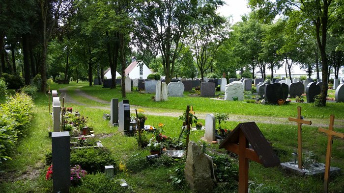
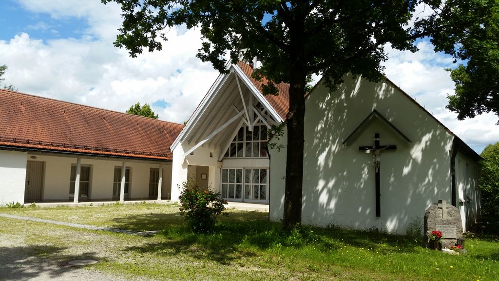
| Memorials | : | 0 |
| Location | : | Markt Indersdorf, Landkreis Dachau, Germany |
| Coordinate | : | 48.3557800, 11.3935500 |
| Description | : | other cemeteries in the county of Dachau (Landkreis Dachau): ► Cemeteries in Dachau County |
frequently asked questions (FAQ):
-
Where is Markt Indersdorf Waldfriedhof?
Markt Indersdorf Waldfriedhof is located at Maroldstr. 51 Markt Indersdorf, Landkreis Dachau ,Bavaria (Bayern) , 85229Germany.
-
Markt Indersdorf Waldfriedhof cemetery's updated grave count on graveviews.com?
0 memorials
-
Where are the coordinates of the Markt Indersdorf Waldfriedhof?
Latitude: 48.3557800
Longitude: 11.3935500
Nearby Cemetories:
1. Markt Indersdorf Alter Friedhof
Markt Indersdorf, Landkreis Dachau, Germany
Coordinate: 48.3554000, 11.3921900
2. Kloster Indersdorf
Markt Indersdorf, Landkreis Dachau, Germany
Coordinate: 48.3574950, 11.3831220
3. Glonn Friedhof
Glonn, Landkreis Dachau, Germany
Coordinate: 48.3700600, 11.3883100
4. St Martin Cemetery
Weichs, Landkreis Dachau, Germany
Coordinate: 48.3776500, 11.4144690
5. Grossinzemoos Kirchfriedhof
Grossinzemoos, Landkreis Dachau, Germany
Coordinate: 48.3372600, 11.4247900
6. Kirchhof St. Leonhard und Anna
Pasenbach, Landkreis Dachau, Germany
Coordinate: 48.3580865, 11.4353491
7. Neuer Friedhof
Weichs, Landkreis Dachau, Germany
Coordinate: 48.3847960, 11.4072490
8. Niederroth Friedhof
Niederroth, Landkreis Dachau, Germany
Coordinate: 48.3219900, 11.3875000
9. Arnbach Kirchfriedhof
Arnbach, Landkreis Dachau, Germany
Coordinate: 48.3370200, 11.3450800
10. Friedhof St. Korbinian
Westerholzhausen, Landkreis Dachau, Germany
Coordinate: 48.3679108, 11.3392932
11. Kleininzemoos Kirchfriedhof
Kleininzemoos, Landkreis Dachau, Germany
Coordinate: 48.3330500, 11.4404400
12. Kirchhof St. Vitalis
Sigmertshausen, Landkreis Dachau, Germany
Coordinate: 48.3191035, 11.4145088
13. Kirchhof St. Lantpert Cemetery
Riedenzhofen, Landkreis Dachau, Germany
Coordinate: 48.3395201, 11.4521216
14. Vierkirchen Friedhof
Vierkirchen, Landkreis Dachau, Germany
Coordinate: 48.3659100, 11.4589700
15. Schwabhausen Neuer Friedhof am Wasserturm
Schwabhausen, Landkreis Dachau, Germany
Coordinate: 48.3111900, 11.3547000
16. Rohrmoos Kirchfriedhof
Rohrmoos, Landkreis Dachau, Germany
Coordinate: 48.3280200, 11.4597400
17. Gemeindefriedhof Rumelsthausen
Rumeltshausen, Landkreis Dachau, Germany
Coordinate: 48.3033578, 11.3884687
18. Kirchhof St. Johannes und Paulus
Arzbach, Landkreis Dachau, Germany
Coordinate: 48.3099595, 11.4362108
19. Friedhof St. Laurentius
Rumeltshausen, Landkreis Dachau, Germany
Coordinate: 48.3018740, 11.3841920
20. Schwabhausen Kirchfriedhof
Schwabhausen, Landkreis Dachau, Germany
Coordinate: 48.3071700, 11.3526500
21. Schönbrunn Klosterfriedhof
Schönbrunn, Landkreis Dachau, Germany
Coordinate: 48.3307500, 11.4748400
22. Gemeindefriedhof Pellheim
Pellheim, Landkreis Dachau, Germany
Coordinate: 48.2975338, 11.4164202
23. Kirchhof Mariä Geburt
Unterweilbach, Landkreis Dachau, Germany
Coordinate: 48.3056984, 11.4483550
24. Dorffriedhof Unterweilbach
Unterweilbach, Landkreis Dachau, Germany
Coordinate: 48.3069619, 11.4509663


