
| Memorials | : | 0 |
| Location | : | Nanih Waiya, Winston County, USA |
| Coordinate | : | 32.9638700, -88.9201000 |
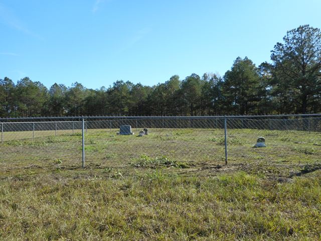
| Description | : | This cemetery is located on Private land Permission needs to be acquired before entering. Mr. Houston (the land owner) said that there are numerous McArthur's were buried in the cemetery without markers. There are several sandstone rocks marking graves. Taken from the Cemetery Book of Winston County completed in 1993 by Louis Taunton. |
frequently asked questions (FAQ):
-
Where is McArthur Cemetery?
McArthur Cemetery is located at Nanih Waiya, Winston County ,Mississippi ,USA.
-
McArthur Cemetery cemetery's updated grave count on graveviews.com?
0 memorials
-
Where are the coordinates of the McArthur Cemetery?
Latitude: 32.9638700
Longitude: -88.9201000
Nearby Cemetories:
1. Boydston Cemetery
Winston County, USA
Coordinate: 32.9485200, -88.9167300
2. Pilgrim Rest Baptist Church Cemetery
Winston County, USA
Coordinate: 32.9543762, -88.9020462
3. Middleton Cemetery
Winston County, USA
Coordinate: 32.9477997, -88.9392014
4. Vernon Methodist Church Cemetery
Vernon, Winston County, USA
Coordinate: 32.9852982, -88.9310989
5. Vernon Assembly of God Cemetery
Vernon, Winston County, USA
Coordinate: 32.9841170, -88.9343250
6. Harmony Cemetery
Vernon, Winston County, USA
Coordinate: 32.9883003, -88.9132996
7. Whitehead Cemetery
Winston County, USA
Coordinate: 32.9941730, -88.9326660
8. Stevenson Cemetery
Noxapater, Winston County, USA
Coordinate: 32.9689500, -88.9594500
9. Fulton Cemetery
Winston County, USA
Coordinate: 32.9874992, -88.9499969
10. Mount Hebron Cemetery
Handle, Winston County, USA
Coordinate: 32.9557991, -88.8724976
11. Lovorn Cemetery
Fearns Springs, Winston County, USA
Coordinate: 32.9651800, -88.8713800
12. McGraw-Reed-McDonald Cemetery
Fearns Springs, Winston County, USA
Coordinate: 32.9717000, -88.8651700
13. Old Enon Cemetery
Claytown, Winston County, USA
Coordinate: 32.9766312, -88.9746170
14. Mount Hebron Old Cemetery
Winston County, USA
Coordinate: 32.9360680, -88.8712760
15. Rosamond Family Cemetery
Handle, Winston County, USA
Coordinate: 32.9352875, -88.8649750
16. Shields Cemetery
Winston County, USA
Coordinate: 32.9858900, -88.9852770
17. Coy United Methodist Church Cemetery
Neshoba County, USA
Coordinate: 32.9039001, -88.9152985
18. Nanih Waiya Mennonite Church Cemetery
Neshoba County, USA
Coordinate: 32.9022360, -88.9259090
19. Anderson Cemetery
Fearns Springs, Winston County, USA
Coordinate: 32.9789740, -88.8485520
20. Jackson Field Cemetery
Winston County, USA
Coordinate: 32.9476940, -88.8457350
21. Enon Baptist Church Cemetery
Claytown, Winston County, USA
Coordinate: 32.9951210, -88.9877220
22. Oak Grove Cemetery
Winston County, USA
Coordinate: 32.9314003, -88.9888992
23. Mount Pisgah Cemetery
Winston County, USA
Coordinate: 32.9552994, -88.8416977
24. Good Hope Baptist Cemetery
Fearns Springs, Winston County, USA
Coordinate: 32.9989014, -88.8514023