
| Memorials | : | 0 |
| Location | : | Monroe County, USA |
| Coordinate | : | 31.5016994, -87.5108032 |
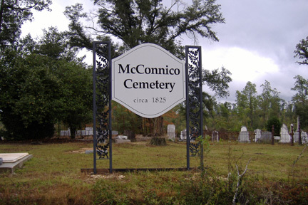
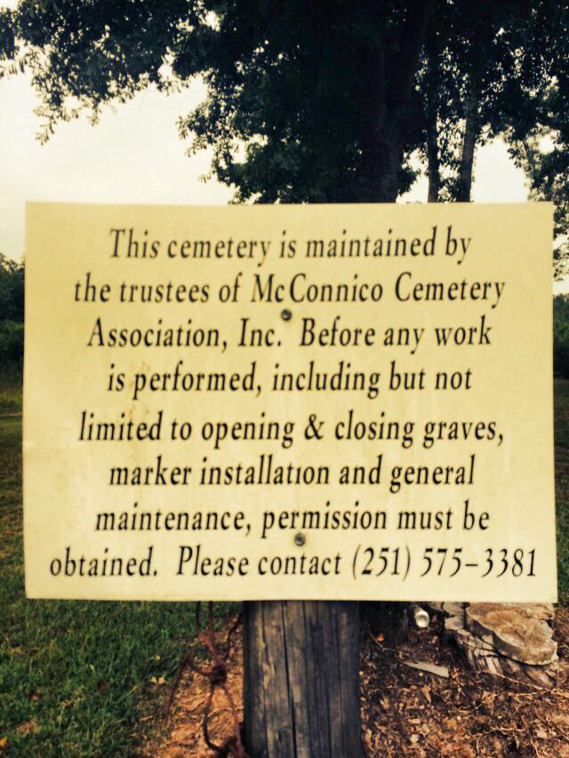
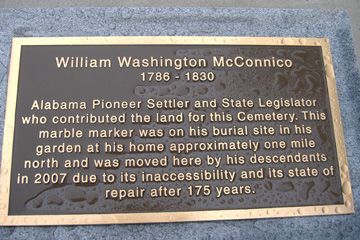
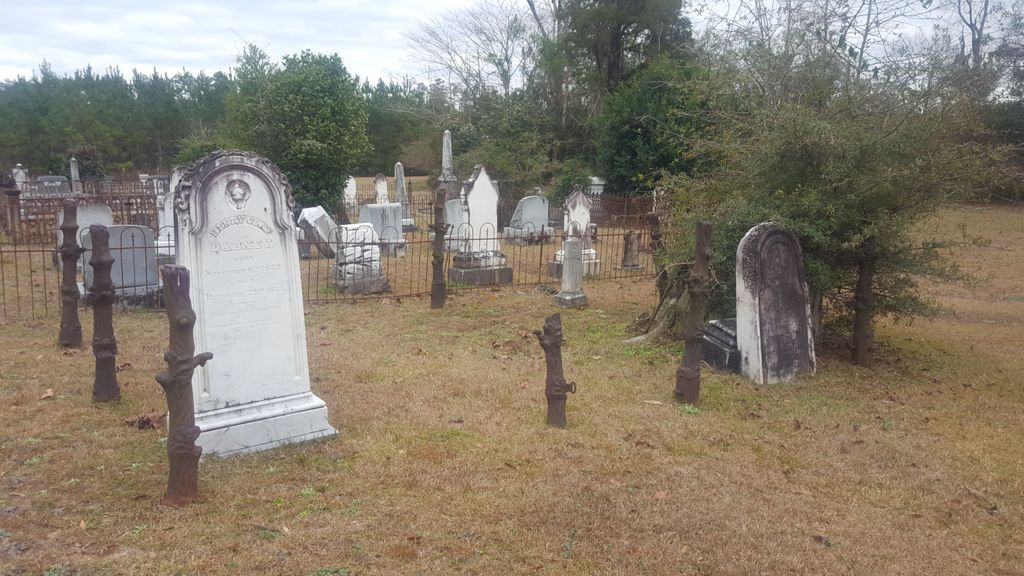
| Description | : | The McConnico Cemetery is also known as the McConnico-Steele Cemetery. Its history goes back to the mid-1800s when William Washington McConnico donated the land. He set aside a parcel large enough to accommodate his friends and neighbors in that part of Monroe County, but there were also African-American and Creek Indian friends for whom he felt had need, in what was then a bustling and growing community along the river. Thus, a section was designated for white folks (McConnico), as was the custom in those times, and a large portion for his Indian and African-American friends (Steele).... Read More |
frequently asked questions (FAQ):
-
Where is McConnico Cemetery?
McConnico Cemetery is located at Monroe County ,Alabama ,USA.
-
McConnico Cemetery cemetery's updated grave count on graveviews.com?
0 memorials
-
Where are the coordinates of the McConnico Cemetery?
Latitude: 31.5016994
Longitude: -87.5108032
Nearby Cemetories:
1. Crook-Moore Cemetery
Perdue Hill, Monroe County, USA
Coordinate: 31.4971900, -87.5007400
2. Claiborne Jewish Cemetery
Claiborne, Monroe County, USA
Coordinate: 31.5254340, -87.5117680
3. Mount Rose Missionary Baptist Church Cemetery
Perdue Hill, Monroe County, USA
Coordinate: 31.5087734, -87.4816564
4. Medlock Cemetery
Perdue Hill, Monroe County, USA
Coordinate: 31.5078640, -87.4751210
5. Mount Zion Missionary Baptist Cemetery
Claiborne, Monroe County, USA
Coordinate: 31.5382200, -87.5238800
6. Mount Zion Baptist Church Cemetery
Claiborne, Monroe County, USA
Coordinate: 31.5390700, -87.5254300
7. Claiborne Cemetery
Monroe County, USA
Coordinate: 31.5464001, -87.5124969
8. Dellet Family Cemetery
Claiborne, Monroe County, USA
Coordinate: 31.5480213, -87.5146866
9. Rivers-Scott Cemetery
Claiborne, Monroe County, USA
Coordinate: 31.5507450, -87.5374320
10. Racom Cemetery
Perdue Hill, Monroe County, USA
Coordinate: 31.5101230, -87.4470280
11. Lilly Baptist Church Cemetery
Frisco City, Monroe County, USA
Coordinate: 31.4799370, -87.4463290
12. Bright Morning Star Missionary Baptist Cemetery
Frisco City, Monroe County, USA
Coordinate: 31.4793870, -87.4455640
13. Polar Bridge Cemetery
Manistee, Monroe County, USA
Coordinate: 31.4452200, -87.4848190
14. Macedonia Church Cemetery
Manistee, Monroe County, USA
Coordinate: 31.4379530, -87.4802680
15. Crapps Cemetery
Old Salem, Monroe County, USA
Coordinate: 31.5411040, -87.4381380
16. James Landing Cemetery
Barlow Bend, Clarke County, USA
Coordinate: 31.4925003, -87.5982971
17. Macedonia Baptist Church Cemetery
Frisco City, Monroe County, USA
Coordinate: 31.4250180, -87.4940550
18. Slaughter Cemetery
Monroe County, USA
Coordinate: 31.4262100, -87.5418100
19. Sheffield Family Cemetery
Frisco City, Monroe County, USA
Coordinate: 31.4996090, -87.4122220
20. Pleasant Hill Cemetery
Frisco City, Monroe County, USA
Coordinate: 31.4180370, -87.4954900
21. Shiloh Missionary Baptist Church Cemetery
Frisco City, Monroe County, USA
Coordinate: 31.4209150, -87.5431760
22. Old Salem Cemetery
Old Salem, Monroe County, USA
Coordinate: 31.5410260, -87.4094710
23. New Chapel Cemetery
Mexia, Monroe County, USA
Coordinate: 31.5413850, -87.4039490
24. Mackey Branch Baptist Church Cemetery
Gosport, Clarke County, USA
Coordinate: 31.5815100, -87.5823000