
| Memorials | : | 0 |
| Location | : | Leighton, Estill County, USA |
| Coordinate | : | 37.9048280, -89.9048280 |
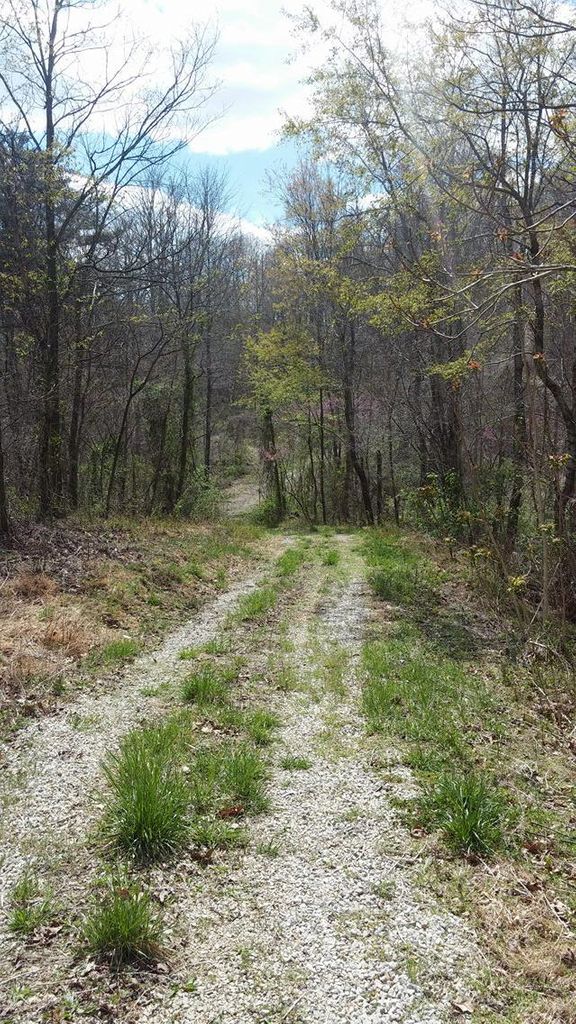
| Description | : | Take Barnes Mountain Road(Road 851) to Bobby Miller Rd. It is the first gravelly path to the left down Bobby Miller Rd.. Path leads to the cemetery atop of the hill. It is a small fenced area with a large cedar tree. Decimal Degrees: Lat 37.904828 Long 89.904828 |
frequently asked questions (FAQ):
-
Where is McKinney Cemetery #2?
McKinney Cemetery #2 is located at Bobby Miller Rd. Leighton, Estill County ,Kentucky , 40336USA.
-
McKinney Cemetery #2 cemetery's updated grave count on graveviews.com?
0 memorials
-
Where are the coordinates of the McKinney Cemetery #2?
Latitude: 37.9048280
Longitude: -89.9048280
Nearby Cemetories:
1. Kaskaskia Cemetery
Kaskaskia, Randolph County, USA
Coordinate: 37.9183006, -89.9338989
2. Southern Illinois Penitentiary Cemetery
Menard, Randolph County, USA
Coordinate: 37.9140210, -89.8383510
3. Old Kaskaskia Cemetery
Kaskaskia, Randolph County, USA
Coordinate: 37.9574630, -89.9229240
4. Garrison Hill Cemetery
Ellis Grove, Randolph County, USA
Coordinate: 37.9667640, -89.9088330
5. Evergreen Cemetery
Chester, Randolph County, USA
Coordinate: 37.9160995, -89.8249969
6. Old Saint Mary's Cemetery
Chester, Randolph County, USA
Coordinate: 37.9354650, -89.8317720
7. Saint Marys Catholic Cemetery
Chester, Randolph County, USA
Coordinate: 37.9235992, -89.8208008
8. Brown Cemetery
Saint Marys Township, Perry County, USA
Coordinate: 37.8499985, -89.9606018
9. Saint John Evangelical Lutheran Cemetery
Chester, Randolph County, USA
Coordinate: 37.9322014, -89.8221970
10. Saint John the Evangelist Catholic Church Cemetery
Lithium, Perry County, USA
Coordinate: 37.8327600, -89.8873360
11. Mann Cemetery
Randolph County, USA
Coordinate: 37.9639015, -89.8358002
12. Crains Island Cemetery
Rockwood, Randolph County, USA
Coordinate: 37.8617168, -89.7953929
13. Crain-Clore Cemetery
Randolph County, USA
Coordinate: 37.8929410, -89.7808310
14. Ellis Grove City Cemetery
Ellis Grove, Randolph County, USA
Coordinate: 38.0112140, -89.9102340
15. Adams Cemetery
Bremen, Randolph County, USA
Coordinate: 37.9604840, -89.7841900
16. New Palestine Church Cemetery
New Palestine, Randolph County, USA
Coordinate: 37.9969749, -89.8178635
17. Preston Cemetery
Perry County, USA
Coordinate: 37.8025017, -89.8330994
18. Will Cemetery
Randolph County, USA
Coordinate: 38.0168690, -89.9657970
19. Nativity of the Blessed Virgin Mary Cemetery
Belgique, Perry County, USA
Coordinate: 37.8358002, -89.7767029
20. Johnson Cemetery
Rockwood, Randolph County, USA
Coordinate: 37.8929120, -89.7489840
21. Christ the Savior Catholic Church Cemetery
Brewer, Perry County, USA
Coordinate: 37.7803000, -89.9274000
22. Stipe Cemetery
Ellis Grove, Randolph County, USA
Coordinate: 38.0327988, -89.8961029
23. Phegley Cemetery
Randolph County, USA
Coordinate: 38.0265970, -89.9691070
24. Frazer Cemetery
Rockwood, Randolph County, USA
Coordinate: 37.8692017, -89.7438965