
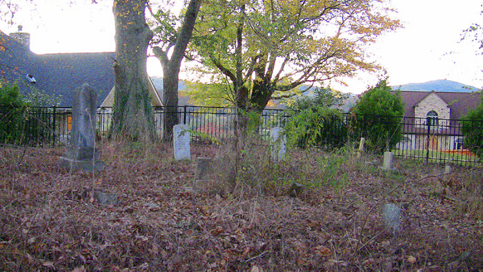
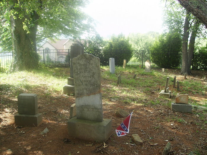
| Memorials | : | 1 |
| Location | : | Fairview, Buncombe County, USA |
| Coordinate | : | 35.4861500, -82.4244100 |
| Description | : | GPS Street Address is 45 Broadleaf Drive, Fairview, NC Lat Long is 35°29'10.32"N 82°25'28.25"W Written directions are "From Fletcher, NC downtown, at intersection of Fanning Bridge Rd @ 25, go east onto Co rd 1358, and take sharp left onto Old Cane Creek Rd. Go about .4 mile take right onto Cane Creek Rd. Continue on Cane creek rd for about 4.9 miles, and take right onto Lower Brush Creek Rd. Go .4 mile and take left onto Upper Brush Creek Rd. Go about .9 mile and turn left into Broadleaf drive. Go about .2 mile and... Read More |
frequently asked questions (FAQ):
-
Where is Merrill Patton Family Cemetery?
Merrill Patton Family Cemetery is located at Upper Bush Creek Road Fairview, Buncombe County ,North Carolina ,USA.
-
Merrill Patton Family Cemetery cemetery's updated grave count on graveviews.com?
1 memorials
-
Where are the coordinates of the Merrill Patton Family Cemetery?
Latitude: 35.4861500
Longitude: -82.4244100
Nearby Cemetories:
1. Tweeds Chapel Cemetery
Fairview, Buncombe County, USA
Coordinate: 35.4777718, -82.4479370
2. Bethany United Methodist Church Cemetery
Fairview, Buncombe County, USA
Coordinate: 35.4900017, -82.3990021
3. Sharon Methodist Cemetery
Fairview, Buncombe County, USA
Coordinate: 35.5117989, -82.4173965
4. Emmas Grove Baptist Church Cemetery
Asheville, Buncombe County, USA
Coordinate: 35.5088005, -82.4423981
5. Pleasant Hill Baptist Church Cemetery
Arden, Buncombe County, USA
Coordinate: 35.4850960, -82.4649940
6. Cane Creek Cemetery
Fairview, Buncombe County, USA
Coordinate: 35.5219002, -82.4011002
7. Hoopers Creek Baptist Church Cemetery
Fletcher, Henderson County, USA
Coordinate: 35.4420395, -82.4358063
8. Williams Cemetery
Arden, Buncombe County, USA
Coordinate: 35.4780998, -82.4819031
9. Penland Family Cemetery
Asheville, Buncombe County, USA
Coordinate: 35.4919310, -82.4895860
10. Christ School
Arden, Buncombe County, USA
Coordinate: 35.4657090, -82.4884740
11. Bearwallow Cemetery
Gerton, Henderson County, USA
Coordinate: 35.4809900, -82.3510300
12. Pleasant Grove Baptist Church Cemetery
Fairview, Buncombe County, USA
Coordinate: 35.5213013, -82.3625031
13. Chapel Hill Baptist Church Cemetery
Asheville, Buncombe County, USA
Coordinate: 35.4963900, -82.4996000
14. Drake Cemetery
Fruitland, Henderson County, USA
Coordinate: 35.4301390, -82.3851940
15. East of Gerton
Gerton, Henderson County, USA
Coordinate: 35.4773890, -82.3387500
16. Sales Cemetery
Asheville, Buncombe County, USA
Coordinate: 35.5517180, -82.4631200
17. Horace E. Bell Memorial Garden and Columbarium
Asheville, Buncombe County, USA
Coordinate: 35.5063870, -82.5137110
18. Givens Estates Columbarium
Asheville, Buncombe County, USA
Coordinate: 35.5063900, -82.5137200
19. Old Salem Cemetery
Fletcher, Henderson County, USA
Coordinate: 35.4380810, -82.4980550
20. New Salem Baptist Church Cemetery
Skyland, Buncombe County, USA
Coordinate: 35.4842200, -82.5214600
21. Calvary Episcopal Church Cemetery
Fletcher, Henderson County, USA
Coordinate: 35.4434013, -82.5062027
22. Saint Barnabas Cemetery
Arden, Buncombe County, USA
Coordinate: 35.4506780, -82.5118850
23. Liberty Baptist Church Cemetery
Henderson County, USA
Coordinate: 35.4266700, -82.3563300
24. Hunter Cemetery
Royal Pines, Buncombe County, USA
Coordinate: 35.4752998, -82.5239029