
| Memorials | : | 24 |
| Location | : | Methwold, Kings Lynn and West Norfolk Borough, England |
| Coordinate | : | 52.5257758, 0.5575197 |
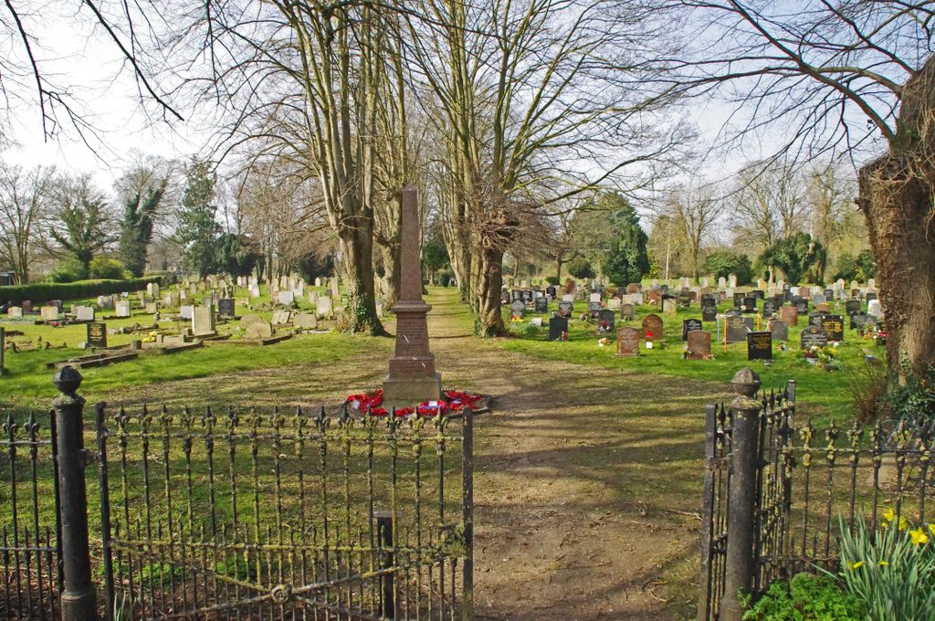
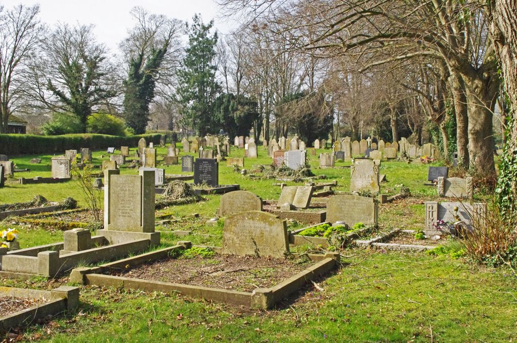
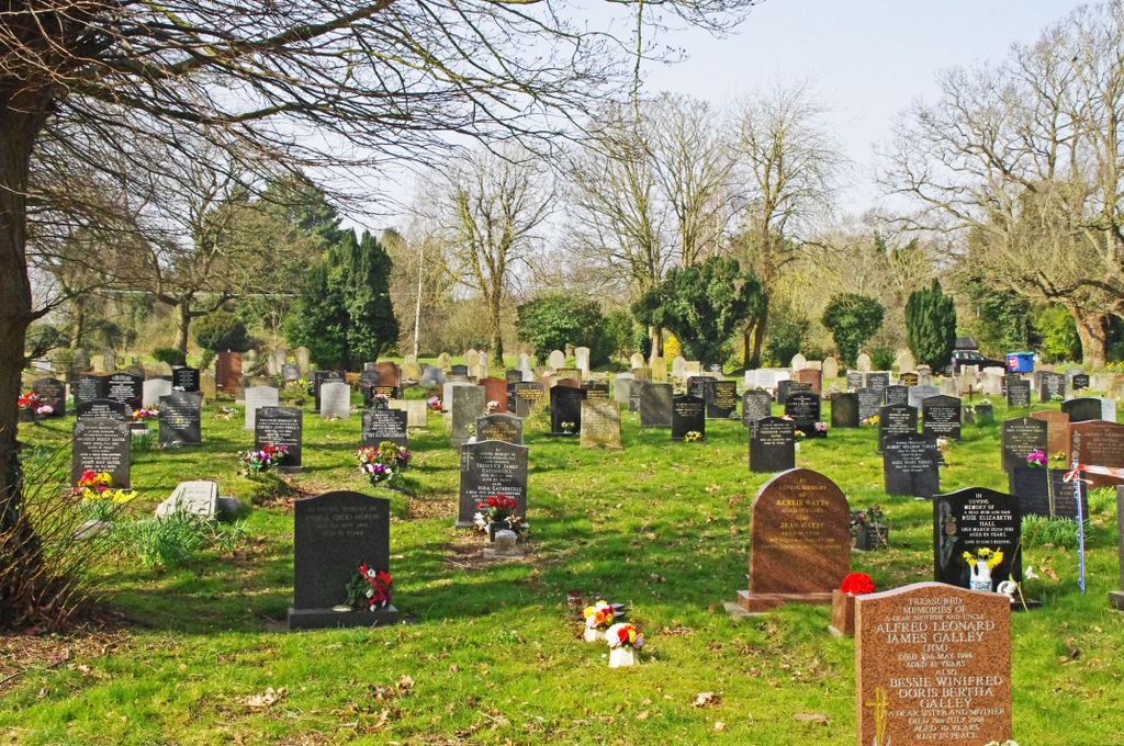
| Description | : | The cemetery is laid to grass so that contractors can maintain it easily and keep the area tidy. This is important when relatives become increasingly frail or live too far away to maintain the grave space. The cemetery is split into two zones, the Old and the New Cemetery. Within the Old Cemetery, which is now full apart from second interments in existing graves, there is a small area, still in use, for cremated remains. Traditional burials take place in the New Cemetery and increasingly families are choosing to have cremated remains buried there too. There is also a section reserved... Read More |
frequently asked questions (FAQ):
-
Where is Methwold Cemetery?
Methwold Cemetery is located at Stoke Road, Methwold Methwold, Kings Lynn and West Norfolk Borough ,Norfolk , IP26 4PEEngland.
-
Methwold Cemetery cemetery's updated grave count on graveviews.com?
24 memorials
-
Where are the coordinates of the Methwold Cemetery?
Latitude: 52.5257758
Longitude: 0.5575197
Nearby Cemetories:
1. St. George's Churchyard
Methwold, Kings Lynn and West Norfolk Borough, England
Coordinate: 52.5229060, 0.5568700
2. Northwold Cemetery
Northwold, Kings Lynn and West Norfolk Borough, England
Coordinate: 52.5419000, 0.5820000
3. St. Andrew's Old Cemetery
Northwold, Kings Lynn and West Norfolk Borough, England
Coordinate: 52.5405523, 0.5864157
4. St Andrew Churchyard
Northwold, Kings Lynn and West Norfolk Borough, England
Coordinate: 52.5425540, 0.5878920
5. St Mary's Churchyard
Cranwich, Breckland Borough, England
Coordinate: 52.5224040, 0.6262310
6. St Nicholas Churchyard
Feltwell, Kings Lynn and West Norfolk Borough, England
Coordinate: 52.4888000, 0.5209700
7. St. Mary's Churchyard
Feltwell, Kings Lynn and West Norfolk Borough, England
Coordinate: 52.4874580, 0.5245110
8. All Saints Churchyard
Foulden, Breckland Borough, England
Coordinate: 52.5599040, 0.6021930
9. All Saints Churchyard
Stoke Ferry, Kings Lynn and West Norfolk Borough, England
Coordinate: 52.5702970, 0.5138070
10. Saint John the Evangelist Churchyard
Oxborough, Breckland Borough, England
Coordinate: 52.5828040, 0.5727550
11. St Leonard's Churchyard
Mundford, Breckland Borough, England
Coordinate: 52.5125080, 0.6521150
12. St James' Church Cemetery
Hockwold, Kings Lynn and West Norfolk Borough, England
Coordinate: 52.4625100, 0.5519400
13. St. Peter Church Cemetery
Hockwold, Kings Lynn and West Norfolk Borough, England
Coordinate: 52.4627780, 0.5376030
14. St George's Churchyard
Gooderstone, Breckland Borough, England
Coordinate: 52.5884010, 0.6003860
15. St Peter's Churchyard
Ickburgh, Breckland Borough, England
Coordinate: 52.5232010, 0.6755200
16. All Saints Churchyard
Boughton, Kings Lynn and West Norfolk Borough, England
Coordinate: 52.5913020, 0.5080360
17. St. Margaret of Antioch Churchyard
Wereham, Kings Lynn and West Norfolk Borough, England
Coordinate: 52.5867700, 0.4799200
18. St. Peter's Churchyard
Brandon, Forest Heath District, England
Coordinate: 52.4445800, 0.6132600
19. St. Andrew's Churchyard
West Dereham, Kings Lynn and West Norfolk Borough, England
Coordinate: 52.5911080, 0.4599020
20. Brandon Cemetery
Brandon, Forest Heath District, England
Coordinate: 52.4445140, 0.6149550
21. All Saints Churchyard
Hilborough, Breckland Borough, England
Coordinate: 52.5673800, 0.6921240
22. St. Mary's Churchyard
Bodney, Breckland Borough, England
Coordinate: 52.5561990, 0.7002570
23. St. Mary the Virgin Churchyard
Beachamwell, Breckland Borough, England
Coordinate: 52.6178670, 0.5844730
24. All Saints Churchyard
Cockley Cley, Breckland Borough, England
Coordinate: 52.6057860, 0.6446070