
| Memorials | : | 4 |
| Location | : | Sharp County, USA |
| Coordinate | : | 35.9740200, -91.3721200 |
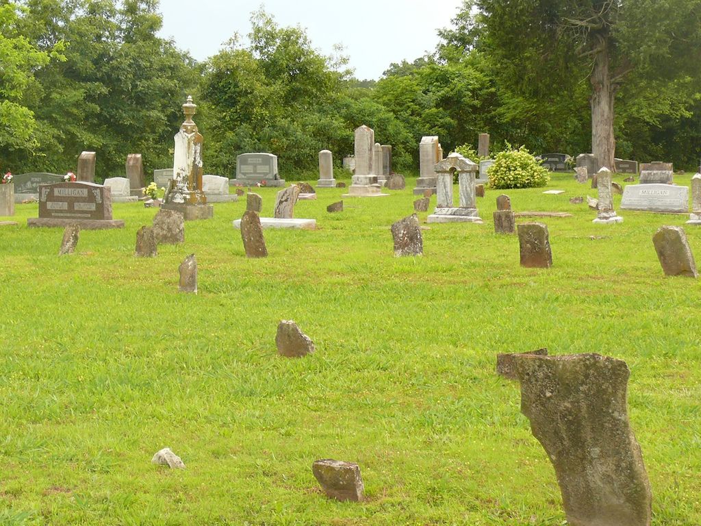
| Description | : | The Milligan Campground was the site of the very first Presbyterian Church in the Missouri Territory being built by John Milligan in 1823. It was also the site where the Illinois 5th Calvary camped during the "Skirmish of Smithville". A large contingency of soldiers took over the Campground and used it as their headquarters while they were in the Smithville area. Hulda Milligan was the first person buried there. John Milligan was in charge of recording the burials in this cemetery, and after his death, his sons took over the task. |
frequently asked questions (FAQ):
-
Where is Milligan Campground Cemetery?
Milligan Campground Cemetery is located at Sharp County ,Arkansas ,USA.
-
Milligan Campground Cemetery cemetery's updated grave count on graveviews.com?
4 memorials
-
Where are the coordinates of the Milligan Campground Cemetery?
Latitude: 35.9740200
Longitude: -91.3721200


Nearby Cemetories:
1. Roe Cemetery
Sharp County, USA
Coordinate: 35.9735985, -91.3925018
2. Gardner Cemetery
Sharp County, USA
Coordinate: 35.9508018, -91.3822021
3. Shaver Cemetery
Sharp County, USA
Coordinate: 35.9646988, -91.4013977
4. Shaver Cemetery
Shelbyville, Sharp County, USA
Coordinate: 35.9651990, -91.4016580
5. Lancaster Cemetery
Strawberry, Lawrence County, USA
Coordinate: 35.9850006, -91.3371964
6. Sullivan Cemetery
Calamine, Sharp County, USA
Coordinate: 35.9989500, -91.3938900
7. Parsley Cemetery
Sharp County, USA
Coordinate: 35.9618988, -91.4143982
8. Wilkerson Cemetery
Sharp County, USA
Coordinate: 35.9658012, -91.4235992
9. Penn Cemetery
Strawberry, Lawrence County, USA
Coordinate: 35.9682999, -91.3099976
10. Little Cemetery
Strawberry, Lawrence County, USA
Coordinate: 35.9877490, -91.3102340
11. Jerusalem Cemetery
Strawberry, Lawrence County, USA
Coordinate: 35.9872017, -91.3097000
12. Massey Cemetery
Lawrence County, USA
Coordinate: 36.0147018, -91.3242035
13. Mount Zion Cemetery
Saffell, Lawrence County, USA
Coordinate: 35.9220000, -91.3390000
14. Mount View Cemetery
Saffell, Lawrence County, USA
Coordinate: 35.9220009, -91.3389969
15. Campbell Cemetery
Lawrence County, USA
Coordinate: 35.9171982, -91.3503036
16. Barnet Cemetery
Calamine, Sharp County, USA
Coordinate: 35.9760440, -91.4483500
17. Willmuth Cemetery
Lawrence County, USA
Coordinate: 35.9197006, -91.3272018
18. Runyan Cemetery
Lawrence County, USA
Coordinate: 35.9110985, -91.3396988
19. Mount View Cemetery
Cave City, Sharp County, USA
Coordinate: 35.9371986, -91.4436035
20. Price Cemetery
Lawrence County, USA
Coordinate: 36.0102430, -91.2939560
21. Dawson Cemetery
Sharp County, USA
Coordinate: 35.9324989, -91.4505997
22. Eagan Family Cemetery
Saffell, Lawrence County, USA
Coordinate: 35.9376580, -91.2841720
23. Captain William Dawson Family Cemetery
Sharp County, USA
Coordinate: 35.8994710, -91.4120060
24. Mahan Cemetery
Sharp County, USA
Coordinate: 35.8998450, -91.4139100