
| Memorials | : | 179 |
| Location | : | Monterey, Monterey County, USA |
| Coordinate | : | 36.5956078, -121.8904190 |
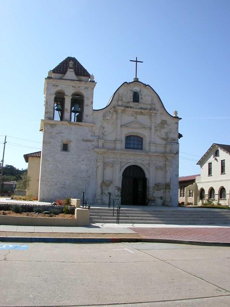
| Description | : | There are two Cemeteries by this name. The first is under the existing church (Royal Presidio Chapel, San Carlos Church, and San Carlos Cathedral) which was constructed between 1792 and 1794. Following the start of construction, the cemetery was moved to what is now the 500 block of Webster Street outside the presidio walls. It remained there until 1834 when the current cemetery (San Carlos Cemetery) was established. Several graves were relocated but not recorded. Persons dying before 1792 where buried in the first cemetery and those dying between 1792 and 1834 were buried in... Read More |
frequently asked questions (FAQ):
-
Where is Mission San Carlos Cemetery?
Mission San Carlos Cemetery is located at 500 Church Street Monterey, Monterey County ,California ,USA.
-
Mission San Carlos Cemetery cemetery's updated grave count on graveviews.com?
179 memorials
-
Where are the coordinates of the Mission San Carlos Cemetery?
Latitude: 36.5956078
Longitude: -121.8904190
Nearby Cemetories:
1. San Carlos Cemetery
Monterey, Monterey County, USA
Coordinate: 36.5951881, -121.8871460
2. Monterey City Cemetery
Monterey, Monterey County, USA
Coordinate: 36.5954475, -121.8845215
3. Alexis Nino Burial Site
Monterey, Monterey County, USA
Coordinate: 36.6055565, -121.8955307
4. Presidio of Monterey Cemetery
Monterey, Monterey County, USA
Coordinate: 36.6058006, -121.9151306
5. Steinbeck Estate Burial Site
Pacific Grove, Monterey County, USA
Coordinate: 36.6197319, -121.9080276
6. Saint Mary's Episcopal Church Leslie Garden
Pacific Grove, Monterey County, USA
Coordinate: 36.6211200, -121.9145800
7. City of Carmel Memorials
Carmel-by-the-Sea, Monterey County, USA
Coordinate: 36.5552979, -121.9203339
8. El Carmelo Cemetery
Pacific Grove, Monterey County, USA
Coordinate: 36.6325836, -121.9319763
9. Carmel Mission Cemetery
Carmel-by-the-Sea, Monterey County, USA
Coordinate: 36.5430603, -121.9199600
10. Mission Memorial Park
Seaside, Monterey County, USA
Coordinate: 36.6191635, -121.8217926
11. Carmelite Monastery Cemetery
Monterey, Monterey County, USA
Coordinate: 36.5231400, -121.9232635
12. California Central Coast Veterans Cemetery
Seaside, Monterey County, USA
Coordinate: 36.6371900, -121.7963600
13. Saint Dunstans Episcopal Church Columbarium
Carmel Valley, Monterey County, USA
Coordinate: 36.5197330, -121.8059160
14. Whitcher Cemetery
East Garrison, Monterey County, USA
Coordinate: 36.6501730, -121.7305270
15. Church of the Good Shepherd Cemetery
Salinas, Monterey County, USA
Coordinate: 36.5413990, -121.7260410
16. Calvary Catholic Cemetery
Salinas, Monterey County, USA
Coordinate: 36.6880341, -121.6818085
17. Saint Pauls Episcopal Church Columbarium
Salinas, Monterey County, USA
Coordinate: 36.6588430, -121.6558850
18. Garden of Memories
Salinas, Monterey County, USA
Coordinate: 36.6565247, -121.6384125
19. Castroville Public Cemetery
Moss Landing, Monterey County, USA
Coordinate: 36.7930145, -121.7851410
20. Yamato Cemetery
Salinas, Monterey County, USA
Coordinate: 36.6552811, -121.6307297
21. Chinese Cemetery
Salinas, Monterey County, USA
Coordinate: 36.6952057, -121.6390381
22. Monterey County Potters Field Cemetery
Salinas, Monterey County, USA
Coordinate: 36.6960900, -121.6381950
23. Saint Georges Episcopal Church Columbarium
Salinas, Monterey County, USA
Coordinate: 36.7062580, -121.6440980
24. Santa Rita Chapel and Cemetery
Salinas, Monterey County, USA
Coordinate: 36.7281303, -121.6565475