
| Memorials | : | 10 |
| Location | : | Salinas, Monterey County, USA |
| Coordinate | : | 36.6960900, -121.6381950 |
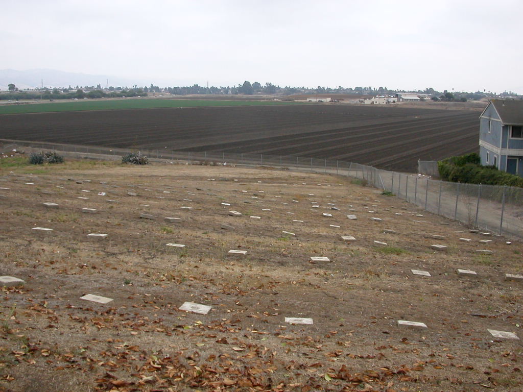
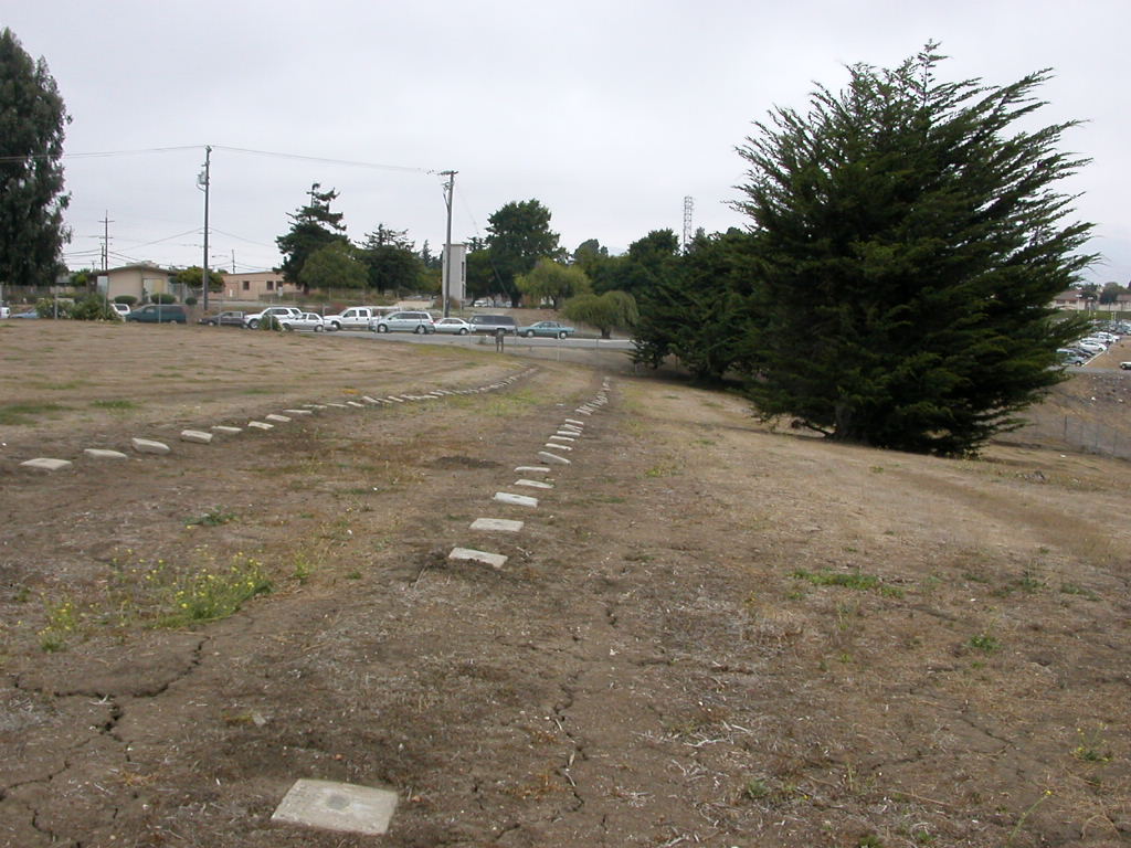
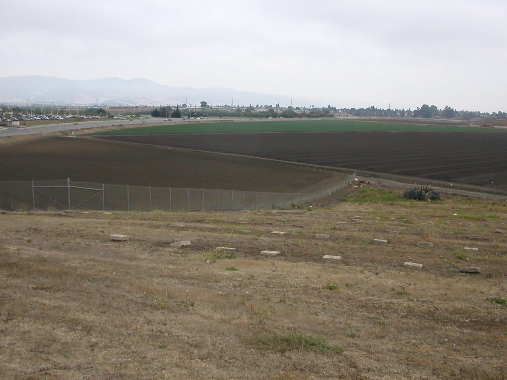
| Description | : | Located on the corner of Natividad Rd. and East Laurel Dr. This is a CLOSED (Fenced/Gated - No Trespassing Signs) county cemetery, where any access would be considered trespassing. I have checked with the county to see about obtaining access to record the burials, and I was promptly denied. Their stand is that the grave markers contain nothing more than a burial number. Anyone interested in obtaining information on these burials are directed to the Monterey County Recorder's Office to obtain a death certificate. Most of the early Monterey County death certificates were microfilmed and are available... Read More |
frequently asked questions (FAQ):
-
Where is Monterey County Potters Field Cemetery?
Monterey County Potters Field Cemetery is located at Natividad Rd. and East Laurel Dr. Salinas, Monterey County ,California ,USA.
-
Monterey County Potters Field Cemetery cemetery's updated grave count on graveviews.com?
10 memorials
-
Where are the coordinates of the Monterey County Potters Field Cemetery?
Latitude: 36.6960900
Longitude: -121.6381950
Nearby Cemetories:
1. Chinese Cemetery
Salinas, Monterey County, USA
Coordinate: 36.6952057, -121.6390381
2. Saint Georges Episcopal Church Columbarium
Salinas, Monterey County, USA
Coordinate: 36.7062580, -121.6440980
3. Santa Rita Chapel and Cemetery
Salinas, Monterey County, USA
Coordinate: 36.7281303, -121.6565475
4. Calvary Catholic Cemetery
Salinas, Monterey County, USA
Coordinate: 36.6880341, -121.6818085
5. Garden of Memories
Salinas, Monterey County, USA
Coordinate: 36.6565247, -121.6384125
6. Saint Pauls Episcopal Church Columbarium
Salinas, Monterey County, USA
Coordinate: 36.6588430, -121.6558850
7. Yamato Cemetery
Salinas, Monterey County, USA
Coordinate: 36.6552811, -121.6307297
8. Queen of Heaven Cemetery
Prunedale, Monterey County, USA
Coordinate: 36.7602425, -121.6611252
9. Whitcher Cemetery
East Garrison, Monterey County, USA
Coordinate: 36.6501730, -121.7305270
10. California Central Coast Veterans Cemetery
Seaside, Monterey County, USA
Coordinate: 36.6371900, -121.7963600
11. Monterey Bay Loved Pet Cemetery
Monterey County, USA
Coordinate: 36.8326160, -121.6812820
12. Hambey Cemetery
Monterey County, USA
Coordinate: 36.8372002, -121.6793976
13. Castroville Public Cemetery
Moss Landing, Monterey County, USA
Coordinate: 36.7930145, -121.7851410
14. Stephen Norriss Gravesite
Monterey County, USA
Coordinate: 36.8214110, -121.7601080
15. Mission Memorial Park
Seaside, Monterey County, USA
Coordinate: 36.6191635, -121.8217926
16. San Juan Bautista Cemetery
San Juan Bautista, San Benito County, USA
Coordinate: 36.8457985, -121.5438995
17. Church of the Good Shepherd Cemetery
Salinas, Monterey County, USA
Coordinate: 36.5413990, -121.7260410
18. Mission San Juan Bautista Cemetery
San Juan Bautista, San Benito County, USA
Coordinate: 36.8460007, -121.5339966
19. Monterey City Cemetery
Monterey, Monterey County, USA
Coordinate: 36.5954475, -121.8845215
20. Saint Dunstans Episcopal Church Columbarium
Carmel Valley, Monterey County, USA
Coordinate: 36.5197330, -121.8059160
21. San Carlos Cemetery
Monterey, Monterey County, USA
Coordinate: 36.5951881, -121.8871460
22. Alexis Nino Burial Site
Monterey, Monterey County, USA
Coordinate: 36.6055565, -121.8955307
23. Mission San Carlos Cemetery
Monterey, Monterey County, USA
Coordinate: 36.5956078, -121.8904190
24. Steinbeck Estate Burial Site
Pacific Grove, Monterey County, USA
Coordinate: 36.6197319, -121.9080276