
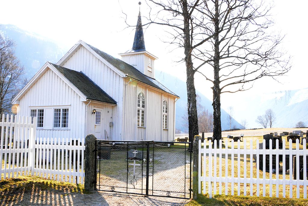
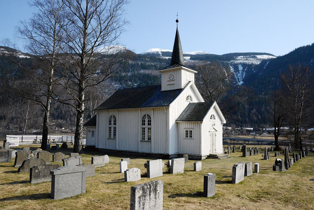
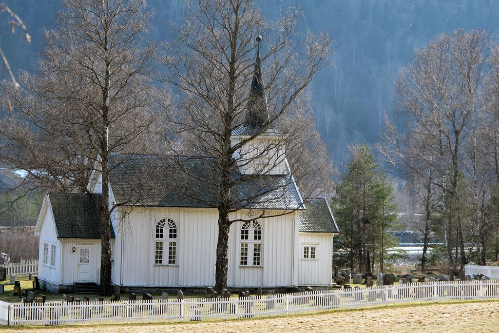
| Memorials | : | 0 |
| Location | : | Rjukan, Tinn kommune, Norway |
| Coordinate | : | 59.9290930, 8.7930050 |
frequently asked questions (FAQ):
-
Where is Mæl Cemetery?
Mæl Cemetery is located at Rjukan, Tinn kommune ,Telemark fylke ,Norway.
-
Mæl Cemetery cemetery's updated grave count on graveviews.com?
0 memorials
-
Where are the coordinates of the Mæl Cemetery?
Latitude: 59.9290930
Longitude: 8.7930050
Nearby Cemetories:
1. Atraa Kirke Cemetery
Tinne, Notodden kommune, Norway
Coordinate: 59.9883980, 8.7319790
2. Austbygde Kirke Cemetery
Tinne, Notodden kommune, Norway
Coordinate: 60.0295356, 8.8263993
3. Rjukan Church
Rjukan, Tinn kommune, Norway
Coordinate: 59.8777290, 8.6085260
4. Hundborg Kirke
Hundborg, Thisted Kommune, Denmark
Coordinate: 59.9284000, 8.5088000
5. Tuddal Cemetery
Sauland, Hjartdal kommune, Norway
Coordinate: 59.7555090, 8.7882190
6. Rollag kirke Cemetery
Rollag, Rollag kommune, Norway
Coordinate: 60.0210370, 9.2726230
7. Gransherad Kyrkje
Notodden, Notodden kommune, Norway
Coordinate: 59.6894580, 9.0360250
8. Sauland
Sauland, Hjartdal kommune, Norway
Coordinate: 59.6205755, 8.9280959
9. Uvdal Old Cemetery
Uvdal, Nore og Uvdal kommune, Norway
Coordinate: 60.2651450, 8.8348110
10. Lyngdal Kirke
Lyngdal, Flesberg kommune, Norway
Coordinate: 59.9105467, 9.5291613
11. Flatdal kirkegård
Flatdal, Seljord kommune, Norway
Coordinate: 59.5607200, 8.5721300
12. Heddal Kirkegard
Notodden, Notodden kommune, Norway
Coordinate: 59.5797430, 9.1761410
13. Eggedal Kirke
Eggedal, Sigdal kommune, Norway
Coordinate: 60.2463170, 9.3573130
14. Notodden
Notodden, Notodden kommune, Norway
Coordinate: 59.5674410, 9.2561230
15. Seljord Kirke
Seljord, Seljord kommune, Norway
Coordinate: 59.4898126, 8.6359361
16. Rauland Cemetery
Rauland, Vinje kommune, Norway
Coordinate: 59.7164150, 7.9990690
17. Åmotsdal kirkegård
Seljord kommune, Norway
Coordinate: 59.4826608, 8.6259205
18. Kongsberg Kirke Gravlund
Kongsberg, Kongsberg kommune, Norway
Coordinate: 59.6656756, 9.6469139
19. Kirkegaarden ved Naeringsparken
Kongsberg, Kongsberg kommune, Norway
Coordinate: 59.6520680, 9.6457200
20. Brunkeberg Kyrkje Cemetery
Brunkeberg, Kviteseid kommune, Norway
Coordinate: 59.4341430, 8.4818850
21. Kongsberg Gomsrud Gravlund
Kongsberg, Kongsberg kommune, Norway
Coordinate: 59.6410080, 9.6566630
22. Bø Kirkegaard
Bo i Telemark, Bø kommune, Norway
Coordinate: 59.4107600, 9.0547360
23. Snarum
Snarum, Modum kommune, Norway
Coordinate: 60.0258190, 9.8682140
24. Bakke Kirke
Øvre Eiker kommune, Norway
Coordinate: 59.8359000, 9.8726000