
| Memorials | : | 0 |
| Location | : | Moorslede, Arrondissement Roeselare, Belgium |
| Coordinate | : | 50.8928900, 3.0676900 |
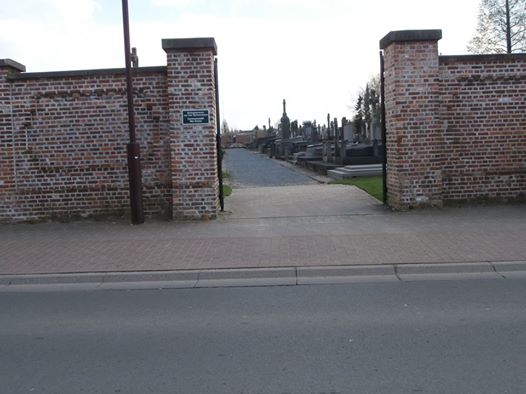
| Description | : | Location Information: The village of Moorslede is locared north east of the town of Ieper off the N313 which runs between Ieper and Roeselare). Driving from Ieper follow the N313 through Langemark-Poelkapelle to Westrozebeke. In Westrozebeke you come to the junction with the N303 to Passendale. Turn right here and follow this road to Passendale and into the town centre. From the centre take Statiestraat, a turning on the left to Moorslede. You come into Moorslede on Stationstraat and come to a crossroads, go straight on into Roeselaresestraat. At the end of this street bear right into Nieuwstraat, at the... Read More |
frequently asked questions (FAQ):
-
Where is Moorslede Communal Cemetery?
Moorslede Communal Cemetery is located at Moorslede, Arrondissement Roeselare ,West Flanders (West-Vlaanderen) ,Belgium.
-
Moorslede Communal Cemetery cemetery's updated grave count on graveviews.com?
0 memorials
-
Where are the coordinates of the Moorslede Communal Cemetery?
Latitude: 50.8928900
Longitude: 3.0676900
Nearby Cemetories:
1. Slypskapelle Cemetery
Moorslede, Arrondissement Roeselare, Belgium
Coordinate: 50.8670590, 3.0848957
2. Slypskapelle Plot of Honour
Moorslede, Arrondissement Roeselare, Belgium
Coordinate: 50.8670700, 3.0885900
3. Beitem Cemetery
Roeselare, Arrondissement Roeselare, Belgium
Coordinate: 50.8915700, 3.1177700
4. Passchendaele New British Cemetery
Zonnebeke, Arrondissement Ieper, Belgium
Coordinate: 50.9047600, 3.0102500
5. Tyne Cot Memorial
Zonnebeke, Arrondissement Ieper, Belgium
Coordinate: 50.8874500, 3.0005100
6. Tyne Cot Cemetery
Zonnebeke, Arrondissement Ieper, Belgium
Coordinate: 50.8870200, 2.9978100
7. Dadizeele New British Cemetery
Moorslede, Arrondissement Roeselare, Belgium
Coordinate: 50.8491800, 3.0877400
8. Dadizele Communal Cemetery
Moorslede, Arrondissement Roeselare, Belgium
Coordinate: 50.8489690, 3.0887910
9. Roeselare New Communal Cemetery
Roeselare, Arrondissement Roeselare, Belgium
Coordinate: 50.9373200, 3.0969100
10. Beselare Cemetery
Zonnebeke, Arrondissement Ieper, Belgium
Coordinate: 50.8524400, 3.0199900
11. Zonnebeke Cemetery
Zonnebeke, Arrondissement Ieper, Belgium
Coordinate: 50.8742600, 2.9914100
12. Ledeghem Military Cemetery
Ledegem, Arrondissement Roeselare, Belgium
Coordinate: 50.8574800, 3.1274400
13. Oostnieuwkerke Cemetery
Staden, Arrondissement Roeselare, Belgium
Coordinate: 50.9464200, 3.0590900
14. Rollegem-Kapelle Cemetery
Ledegem, Arrondissement Roeselare, Belgium
Coordinate: 50.8679300, 3.1466200
15. Ledegem Communal Cemetery
Ledegem, Arrondissement Roeselare, Belgium
Coordinate: 50.8512200, 3.1271100
16. Roeselare Old Communal Cemetery
Roeselare, Arrondissement Roeselare, Belgium
Coordinate: 50.9434600, 3.1181500
17. Polygon Wood Commonwealth War Graves Cemetery
Zonnebeke, Arrondissement Ieper, Belgium
Coordinate: 50.8574200, 2.9905100
18. Buttes New British Cemetery
Zonnebeke, Arrondissement Ieper, Belgium
Coordinate: 50.8559300, 2.9916800
19. Dochy Farm New British Cemetery
Langemark-Poelkapelle, Arrondissement Ieper, Belgium
Coordinate: 50.8815900, 2.9718600
20. Oekene Cemetery
Roeselare, Arrondissement Roeselare, Belgium
Coordinate: 50.9172400, 3.1637300
21. Poelcapelle British Cemetery
Langemark-Poelkapelle, Arrondissement Ieper, Belgium
Coordinate: 50.9201800, 2.9715400
22. Poelkapelle British Cemetery
Brugsken, Arrondissement Dendermonde, Belgium
Coordinate: 50.9202445, 2.9713097
23. Brothers in arms memorial
Zonnebeke, Arrondissement Ieper, Belgium
Coordinate: 50.8546300, 2.9783300
24. Rumbeke Cemetery
Roeselare, Arrondissement Roeselare, Belgium
Coordinate: 50.9309800, 3.1584900