
| Memorials | : | 0 |
| Location | : | Noble Township, Jay County, USA |
| Coordinate | : | 40.4262620, -84.8746230 |
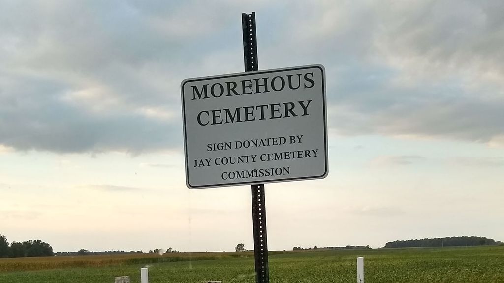
| Description | : | The cemetery is located in Noble Township on the north side of E County Road 100 S about 0.6 miles west of its intersection with S County Road 600 E. Indiana Cemetery Locations, Volume 2, published by the Indiana Genealogical Society (01 April 2006), gives the primary cemetery name as Morehouse Cemetery. The cemetery is listed in the Cemetery and Burial Grounds Registry of the Indiana Department of Natural Resources (DNR) and in the State Historical Architectural and Archaeological Research Database (SHAARD) with Cemetery Record Number CR-38-35 (Morehouse). |
frequently asked questions (FAQ):
-
Where is Morehouse Cemetery?
Morehouse Cemetery is located at E County Road 100 S Noble Township, Jay County ,Indiana , 47371USA.
-
Morehouse Cemetery cemetery's updated grave count on graveviews.com?
0 memorials
-
Where are the coordinates of the Morehouse Cemetery?
Latitude: 40.4262620
Longitude: -84.8746230
Nearby Cemetories:
1. Mount Zion Cemetery
Noble Township, Jay County, USA
Coordinate: 40.4685173, -84.8642960
2. Salamonia Cemetery
Salamonia, Jay County, USA
Coordinate: 40.3795800, -84.8641300
3. Pleasant Hill Cemetery
Wayne Township, Jay County, USA
Coordinate: 40.4546585, -84.9309616
4. Green Mound Cemetery
Fort Recovery, Mercer County, USA
Coordinate: 40.4137600, -84.7983900
5. Spring Hill Cemetery
Fort Recovery, Mercer County, USA
Coordinate: 40.4129000, -84.7918700
6. Scott-Anderson Cemetery
Fort Recovery, Mercer County, USA
Coordinate: 40.4356003, -84.7908020
7. Hawkins Cemetery
Pike Township, Jay County, USA
Coordinate: 40.3725210, -84.9256950
8. Money Cemetery
Fort Recovery, Mercer County, USA
Coordinate: 40.4534120, -84.7939800
9. Little Salamonia Cemetery
Wayne Township, Jay County, USA
Coordinate: 40.3967018, -84.9561005
10. Lotz Cemetery
Madison Township, Jay County, USA
Coordinate: 40.3703194, -84.8174667
11. Saint Mary Cemetery
Fort Recovery, Mercer County, USA
Coordinate: 40.4071999, -84.7835999
12. Westchester Cemetery
Bearcreek Township, Jay County, USA
Coordinate: 40.4986229, -84.8819809
13. Old Pioneer Cemetery
Fort Recovery, Mercer County, USA
Coordinate: 40.4108009, -84.7814026
14. Liber Cemetery
Wayne Township, Jay County, USA
Coordinate: 40.4103012, -84.9705963
15. Fort Recovery Monument Park
Fort Recovery, Mercer County, USA
Coordinate: 40.4131860, -84.7758080
16. Antioch Cemetery
Pike Township, Jay County, USA
Coordinate: 40.3669510, -84.9410934
17. Stevenson Cemetery
Wabash Township, Jay County, USA
Coordinate: 40.4848290, -84.8059130
18. Jay County Farm Cemetery
Wayne Township, Jay County, USA
Coordinate: 40.4729996, -84.9581223
19. Jaque Cemetery
Portland, Jay County, USA
Coordinate: 40.4268990, -84.9835968
20. Pisgah Cemetery
Fort Recovery, Mercer County, USA
Coordinate: 40.3802986, -84.7814026
21. Boundary Cemetery
Pike Township, Jay County, USA
Coordinate: 40.3442268, -84.9215622
22. Green Park Cemetery
Portland, Jay County, USA
Coordinate: 40.4229590, -84.9923100
23. Reed Cemetery
Wayne Township, Jay County, USA
Coordinate: 40.4177620, -85.0058050
24. Saint Peter Cemetery
Saint Peter, Mercer County, USA
Coordinate: 40.4511108, -84.7467957