| Memorials | : | 0 |
| Location | : | Bruins, Crittenden County, USA |
| Coordinate | : | 34.9037370, -90.3656570 |
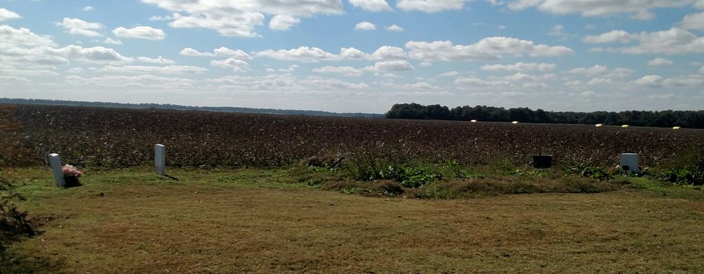
| Description | : | Off Arkansas Rd 147 and GPS shows cross road as being TNHDQTS (yes that is what it showed). The church sits at a 3way intersection in the middle of farm land on gravel roads in Bruins, Arkansas. The following address is as it appears on the GPS: Horseshoe Cir & TNHDQTS Rd & AR-147, Hughes, AR 72348 The cemetery is located in the yard of the Morning Star Church of Jesus Christ. |
frequently asked questions (FAQ):
-
Where is Morning Star Cemetery?
Morning Star Cemetery is located at Bruins, Crittenden County ,Arkansas ,USA.
-
Morning Star Cemetery cemetery's updated grave count on graveviews.com?
0 memorials
-
Where are the coordinates of the Morning Star Cemetery?
Latitude: 34.9037370
Longitude: -90.3656570
Nearby Cemetories:
1. Sweet Home Cemetery
Hughes, St. Francis County, USA
Coordinate: 34.9265840, -90.3816820
2. Beck's Plantation Cemetery
Beck, Crittenden County, USA
Coordinate: 34.9048240, -90.4001430
3. Happy Cemetery
Crittenden County, USA
Coordinate: 34.8602920, -90.3991250
4. Rodgers Cemetery
Horseshoe Lake, Crittenden County, USA
Coordinate: 34.9094009, -90.2925034
5. Saint Peters Cemetery
Tunica County, USA
Coordinate: 34.8325005, -90.3469009
6. Mount Olive Cemetery
Tunica County, USA
Coordinate: 34.8293991, -90.3328018
7. Locust Grove Cemetery
Crittenden County, USA
Coordinate: 34.9397011, -90.2774963
8. Locust Grove Cemetery East
Crittenden County, USA
Coordinate: 34.9402880, -90.2756520
9. Mullin Cemetery
Tunica County, USA
Coordinate: 34.8418465, -90.2980499
10. Covington Archibald Cemetery
Commerce Landing, Tunica County, USA
Coordinate: 34.8234900, -90.3932400
11. Rising Sun MB Church Cemetery
Lake Cormorant, DeSoto County, USA
Coordinate: 34.8619600, -90.2751200
12. Cat Island Cemetery
Crittenden County, USA
Coordinate: 34.9543130, -90.2788460
13. Commerce Boulevard Christian Church Cemetery
Tunica, Tunica County, USA
Coordinate: 34.8166730, -90.3833900
14. New Mount Zion Cemetery
Crittenden County, USA
Coordinate: 34.9942017, -90.3447037
15. Saint Marys Cemetery
Lee County, USA
Coordinate: 34.8927994, -90.4831009
16. Christian Community Mission
Robinsonville, Tunica County, USA
Coordinate: 34.7901010, -90.3371110
17. Bethlehem Cemetery
Tunica County, USA
Coordinate: 34.8011017, -90.2949982
18. Johnson Chapel Cemetery
Tunica County, USA
Coordinate: 34.8025017, -90.2906036
19. Sandy Hill Cemetery
Democrat, St. Francis County, USA
Coordinate: 35.0157623, -90.4169464
20. Mount Zion Cemetery
Greasy Corner, St. Francis County, USA
Coordinate: 35.0174900, -90.4198100
21. Stoddard Farm Cemetery
Hughes, St. Francis County, USA
Coordinate: 34.9769680, -90.4869820
22. Hopewell Cemetery
Commerce, Tunica County, USA
Coordinate: 34.7819100, -90.3913000
23. Morning Star M.B. Church Cemetery
Walls, DeSoto County, USA
Coordinate: 34.9410744, -90.2155228
24. Peters Cemetery
Lee County, USA
Coordinate: 34.8314018, -90.4969025

