
| Memorials | : | 0 |
| Location | : | Sweetwater, Monroe County, USA |
| Coordinate | : | 35.6013908, -84.4611130 |
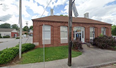
| Description | : | Copied by Lawrence McConkey, Englewood, Tenn. Date: Sep. 8, 1939 It seems that approximately fifty years ago the Negroes of Sweetwater needed a building for a church and land for a cemetery, so they purchased a building and about one acre of land from Raz Ragon. The building, used by the Cumberland Presbyterian, Baptist and Methodist denominations to worship in, was called Mount Bethel. The rest of the lot was used as a Negro cemetery. The entire lot is now used for the cemetery and the Mount Bethel Baptist Church is just across a side street from... Read More |
frequently asked questions (FAQ):
-
Where is Mount Bethel Baptist Church Cemetery?
Mount Bethel Baptist Church Cemetery is located at 908 Wright St., Sweetwater, TN Sweetwater, Monroe County ,Tennessee , 37874USA.
-
Mount Bethel Baptist Church Cemetery cemetery's updated grave count on graveviews.com?
0 memorials
-
Where are the coordinates of the Mount Bethel Baptist Church Cemetery?
Latitude: 35.6013908
Longitude: -84.4611130
Nearby Cemetories:
1. Heiskell Cemetery
Sweetwater, Monroe County, USA
Coordinate: 35.5971985, -84.4569016
2. West View Cemetery
Sweetwater, Monroe County, USA
Coordinate: 35.6025009, -84.4794006
3. West End Community Cemetery
Sweetwater, Monroe County, USA
Coordinate: 35.6086006, -84.4856033
4. Northpoint Cemetery
Monroe County, USA
Coordinate: 35.6250000, -84.4697037
5. Sweetwater Valley Memorial Park
Sweetwater, Monroe County, USA
Coordinate: 35.6246986, -84.4494019
6. Greenbriar Cemetery
Monroe County, USA
Coordinate: 35.5738983, -84.4411011
7. Forkners Chapel Cemetery
Monroe County, USA
Coordinate: 35.5934087, -84.4157592
8. East Sweetwater Free Will Baptist Church Cemetery
Sweetwater, Monroe County, USA
Coordinate: 35.6103700, -84.4123600
9. Browder-County Line Cemetery
McMinn County, USA
Coordinate: 35.5709991, -84.4993973
10. Richardson Cemetery
Loudon County, USA
Coordinate: 35.6256600, -84.5085700
11. Murrays Chapel Cemetery
Loudon County, USA
Coordinate: 35.6221419, -84.5138108
12. Old Sweetwater Cemetery
Monroe County, USA
Coordinate: 35.6464005, -84.4291992
13. Cedar Valley Cemetery
Monroe County, USA
Coordinate: 35.6572970, -84.4688180
14. Glaze Cemetery
McMinn County, USA
Coordinate: 35.5606003, -84.5136032
15. Jones Cemetery
Monroe County, USA
Coordinate: 35.6581001, -84.4863968
16. Walker Family Cemetery
Sweetwater, Monroe County, USA
Coordinate: 35.5873080, -84.3886620
17. Christianburg Church Cemetery
Sweetwater, Monroe County, USA
Coordinate: 35.5380000, -84.4300000
18. Harris Cemetery
Loudon County, USA
Coordinate: 35.6697006, -84.4655991
19. Roy Cemetery
Monroe County, USA
Coordinate: 35.5327988, -84.4539032
20. Rockville Cemetery
Sweetwater, Monroe County, USA
Coordinate: 35.6013900, -84.3720500
21. Mount Cumberland Cemetery
McMinn County, USA
Coordinate: 35.6356010, -84.5397034
22. New Hope Methodist Cemetery
Loudon County, USA
Coordinate: 35.6734000, -84.4807600
23. Fenders Methodist Church Cemetery
Luttrell, Loudon County, USA
Coordinate: 35.6493500, -84.5314200
24. Carter Cemetery
Loudon County, USA
Coordinate: 35.6761017, -84.4563980