
| Memorials | : | 801 |
| Location | : | Wheeling, Ohio County, USA |
| Coordinate | : | 40.0602989, -80.6710968 |
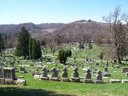
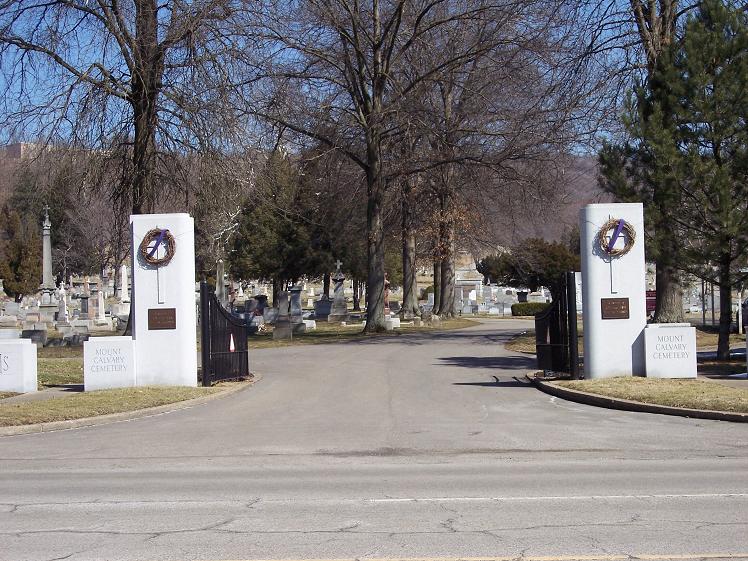
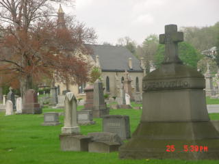
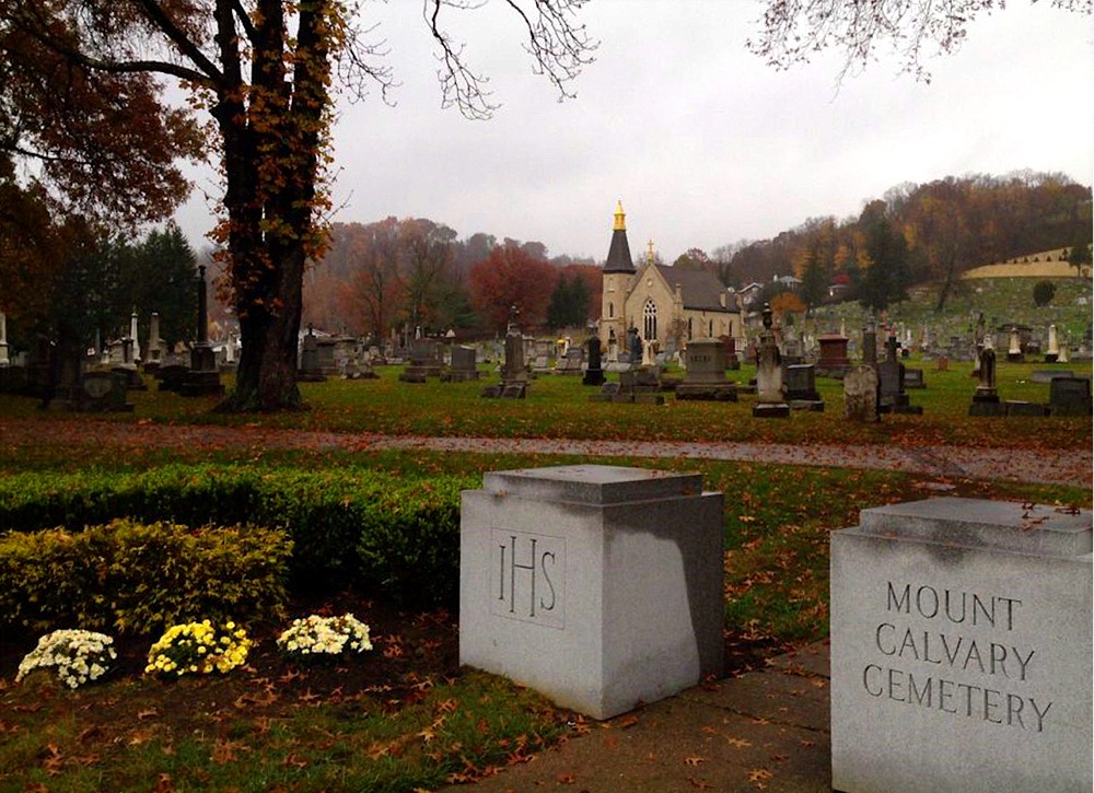
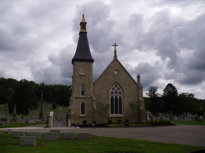
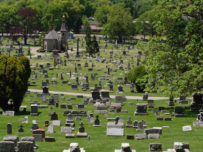
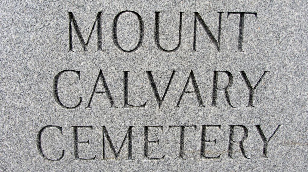
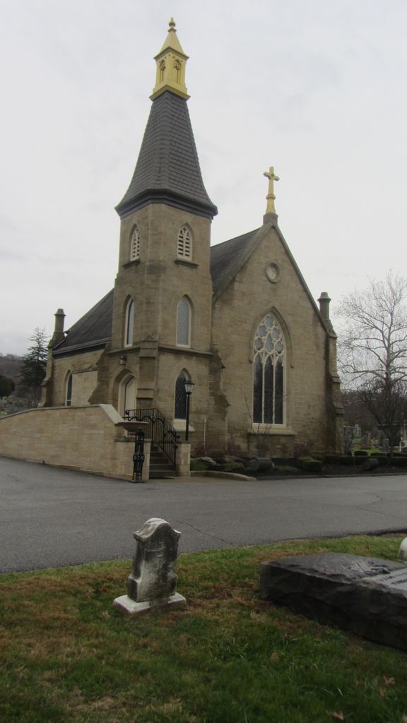
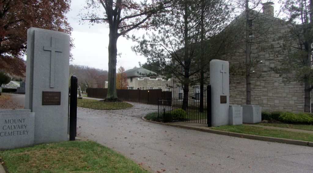
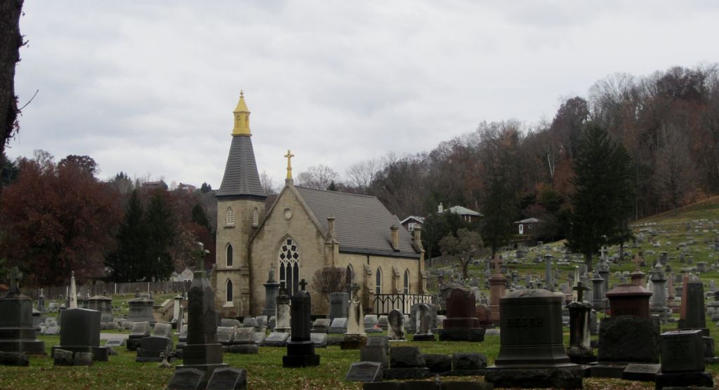
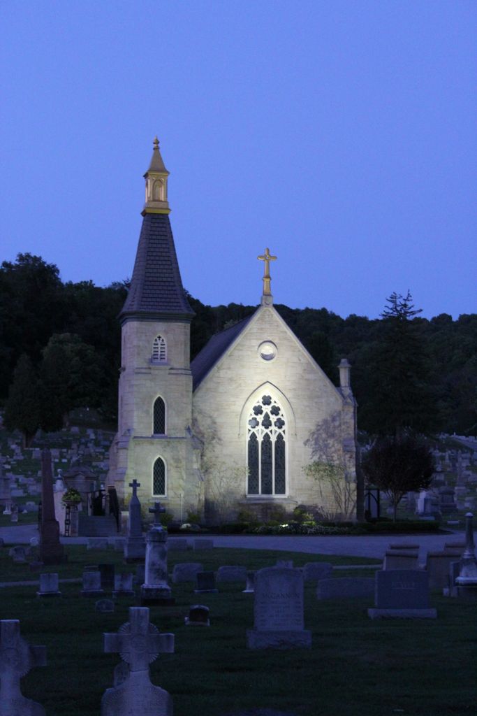
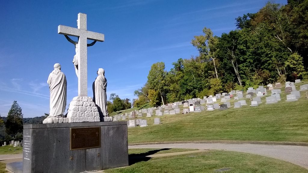
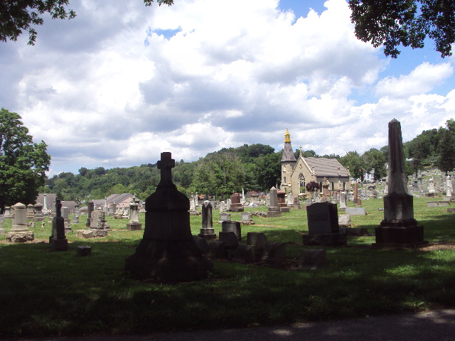
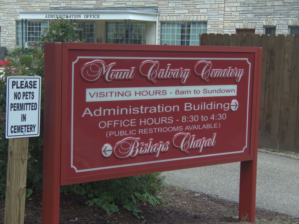
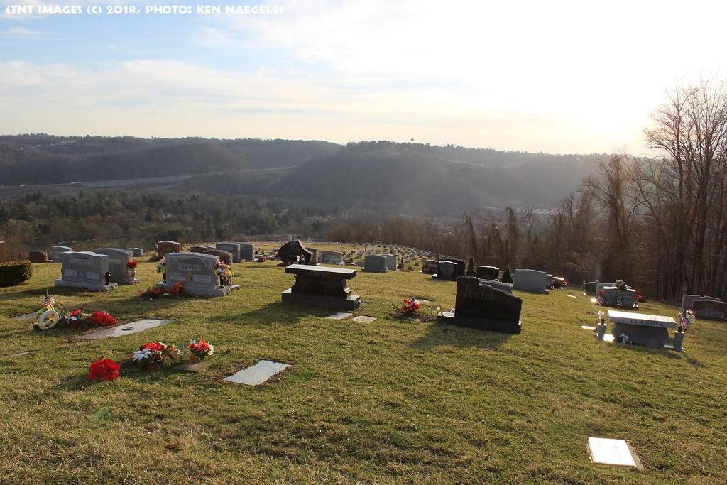
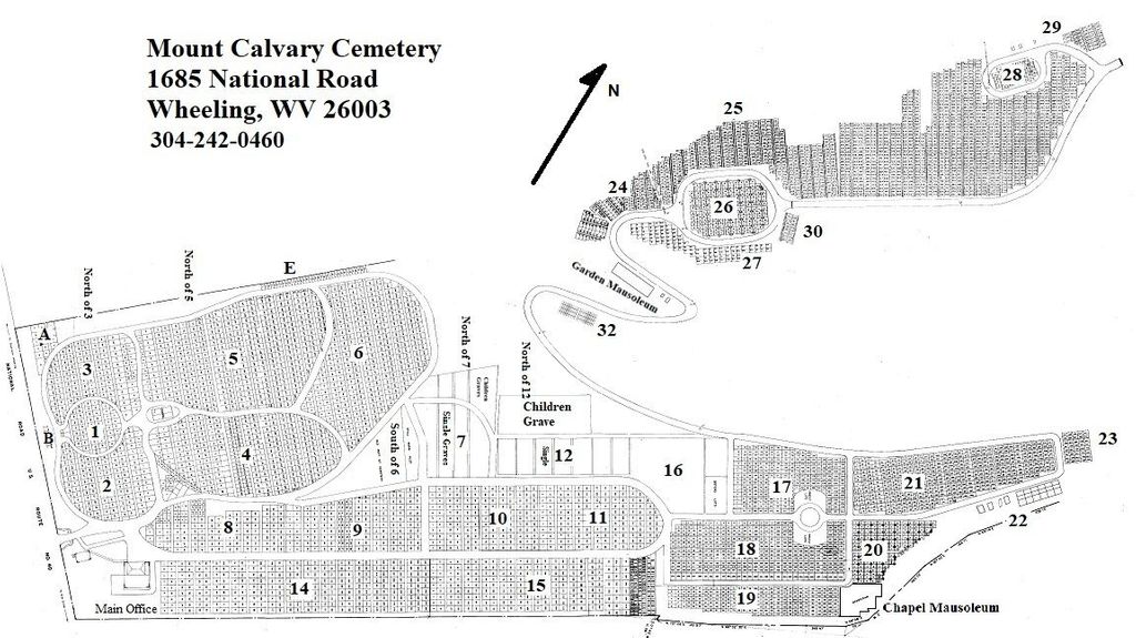
| Description | : | Prior to 1851, Roman Catholics in Wheeling, West Virginia possessed no dedicated ecclesiastical location for burial of their dead. Bishop Richard V. Whelan secured several small locations (Catholic Cemetery, Hempfield Cemetery, and Manchester Cemetery) which became full and necessitated a more commodious location. Mount Calvary Cemetery was established about 4 miles east of downtown Wheeling at 1685 National Road. In 1876, the cornerstone was laid and the grounds were designed by Bishop Whelan for exclusive use of Catholics in the area. Today, the cemetery includes nearly 100 acres of land featuring a Bishop's Chapel that was... Read More |
frequently asked questions (FAQ):
-
Where is Mount Calvary Cemetery?
Mount Calvary Cemetery is located at Wheeling, Ohio County ,West Virginia ,USA.
-
Mount Calvary Cemetery cemetery's updated grave count on graveviews.com?
726 memorials
-
Where are the coordinates of the Mount Calvary Cemetery?
Latitude: 40.0602989
Longitude: -80.6710968
Nearby Cemetories:
1. Greenwood Cemetery
Wheeling, Ohio County, USA
Coordinate: 40.0619200, -80.6793100
2. Mount de Chantal Visitation Cemetery
Wheeling, Ohio County, USA
Coordinate: 40.0686640, -80.6951520
3. Stone Church Cemetery
Wheeling, Ohio County, USA
Coordinate: 40.0416985, -80.6530991
4. East Wheeling Cemetery
Wheeling, Ohio County, USA
Coordinate: 40.0650270, -80.7130310
5. Parkview Memorial Gardens
Wheeling, Ohio County, USA
Coordinate: 40.0917015, -80.6560974
6. Our Lady of Seven Dolors Cemetery
Triadelphia, Ohio County, USA
Coordinate: 40.0543404, -80.6280594
7. Mount Zion Cemetery
Wheeling, Ohio County, USA
Coordinate: 40.0452995, -80.7136002
8. Gregg Cemetery
Greggsville, Ohio County, USA
Coordinate: 40.0942001, -80.6881027
9. Peninsula Cemetery
Wheeling, Ohio County, USA
Coordinate: 40.0758000, -80.7144000
10. Mount Olivet Cemetery
Mount Olivet, Marshall County, USA
Coordinate: 40.0269012, -80.6952972
11. Red Mens Cemetery
Ohio County, USA
Coordinate: 40.0550500, -80.7219000
12. Mount Wood Cemetery
Wheeling, Ohio County, USA
Coordinate: 40.0814018, -80.7225037
13. Jewish Memorial Park
Ohio County, USA
Coordinate: 40.0419700, -80.6107700
14. Walnut Grove Cemetery
Martins Ferry, Belmont County, USA
Coordinate: 40.0999985, -80.7181015
15. Old Tent Cemetery
Wheeling, Ohio County, USA
Coordinate: 40.1090164, -80.6372910
16. Boggs Run Cemetery
Benwood, Marshall County, USA
Coordinate: 40.0259900, -80.7277000
17. Kirkwood Cemetery
Bridgeport, Belmont County, USA
Coordinate: 40.0683320, -80.7427760
18. Roneys Point Cemetery
Wheeling, Ohio County, USA
Coordinate: 40.0932530, -80.6105200
19. Riverview Cemetery
Martins Ferry, Belmont County, USA
Coordinate: 40.1032000, -80.7207600
20. Nelson Cemetery
Bellaire, Belmont County, USA
Coordinate: 40.0321900, -80.7436400
21. Saint Mary's Cemetery
Martins Ferry, Belmont County, USA
Coordinate: 40.0931015, -80.7446976
22. Lawrencefield Parish Church Cemetery
Ohio County, USA
Coordinate: 40.1281310, -80.6615600
23. Henschel Cemetery
Pease Township, Belmont County, USA
Coordinate: 40.1197200, -80.7177840
24. Antioch Cemetery
Marshall County, USA
Coordinate: 39.9900810, -80.6787940