
| Memorials | : | 0 |
| Location | : | Lowes, Graves County, USA |
| Coordinate | : | 36.8563423, -88.7776871 |
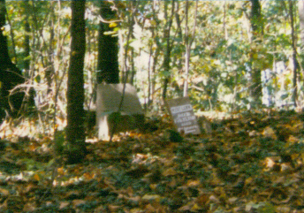
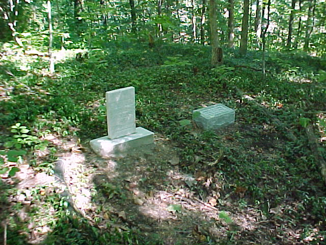
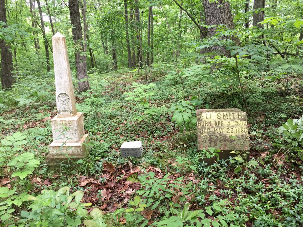
| Description | : | Known as Old Mt Carmel Cemetery to distinquish it from Lowes. This is an abandoned cemetery now on private land, not easily accessible, on a knoll near the intersection of Hwy 339 and Road from Pottsville to Wheel. Established on the Land Grant to James Lamm in 1829 in what was once the Wilson Creek Communiity. This is several miles south of Lowes.. Identified by Graves County Gen Society in the Cemetery Inscriptions book as Cannon Ridge. |
frequently asked questions (FAQ):
-
Where is Mount Carmel Cemetery?
Mount Carmel Cemetery is located at Lowes, Graves County ,Kentucky ,USA.
-
Mount Carmel Cemetery cemetery's updated grave count on graveviews.com?
0 memorials
-
Where are the coordinates of the Mount Carmel Cemetery?
Latitude: 36.8563423
Longitude: -88.7776871
Nearby Cemetories:
1. Lowes Cemetery
Lowes, Graves County, USA
Coordinate: 36.8819300, -88.7735400
2. Paschall Cemetery
Lowes, Graves County, USA
Coordinate: 36.8747300, -88.7462200
3. Hebron Church Cemetery
Lowes, Graves County, USA
Coordinate: 36.8780600, -88.8126000
4. Pottsville Cemetery
Pottsville, Graves County, USA
Coordinate: 36.8517500, -88.7289870
5. Armistead Cemetery
Graves County, USA
Coordinate: 36.8903008, -88.7433014
6. Pleasant Grove Baptist Church Cemetery
Mayfield, Graves County, USA
Coordinate: 36.8404000, -88.7178000
7. Hickory Amish Mennonite Church Cemetery
Hickory, Graves County, USA
Coordinate: 36.8166470, -88.7291450
8. Saint Jerome Cemetery
Fancy Farm, Graves County, USA
Coordinate: 36.7996267, -88.7889232
9. Heard Cemetery
Graves County, USA
Coordinate: 36.9122009, -88.7474976
10. Kansas Cemetery
Kansas, Graves County, USA
Coordinate: 36.9037220, -88.7284720
11. Moyers Cemetery
Cunningham, Carlisle County, USA
Coordinate: 36.9033980, -88.8278360
12. Zoar Baptist Church Cemetery
Cunningham, Carlisle County, USA
Coordinate: 36.8849200, -88.8495000
13. Kirbyton Cemetery
Carlisle County, USA
Coordinate: 36.8483009, -88.8617020
14. Hocker-Russell Cemetery
Graves County, USA
Coordinate: 36.8934444, -88.7064440
15. Sellars Cemetery
Mayfield, Graves County, USA
Coordinate: 36.8010300, -88.7262300
16. Saint Charles Cemetery
Carlisle County, USA
Coordinate: 36.8550300, -88.8672300
17. Palestine Methodist Church Cemetery
Bardwell, Carlisle County, USA
Coordinate: 36.9147660, -88.8314470
18. Emmaus Cemetery
Carlisle County, USA
Coordinate: 36.8149986, -88.8531036
19. Allcock Cemetery
Mayfield, Graves County, USA
Coordinate: 36.9233017, -88.7399979
20. Owens Chapel Cemetery
Melber, Graves County, USA
Coordinate: 36.9289640, -88.7943740
21. Bethel Holiness Church Cemetery
Melber, Graves County, USA
Coordinate: 36.9318410, -88.7958760
22. New Concord Baptist Church Cemetery
Melber, Graves County, USA
Coordinate: 36.9312700, -88.7553900
23. Trinity Holiness Church Cemetery
Cunningham, Carlisle County, USA
Coordinate: 36.9233930, -88.8291170
24. Liberty Cemetery
Folsomdale, Graves County, USA
Coordinate: 36.8917007, -88.6838989