
| Memorials | : | 0 |
| Location | : | Graves County, USA |
| Coordinate | : | 36.8934444, -88.7064440 |
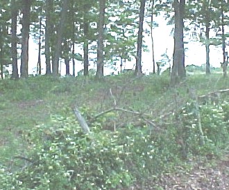
| Description | : | We visited this abandoned cemetery May 22, 2003. It is located on what is locally referred to as "the old Dossett farm". It's about one mile north of Highway 849 on Meridan Road. It is on private property and not visible from the road. We spoke to Gary Miller who owns the property and lives in the closest house to it. He directed us to a rusty old iron gate just past his house on the same side of the road. It had a sign wired to it that said "Wyatt". After going through the gate we saw a very old,... Read More |
frequently asked questions (FAQ):
-
Where is Hocker-Russell Cemetery?
Hocker-Russell Cemetery is located at Graves County ,Kentucky ,USA.
-
Hocker-Russell Cemetery cemetery's updated grave count on graveviews.com?
0 memorials
-
Where are the coordinates of the Hocker-Russell Cemetery?
Latitude: 36.8934444
Longitude: -88.7064440
Nearby Cemetories:
1. Liberty Cemetery
Folsomdale, Graves County, USA
Coordinate: 36.8917007, -88.6838989
2. Kansas Cemetery
Kansas, Graves County, USA
Coordinate: 36.9037220, -88.7284720
3. Mason Fristoe Family Cemetery
Folsomdale, Graves County, USA
Coordinate: 36.9204722, -88.6983060
4. Armistead Cemetery
Graves County, USA
Coordinate: 36.8903008, -88.7433014
5. Nall Cemetery
Folsomdale, Graves County, USA
Coordinate: 36.9109170, -88.6733330
6. Paschall Cemetery
Lowes, Graves County, USA
Coordinate: 36.8747300, -88.7462200
7. Heard Cemetery
Graves County, USA
Coordinate: 36.9122009, -88.7474976
8. Allcock Cemetery
Mayfield, Graves County, USA
Coordinate: 36.9233017, -88.7399979
9. Pottsville Cemetery
Pottsville, Graves County, USA
Coordinate: 36.8517500, -88.7289870
10. McNeill Cemetery
Graves County, USA
Coordinate: 36.9139470, -88.6457220
11. McNeil Cemetery
McCracken County, USA
Coordinate: 36.9136009, -88.6453018
12. Pleasant Grove Baptist Church Cemetery
Mayfield, Graves County, USA
Coordinate: 36.8404000, -88.7178000
13. New Concord Baptist Church Cemetery
Melber, Graves County, USA
Coordinate: 36.9312700, -88.7553900
14. Lowes Cemetery
Lowes, Graves County, USA
Coordinate: 36.8819300, -88.7735400
15. Johnson Cemetery
Boaz, Graves County, USA
Coordinate: 36.8993988, -88.6283035
16. Colliers Cemetery
Saint Johns, McCracken County, USA
Coordinate: 36.9536300, -88.6789920
17. Straub Cemetery
McCracken County, USA
Coordinate: 36.9432983, -88.6539001
18. Mount Carmel Cemetery
Lowes, Graves County, USA
Coordinate: 36.8563423, -88.7776871
19. Salem Cemetery
Boaz, Graves County, USA
Coordinate: 36.8669014, -88.6278000
20. Woodlawn Memorial Gardens
Paducah, McCracken County, USA
Coordinate: 36.9585991, -88.6744003
21. Purchase Cemetery
Saint Johns, McCracken County, USA
Coordinate: 36.9639015, -88.6896973
22. Johnson Cemetery
McCracken County, USA
Coordinate: 36.9618988, -88.6624985
23. Saint John Catholic Church Cemetery
Saint Johns, McCracken County, USA
Coordinate: 36.9666090, -88.6721560
24. Mount Pisgah Cemetery
Boaz, Graves County, USA
Coordinate: 36.8842200, -88.6086600