
| Memorials | : | 12 |
| Location | : | Beverly, Randolph County, USA |
| Coordinate | : | 38.8444500, -79.8666600 |
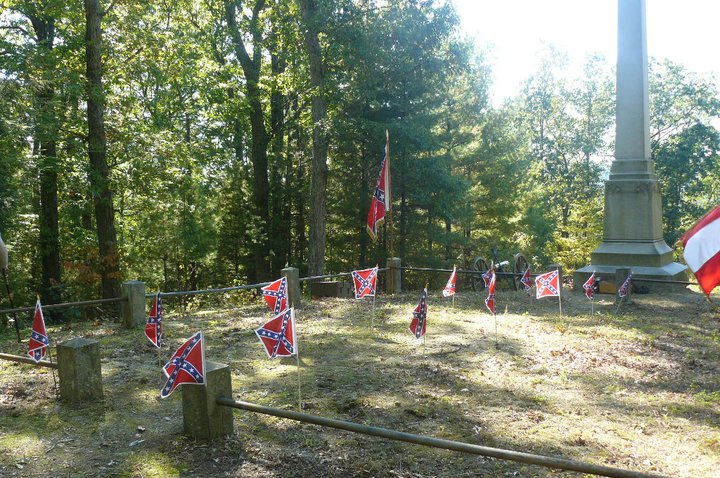
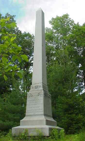
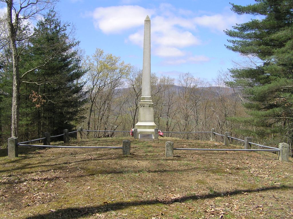
| Description | : | The large monument was erected by the Daughters of the Confederacy in 1908. On historic Mt. Isner rests at least 33 Confederate dead killed in the Battle of Rich Mountain. The small cemetery rests on a hill overlooking historic Beverly, West Virginia. It is surrounded by a rock and iron fence and includes an obelisk over 20 feet in height. The cemetery is surrounded by Union fortifications. Many of the trenches are still visible. |
frequently asked questions (FAQ):
-
Where is Mount Iser Confederate Cemetery?
Mount Iser Confederate Cemetery is located at Beverly, Randolph County ,West Virginia , 26253USA.
-
Mount Iser Confederate Cemetery cemetery's updated grave count on graveviews.com?
11 memorials
-
Where are the coordinates of the Mount Iser Confederate Cemetery?
Latitude: 38.8444500
Longitude: -79.8666600
Nearby Cemetories:
1. Butcher Family Cemetery
Beverly, Randolph County, USA
Coordinate: 38.8419500, -79.8672600
2. Beverly Cemetery
Beverly, Randolph County, USA
Coordinate: 38.8455200, -79.8726807
3. Thomas Phillips Farm Cemetery
Beverly, Randolph County, USA
Coordinate: 38.8543472, -79.8824921
4. Hazelwood Cemetery
Elkins, Randolph County, USA
Coordinate: 38.8597641, -79.8577118
5. John M Stalnaker Cemetery
Beverly, Randolph County, USA
Coordinate: 38.8245470, -79.8731770
6. Trinity Cemetery
Beverly, Randolph County, USA
Coordinate: 38.8329440, -79.8920230
7. Park Cemetery
Beverly, Randolph County, USA
Coordinate: 38.8407560, -79.8369520
8. Mount Vernon Cemetery
Randolph County, USA
Coordinate: 38.8213300, -79.8482900
9. Old Stalnaker Family Cemetery
Randolph County, USA
Coordinate: 38.8143083, -79.8767627
10. Arnolds Hill Baptist Church Cemetery
Elkins, Randolph County, USA
Coordinate: 38.8863000, -79.8635000
11. Chenoweth Hill Cemetery
Elkins, Randolph County, USA
Coordinate: 38.8792590, -79.8357770
12. Elkins Memorial Gardens
Elkins, Randolph County, USA
Coordinate: 38.8838997, -79.8469009
13. Ward Family Cemetery
Elkins, Randolph County, USA
Coordinate: 38.8956814, -79.8634269
14. Armstrong Cemetery
Randolph County, USA
Coordinate: 38.7916500, -79.8841070
15. Waybright Cemetery #05
Franklin, Pendleton County, USA
Coordinate: 38.8646300, -79.7964600
16. Harper Cemetery
Pendleton County, USA
Coordinate: 38.8646300, -79.7964600
17. Saint Brendan Catholic Cemetery
Elkins, Randolph County, USA
Coordinate: 38.9002991, -79.8442001
18. Shrader Cemetery #1
Franklin, Pendleton County, USA
Coordinate: 38.8235000, -79.7740500
19. Greenwood-Valley Bend Cemetery
East Dailey, Randolph County, USA
Coordinate: 38.7713200, -79.9009800
20. Hinkle Cemetery
Elkins, Randolph County, USA
Coordinate: 38.9317890, -79.8574520
21. Rowan Memorial Cemetery
Mabie, Randolph County, USA
Coordinate: 38.8717260, -79.9741620
22. Kelly Mountain Cemetery
Elkins, Randolph County, USA
Coordinate: 38.9013930, -79.7789460
23. Watson Cemetery
Mill Creek, Randolph County, USA
Coordinate: 38.7876290, -79.9578120
24. Old Catholic Cemetery
Elkins, Randolph County, USA
Coordinate: 38.9335117, -79.8391259