
| Memorials | : | 35 |
| Location | : | Halswell, Christchurch City, New Zealand |
| Coordinate | : | -43.5622700, 172.5672600 |
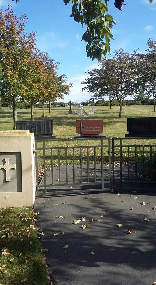
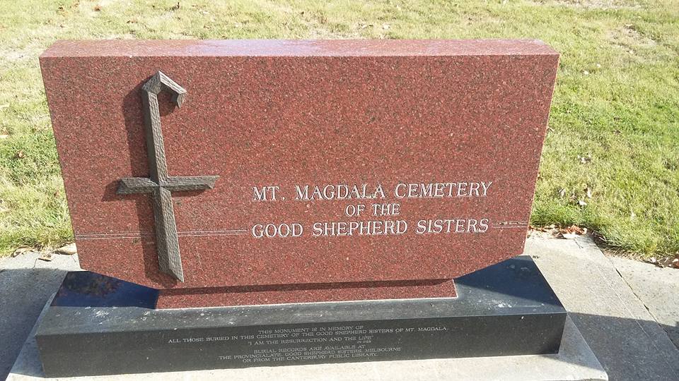
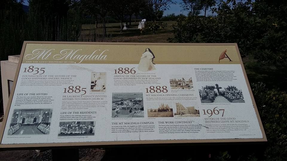
| Description | : | Mount Magdala Historic Cemetery is West of Halswell Road between Oaklands,and Hillmorton, The closed cemetery is located behind (and above) the small reserve at the traffic roundabout of Aidanfield Drive and McMahon Drive The Central City area of Christchurch is about 10 minutes drive from what is now known as the Suburb of Aidanfield. Mt Magdala Cemetery has become an historic reserve. The Aidanfield subdivision comprises the former land of the Good Shepherd Sisters. The establishment of the Good Shepherd Convent at Mount Magdala, Christchurch, dates from the early 1880s. It was established to provide residential care for marginalised women and girls. Mt Magdala... Read More |
frequently asked questions (FAQ):
-
Where is Mount Magdala Cemetery?
Mount Magdala Cemetery is located at 54 Aidanfield Drive Halswell, Christchurch City ,Canterbury , 8025New Zealand.
-
Mount Magdala Cemetery cemetery's updated grave count on graveviews.com?
32 memorials
-
Where are the coordinates of the Mount Magdala Cemetery?
Latitude: -43.5622700
Longitude: 172.5672600
Nearby Cemetories:
1. St. Mary's Anglican Church Cemetery
Halswell, Christchurch City, New Zealand
Coordinate: -43.5794830, 172.5686440
2. St Peter's Anglican Churchyard
Upper Riccarton, Christchurch City, New Zealand
Coordinate: -43.5317570, 172.5701330
3. All Saint's Churchyard
Prebbleton, Selwyn District, New Zealand
Coordinate: -43.5781040, 172.5131430
4. Sydenham Cemetery
Sydenham, Christchurch City, New Zealand
Coordinate: -43.5582330, 172.6254900
5. Addington Cemetery
Addington, Christchurch City, New Zealand
Coordinate: -43.5434880, 172.6235790
6. Prebbleton Cemetery
Prebbleton, Selwyn District, New Zealand
Coordinate: -43.5887200, 172.5053500
7. Avonhead Memorial Cemetery
Avonhead, Christchurch City, New Zealand
Coordinate: -43.5095390, 172.5503920
8. Shands Road Cemetery
Prebbleton, Selwyn District, New Zealand
Coordinate: -43.5792540, 172.4888630
9. Blessed Sacrament Cathedral
Christchurch, Christchurch City, New Zealand
Coordinate: -43.5384250, 172.6458880
10. Waimairi Cemetery
Burnside, Christchurch City, New Zealand
Coordinate: -43.4997760, 172.5773860
11. Barbadoes Street Cemetery
Christchurch, Christchurch City, New Zealand
Coordinate: -43.5230370, 172.6458760
12. St Saviours Churchyard
Templeton, Christchurch City, New Zealand
Coordinate: -43.5501420, 172.4714620
13. St Paul's Anglican Church Cemetery
Papanui, Christchurch City, New Zealand
Coordinate: -43.4966540, 172.6067210
14. Avonside Anglican Cemetery
Avonside, Christchurch City, New Zealand
Coordinate: -43.5265780, 172.6585100
15. Yaldhurst Cemetery
Yaldhurst, Christchurch City, New Zealand
Coordinate: -43.5109640, 172.4765980
16. St James Anglican Church
Harewood, Christchurch City, New Zealand
Coordinate: -43.4788400, 172.5579800
17. Woolston Cemetery
Woolston, Christchurch City, New Zealand
Coordinate: -43.5559770, 172.6825880
18. Bromley Cemetery
Bromley, Christchurch City, New Zealand
Coordinate: -43.5384980, 172.6862960
19. Linwood Cemetery
Linwood, Christchurch City, New Zealand
Coordinate: -43.5299220, 172.6828180
20. Lincoln Cemetery
Lincoln, Selwyn District, New Zealand
Coordinate: -43.6311790, 172.4862570
21. St Cuthbert's Cemetery
Governors Bay, Christchurch City, New Zealand
Coordinate: -43.6326900, 172.6458000
22. Canterbury Memorial Gardens and Crematorium
Bromley, Christchurch City, New Zealand
Coordinate: -43.5420790, 172.6893340
23. Memorial Park Cemetery
Bromley, Christchurch City, New Zealand
Coordinate: -43.5291840, 172.6877410
24. Canterbury Provincial Memorial
Bromley, Christchurch City, New Zealand
Coordinate: -43.5329620, 172.6896830