
| Memorials | : | 0 |
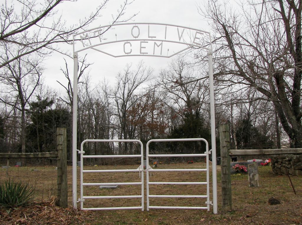
| Location | : | Kingston, Madison County, USA |
| Coordinate | : | 35.9942017, -93.5100021 |
| Description | : | From Kingston, go South on Highway 74 for 1/2 mile; turn East (left) on County Road #3605 / #3625. Go 1/4 mile and take right fork which will be County Road #3625 (you will cross a low-water bridge across a creek almost immediately); continue on #3625 for 3 1/2 miles. Mt. Olive Cemetery will be on the right side of the road, it is fenced and can easily be seen from the road. |
frequently asked questions (FAQ):
-
Where is Mount Olive Cemetery?
Mount Olive Cemetery is located at Kingston, Madison County ,Arkansas ,USA.
-
Mount Olive Cemetery cemetery's updated grave count on graveviews.com?
0 memorials
-
Where are the coordinates of the Mount Olive Cemetery?
Latitude: 35.9942017
Longitude: -93.5100021
Nearby Cemetories:
1. Burk Cemetery
Madison County, USA
Coordinate: 35.9712600, -93.5151500
2. Bolinger Cemetery
Madison County, USA
Coordinate: 35.9720000, -93.5409400
3. Page-David Page Grave
Kingston, Madison County, USA
Coordinate: 36.0235200, -93.4798800
4. Lane Cemetery
Loy, Madison County, USA
Coordinate: 36.0093994, -93.5599976
5. Silver Ridge Cemetery
Kingston, Madison County, USA
Coordinate: 36.0326700, -93.5400500
6. Kingston Cemetery
Kingston, Madison County, USA
Coordinate: 36.0416985, -93.5194016
7. Cecil Cemetery
Kingston, Madison County, USA
Coordinate: 36.0490300, -93.5159200
8. Murrell Cemetery
Kingston, Madison County, USA
Coordinate: 36.0520700, -93.5156700
9. Fields Family Gravesite
Madison County, USA
Coordinate: 35.9349270, -93.5147840
10. Ribbon Ridge Graves
Madison County, USA
Coordinate: 36.0326700, -93.5683100
11. Upper Campground Cemetery
Kingston, Madison County, USA
Coordinate: 36.0586014, -93.5447006
12. Steele Cemetery
Wharton, Madison County, USA
Coordinate: 36.0249580, -93.5953700
13. Taylor Graves
Madison County, USA
Coordinate: 36.0016100, -93.6109100
14. Spangler - Ford Cemetery
Wharton, Madison County, USA
Coordinate: 36.0457610, -93.5946150
15. Walnut Grove Cemetery
Boxley, Newton County, USA
Coordinate: 35.9710000, -93.4059000
16. Eagle Gap Cemetery
Madison County, USA
Coordinate: 35.9089012, -93.5483017
17. Jonas Sparks Homestead Graves
Red Star, Madison County, USA
Coordinate: 35.9134280, -93.5619730
18. Parker Family Cemetery
Wharton Township, Madison County, USA
Coordinate: 36.0221170, -93.6227930
19. Crossroads Cemetery
Stoverville, Newton County, USA
Coordinate: 36.0321900, -93.3983810
20. Cave Mountain Cemetery
Boxley, Newton County, USA
Coordinate: 35.9052310, -93.4553150
21. Phillips - R. M. Phillips Grave
Purdy, Madison County, USA
Coordinate: 36.0707700, -93.5890400
22. Venus Cemetery
Venus, Madison County, USA
Coordinate: 35.9406013, -93.6177979
23. Whiteley Cemetery
Boxley, Newton County, USA
Coordinate: 35.9439011, -93.3993988
24. Carpenter Cemetery
Madison County, USA
Coordinate: 35.8925018, -93.5485992