
| Memorials | : | 533 |
| Location | : | Neapolis, Lucas County, USA |
| Coordinate | : | 41.4585700, -83.8778000 |
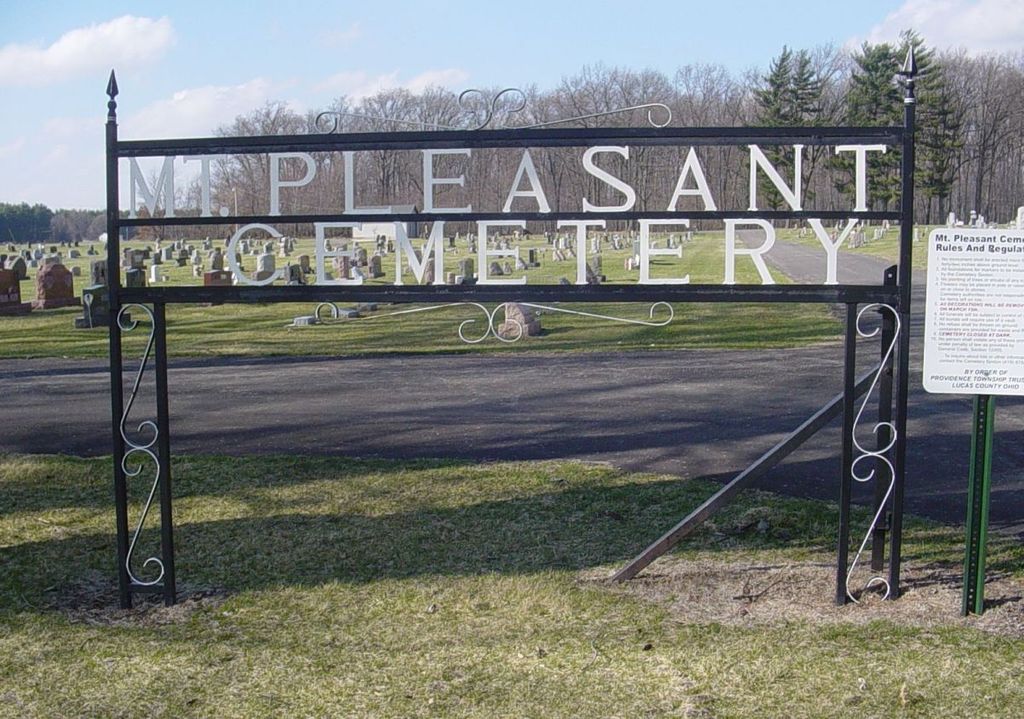
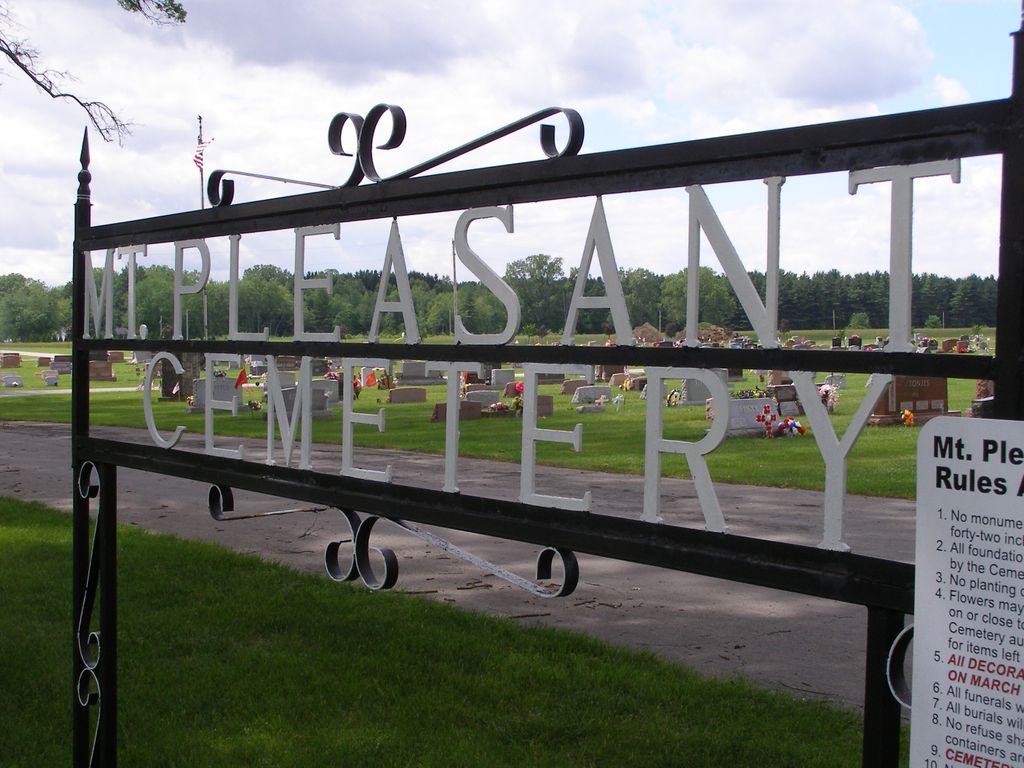
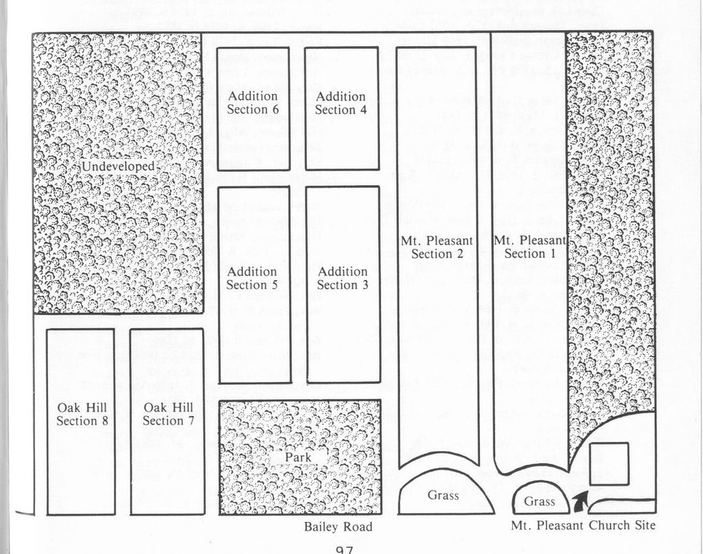
| Description | : | The cemetery is located on the north side of Bailey Road (County Road 145) about 0.2 miles west of its intersection with Providence-Neapolis-Swanton Road (County Road 109) The cemetery was established in 1855. The western portion of this cemetery was once known as Oak Hill Cemetery. The cemetery is located in Providence Township, Lucas County, Ohio, and is # 7047 (Mount Pleasant Cemetery) in “Ohio Cemeteries 1803-2003”, compiled by the Ohio Genealogical Society. The cemetery is registered with the Ohio Division of Real Estate and Professional Licensing (ODRE) as Mt. Pleasant Cemetery with registration license number CGR.0000980517. The U.S. Geological Survey... Read More |
frequently asked questions (FAQ):
-
Where is Mount Pleasant Cemetery?
Mount Pleasant Cemetery is located at Bailey Road (County Road 145) Neapolis, Lucas County ,Ohio , 43522USA.
-
Mount Pleasant Cemetery cemetery's updated grave count on graveviews.com?
532 memorials
-
Where are the coordinates of the Mount Pleasant Cemetery?
Latitude: 41.4585700
Longitude: -83.8778000
Nearby Cemetories:
1. Saint Patricks Cemetery
Providence, Lucas County, USA
Coordinate: 41.4268990, -83.8469009
2. Howard Cemetery
Grand Rapids, Wood County, USA
Coordinate: 41.4128342, -83.8638992
3. Showman Cemetery
Napoleon, Henry County, USA
Coordinate: 41.4101260, -83.8778690
4. Heath-Colton Cemetery
Colton, Henry County, USA
Coordinate: 41.4734180, -83.9405300
5. Texas Cemetery
Texas, Henry County, USA
Coordinate: 41.4286003, -83.9539032
6. Otsego Cemetery
Tontogany, Wood County, USA
Coordinate: 41.4444008, -83.7827988
7. Franklin Cemetery
East Swanton, Lucas County, USA
Coordinate: 41.5295110, -83.8550380
8. Beaver Creek Cemetery
Grand Rapids, Wood County, USA
Coordinate: 41.3883018, -83.8463974
9. Shiloh Cemetery
Fulton County, USA
Coordinate: 41.5008011, -83.9606018
10. Mohler-Union Cemetery
Colton, Henry County, USA
Coordinate: 41.4650002, -83.9785995
11. Wiemer Cemetery
Henry County, USA
Coordinate: 41.4125970, -83.9611500
12. Lutheran Cemetery
Fulton County, USA
Coordinate: 41.5236000, -83.9419000
13. North Cemetery
McClure, Henry County, USA
Coordinate: 41.3863983, -83.9411011
14. Hockman Cemetery
McClure, Henry County, USA
Coordinate: 41.3792240, -83.9333470
15. Washington Cemetery
Tontogany, Wood County, USA
Coordinate: 41.4227982, -83.7675018
16. Whitehouse Cemetery
Whitehouse, Lucas County, USA
Coordinate: 41.5197983, -83.7845001
17. Bird Family Cemetery
Swanton Township, Lucas County, USA
Coordinate: 41.5499220, -83.8541060
18. Winslow Cemetery
Whitehouse, Lucas County, USA
Coordinate: 41.5345000, -83.8007700
19. Mennonite Cemetery
Whitehouse, Lucas County, USA
Coordinate: 41.5235176, -83.7817841
20. Youngs Cemetery
Liberty Center, Henry County, USA
Coordinate: 41.4392014, -84.0074997
21. Rupp Cemetery
Whitehouse, Lucas County, USA
Coordinate: 41.5323067, -83.7855759
22. Olive Branch Cemetery
McClure, Henry County, USA
Coordinate: 41.3833008, -83.9713974
23. Wright Cemetery
Liberty Center, Henry County, USA
Coordinate: 41.4464820, -84.0160860
24. Tontogany Cemetery
Tontogany, Wood County, USA
Coordinate: 41.4294014, -83.7427979