
| Memorials | : | 0 |
| Location | : | Lawrence County, USA |
| Coordinate | : | 31.6071300, -90.1925900 |
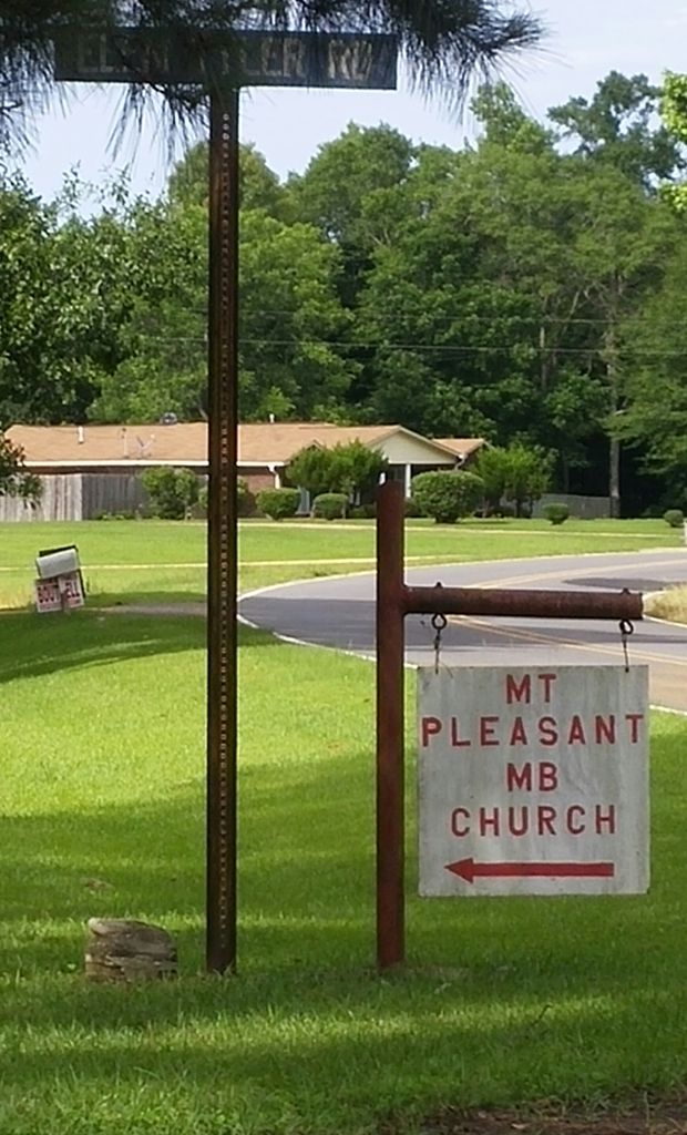
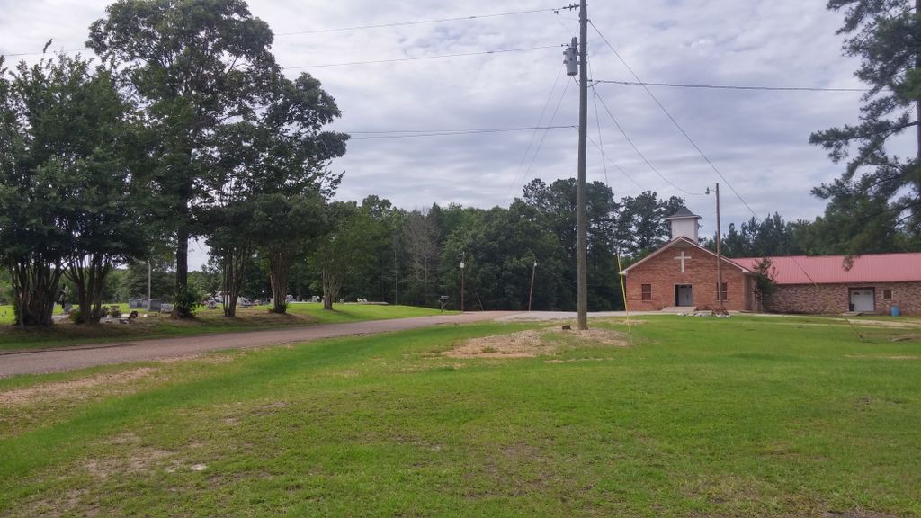
| Description | : | Location: S3 T7N R10E, between Monticello and Nola. Directions: Leave Monticello on Hwy. 27 north. One mile after junction of Hwy. 84 and 27, turn left on Nola Road. The church and cemetery are on the right, 5 miles from Hwy. 27. Cemetery Records of Lawrence County, Mississippi 1810-1988, Compiled by Lawrence County Historical Society. |
frequently asked questions (FAQ):
-
Where is Mount Pleasant Missionary Baptist Church Cemetery?
Mount Pleasant Missionary Baptist Church Cemetery is located at Lawrence County ,Mississippi ,USA.
-
Mount Pleasant Missionary Baptist Church Cemetery cemetery's updated grave count on graveviews.com?
0 memorials
-
Where are the coordinates of the Mount Pleasant Missionary Baptist Church Cemetery?
Latitude: 31.6071300
Longitude: -90.1925900
Nearby Cemetories:
1. Shiloh Baptist Church Cemetery
Sontag, Lawrence County, USA
Coordinate: 31.6368103, -90.2148285
2. Nola Baptist Church Cemetery
Lincoln County, USA
Coordinate: 31.6176530, -90.2382160
3. Nola Baptist Church Cemetery
Nola, Lawrence County, USA
Coordinate: 31.6144310, -90.2406240
4. New Zion Baptist Church Cemetery
Lawrence County, USA
Coordinate: 31.5547310, -90.2031830
5. Friendship Missionary Baptist Church Cemetery
Lawrence County, USA
Coordinate: 31.6198700, -90.1236500
6. Bethshan Memorial Park
Monticello, Lawrence County, USA
Coordinate: 31.5567400, -90.1513200
7. Seed Sowers Church and Ministry Cemetery
Monticello, Lawrence County, USA
Coordinate: 31.5559500, -90.1506100
8. Monticello Pentecostal Cemetery
Monticello, Lawrence County, USA
Coordinate: 31.5613400, -90.1396800
9. Wanilla Baptist Church Cemetery
Wanilla, Lawrence County, USA
Coordinate: 31.6432705, -90.1284332
10. Quin Temple Cemetery
Monticello, Lawrence County, USA
Coordinate: 31.5591300, -90.1378000
11. Holly Springs Baptist Church Cemetery
Lincoln County, USA
Coordinate: 31.6042709, -90.2723236
12. Saint James Baptist Church Cemetery
Oma, Lawrence County, USA
Coordinate: 31.6514080, -90.1264080
13. Wanilla Cemetery
Lawrence County, USA
Coordinate: 31.6559020, -90.1284460
14. Monticello First Baptist Church Cemetery
Monticello, Lawrence County, USA
Coordinate: 31.5626000, -90.1238000
15. Wilson Cemetery
Lawrence County, USA
Coordinate: 31.6161003, -90.1044006
16. Fair River Baptist Church Cemetery
Lincoln County, USA
Coordinate: 31.5647200, -90.2702800
17. North Riverside Baptist Church Cemetery
Monticello, Lawrence County, USA
Coordinate: 31.5637240, -90.1128920
18. Hickman-Stephens Cemetery
Lawrence County, USA
Coordinate: 31.5300400, -90.1514700
19. Smith-Gillaspy Cemetery
Lawrence County, USA
Coordinate: 31.5565300, -90.1098300
20. Pine Grove Baptist Church Cemetery
Lincoln County, USA
Coordinate: 31.6745900, -90.2569800
21. Fair Hill Cemetery
Tryus, Lawrence County, USA
Coordinate: 31.6947500, -90.1764500
22. Carmel Baptist Church Cemetery
Monticello, Lawrence County, USA
Coordinate: 31.5217609, -90.1612701
23. Bahala Chapel Cemetery
Tryus, Lawrence County, USA
Coordinate: 31.6972504, -90.1979828
24. Monticello City Cemetery
Monticello, Lawrence County, USA
Coordinate: 31.5487003, -90.1084213