
| Memorials | : | 0 |
| Location | : | Lawrence County, USA |
| Coordinate | : | 31.6198700, -90.1236500 |
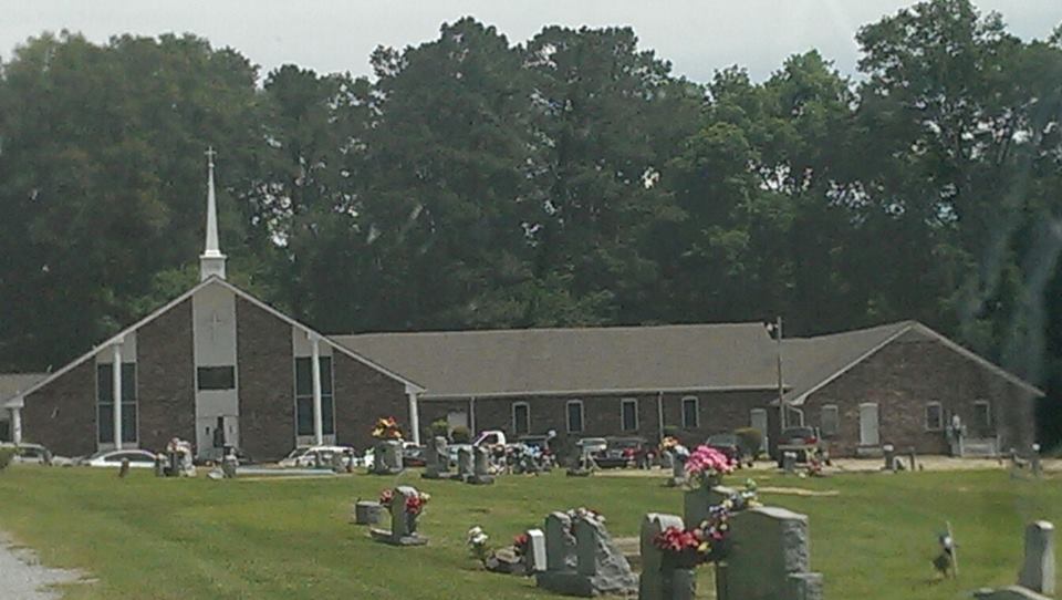
| Description | : | four miles north of Monticello, where old Hwy. 27 once crossed Fair River. Directions: Leave Monticello on old Hwy. 27 and go until the road dead ends at Fair River. The Friendship Church was at one time a white church. Elisha Douglas was pastor until it ceased to exist in the 1850's. It was reactivated ca. 1885 as a black church and retained the name Friendship. Historical and Grave information was provided by "Cemetery Records of Lawrence County, Mississippi, 1810 - 1988" which was compiled by the Lawrence County Historical Society. (Grave information was provided by "Cemetery Records of... Read More |
frequently asked questions (FAQ):
-
Where is Friendship Missionary Baptist Church Cemetery?
Friendship Missionary Baptist Church Cemetery is located at S32 TBN R11E Lawrence County ,Mississippi ,USA.
-
Friendship Missionary Baptist Church Cemetery cemetery's updated grave count on graveviews.com?
0 memorials
-
Where are the coordinates of the Friendship Missionary Baptist Church Cemetery?
Latitude: 31.6198700
Longitude: -90.1236500
Nearby Cemetories:
1. Wilson Cemetery
Lawrence County, USA
Coordinate: 31.6161003, -90.1044006
2. Wanilla Baptist Church Cemetery
Wanilla, Lawrence County, USA
Coordinate: 31.6432705, -90.1284332
3. Saint James Baptist Church Cemetery
Oma, Lawrence County, USA
Coordinate: 31.6514080, -90.1264080
4. Wanilla Cemetery
Lawrence County, USA
Coordinate: 31.6559020, -90.1284460
5. Pleasant Grove Cemetery
Lawrence County, USA
Coordinate: 31.6411500, -90.0727600
6. Sharp Cemetery
Lawrence County, USA
Coordinate: 31.6553700, -90.0827400
7. North Riverside Baptist Church Cemetery
Monticello, Lawrence County, USA
Coordinate: 31.5637240, -90.1128920
8. Monticello First Baptist Church Cemetery
Monticello, Lawrence County, USA
Coordinate: 31.5626000, -90.1238000
9. Mount Pleasant Missionary Baptist Church Cemetery
Lawrence County, USA
Coordinate: 31.6071300, -90.1925900
10. Monticello Pentecostal Cemetery
Monticello, Lawrence County, USA
Coordinate: 31.5613400, -90.1396800
11. Quin Temple Cemetery
Monticello, Lawrence County, USA
Coordinate: 31.5591300, -90.1378000
12. Smith-Gillaspy Cemetery
Lawrence County, USA
Coordinate: 31.5565300, -90.1098300
13. Pearl River Valley Cemetery
Monticello, Lawrence County, USA
Coordinate: 31.5662000, -90.0765000
14. Bethshan Memorial Park
Monticello, Lawrence County, USA
Coordinate: 31.5567400, -90.1513200
15. Seed Sowers Church and Ministry Cemetery
Monticello, Lawrence County, USA
Coordinate: 31.5559500, -90.1506100
16. Monticello City Cemetery
Monticello, Lawrence County, USA
Coordinate: 31.5487003, -90.1084213
17. Crooked Creek Baptist Church Cemetery
New Hebron, Lawrence County, USA
Coordinate: 31.6641693, -90.0555573
18. Monticello United Methodist Church Cemetery
Monticello, Lawrence County, USA
Coordinate: 31.5485100, -90.1040100
19. Faith Baptist Church Cemetery
Ferguson, Lawrence County, USA
Coordinate: 31.6576500, -90.0486700
20. Masonic Cemetery
Monticello, Lawrence County, USA
Coordinate: 31.5474205, -90.1034012
21. Saint James Cemetery Old
Lawrence County, USA
Coordinate: 31.6965500, -90.1196300
22. Shiloh Baptist Church Cemetery
Sontag, Lawrence County, USA
Coordinate: 31.6368103, -90.2148285
23. Bible Church Cemetery
Silver Creek, Lawrence County, USA
Coordinate: 31.6148470, -90.0286986
24. Pen Oak Cemetery
Lawrence County, USA
Coordinate: 31.5818300, -90.0350600