
| Memorials | : | 0 |
| Location | : | Prioleau, Berkeley County, USA |
| Coordinate | : | 33.3948360, -80.2113110 |
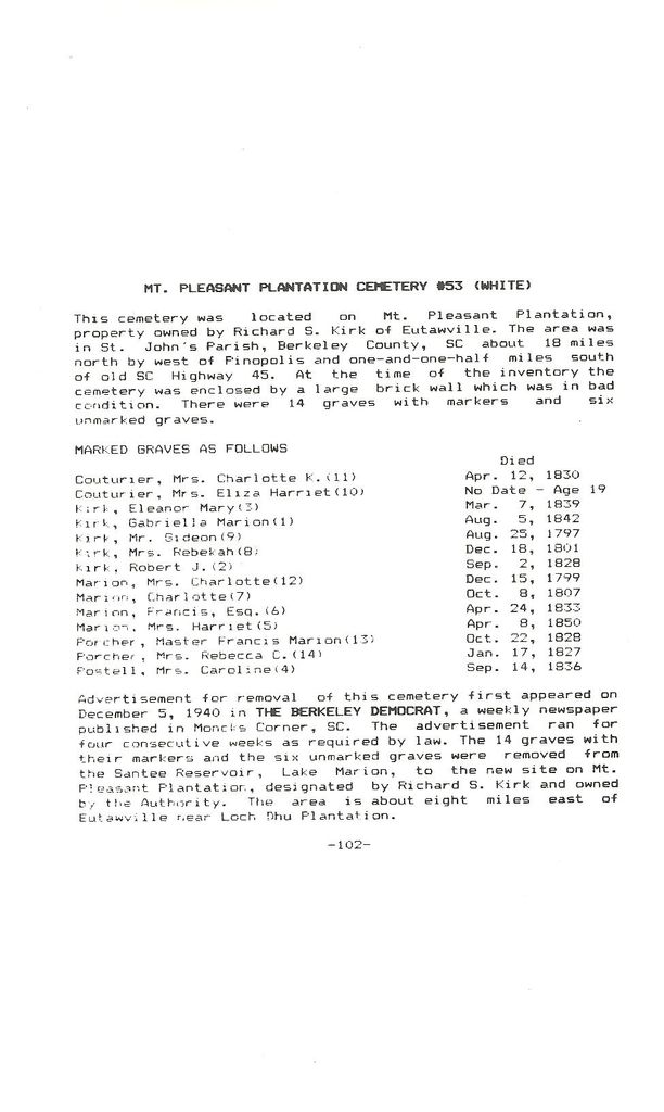
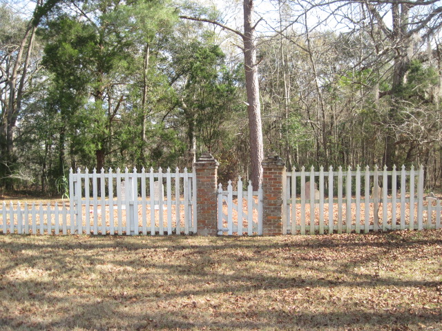
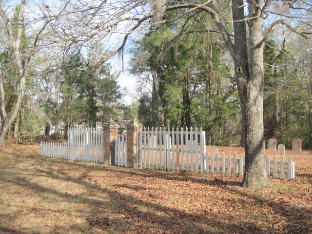
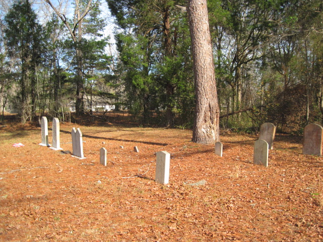
| Description | : | Located 5 miles east of Eutaw Springs & about 1.5 miles from Hwy. 6. This cemetery is a very small area enclosed by a broken brick wall. Located on Devans Estate Lane off of Spires Landing Road. Go to the end of the road you will pass a cemetery on the right side and then you will come to a gate. You can park at the gate and walk in about a 8 minute walk. The road is public and the cemetery is public. The gate is for security for the homes at the end of the road. |
frequently asked questions (FAQ):
-
Where is Mount Pleasant Plantation Cemetery?
Mount Pleasant Plantation Cemetery is located at Prioleau, Berkeley County ,South Carolina ,USA.
-
Mount Pleasant Plantation Cemetery cemetery's updated grave count on graveviews.com?
0 memorials
-
Where are the coordinates of the Mount Pleasant Plantation Cemetery?
Latitude: 33.3948360
Longitude: -80.2113110
Nearby Cemetories:
1. Loch Dhu Cemetery
Cross, Berkeley County, USA
Coordinate: 33.3919280, -80.2139550
2. Belmont Graveyard
Cross, Berkeley County, USA
Coordinate: 33.3872940, -80.2236990
3. Rocks Plantation Graveyard
Eutawville, Orangeburg County, USA
Coordinate: 33.4001510, -80.2340660
4. Church of the Epiphany Episcopal Church Cemetery
Berkeley County, USA
Coordinate: 33.4131012, -80.1994019
5. Cassada Plantation Cemetery
Nelson Hill, Berkeley County, USA
Coordinate: 33.3757480, -80.1865110
6. Johnson Casino Cemetery
Cross, Berkeley County, USA
Coordinate: 33.3687450, -80.1973930
7. Rocks Cemetery
Orangeburg County, USA
Coordinate: 33.3800011, -80.2422028
8. Unity Baptist Church of Eutawville
Eutawville, Orangeburg County, USA
Coordinate: 33.3801970, -80.2423470
9. Eternal Rest Cemetery
Cross, Berkeley County, USA
Coordinate: 33.3738980, -80.1828640
10. Zion Cemetery
Saint Stephen, Berkeley County, USA
Coordinate: 33.3608017, -80.1936035
11. Walnut Grove Cemetery
Eutawville, Orangeburg County, USA
Coordinate: 33.4054830, -80.2602880
12. Antioch Holiness Church Cemetery
Cross, Berkeley County, USA
Coordinate: 33.3558270, -80.1714740
13. Silas U.M. Church Cemetery
Eutawville, Orangeburg County, USA
Coordinate: 33.4000640, -80.2841900
14. Moses Lee Sr. Memorial Garden
Cross, Berkeley County, USA
Coordinate: 33.3386240, -80.2473340
15. Walworth Cemetery
Eutawville, Orangeburg County, USA
Coordinate: 33.3787350, -80.2870560
16. Immanuel Cemetery
Cross, Berkeley County, USA
Coordinate: 33.3715540, -80.1364440
17. Eadie Family Cemetery
Nelson Hill, Berkeley County, USA
Coordinate: 33.3853620, -80.1320290
18. Britton Family Cemetery
Pineville, Berkeley County, USA
Coordinate: 33.4266120, -80.1397690
19. Jerusalem United Methodist Church Cemetery
Cross, Berkeley County, USA
Coordinate: 33.3494520, -80.1484530
20. Bluefield Cemetery
Berkeley County, USA
Coordinate: 33.4472008, -80.1556015
21. Spring Hill Baptist Church Cemetery
Eutawville, Orangeburg County, USA
Coordinate: 33.4055400, -80.2949550
22. Belvidere Plantation Cemetery
Eutaw Springs, Orangeburg County, USA
Coordinate: 33.4055550, -80.2950600
23. Eutaw Springs Battle Ground
Eutaw Springs, Orangeburg County, USA
Coordinate: 33.4075870, -80.2985290
24. Thomas Walter Grave
Berkeley County, USA
Coordinate: 33.4538994, -80.1433029