
| Memorials | : | 47 |
| Location | : | Eutawville, Orangeburg County, USA |
| Coordinate | : | 33.4001510, -80.2340660 |
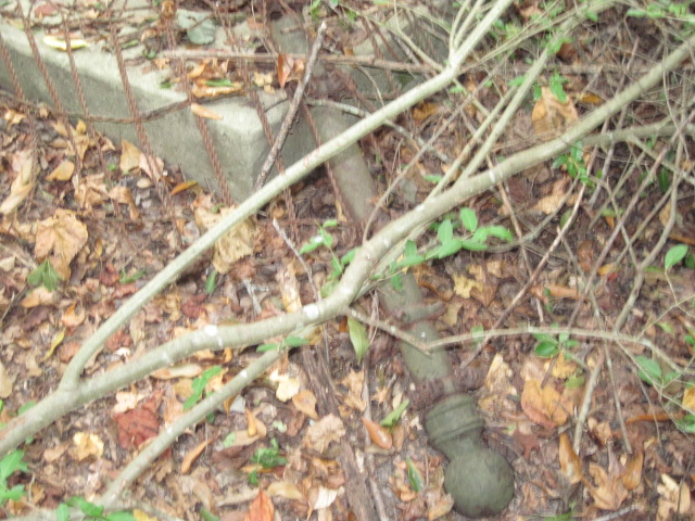
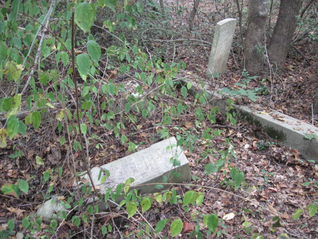
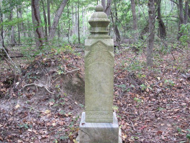
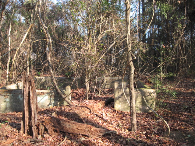
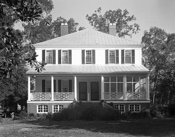
| Description | : | This cemetery is located in Rocks Pond Campground on Campground Road. Go to Entrance of Rocks Pond Campground. First right onto Whipperwhil Trail - all the way to the end of the laned road and to the right. Down the dirt path 100 feet on right in wooded area. Land that was once "The Rocks Plantation" and was built by Captain Peter Gaillard in 1802 and completed November 27, 1805. This was a large working plantation on the Santee River. The house was moved in 1942- 1.6 miles due to the rising waters of the Santee River for the hydroelectric project.... Read More |
frequently asked questions (FAQ):
-
Where is Rocks Plantation Graveyard?
Rocks Plantation Graveyard is located at Eutawville, Orangeburg County ,South Carolina ,USA.
-
Rocks Plantation Graveyard cemetery's updated grave count on graveviews.com?
47 memorials
-
Where are the coordinates of the Rocks Plantation Graveyard?
Latitude: 33.4001510
Longitude: -80.2340660
Nearby Cemetories:
1. Belmont Graveyard
Cross, Berkeley County, USA
Coordinate: 33.3872940, -80.2236990
2. Loch Dhu Cemetery
Cross, Berkeley County, USA
Coordinate: 33.3919280, -80.2139550
3. Mount Pleasant Plantation Cemetery
Prioleau, Berkeley County, USA
Coordinate: 33.3948360, -80.2113110
4. Unity Baptist Church of Eutawville
Eutawville, Orangeburg County, USA
Coordinate: 33.3801970, -80.2423470
5. Rocks Cemetery
Orangeburg County, USA
Coordinate: 33.3800011, -80.2422028
6. Walnut Grove Cemetery
Eutawville, Orangeburg County, USA
Coordinate: 33.4054830, -80.2602880
7. Church of the Epiphany Episcopal Church Cemetery
Berkeley County, USA
Coordinate: 33.4131012, -80.1994019
8. Silas U.M. Church Cemetery
Eutawville, Orangeburg County, USA
Coordinate: 33.4000640, -80.2841900
9. Johnson Casino Cemetery
Cross, Berkeley County, USA
Coordinate: 33.3687450, -80.1973930
10. Cassada Plantation Cemetery
Nelson Hill, Berkeley County, USA
Coordinate: 33.3757480, -80.1865110
11. Walworth Cemetery
Eutawville, Orangeburg County, USA
Coordinate: 33.3787350, -80.2870560
12. Eternal Rest Cemetery
Cross, Berkeley County, USA
Coordinate: 33.3738980, -80.1828640
13. Spring Hill Baptist Church Cemetery
Eutawville, Orangeburg County, USA
Coordinate: 33.4055400, -80.2949550
14. Belvidere Plantation Cemetery
Eutaw Springs, Orangeburg County, USA
Coordinate: 33.4055550, -80.2950600
15. Zion Cemetery
Saint Stephen, Berkeley County, USA
Coordinate: 33.3608017, -80.1936035
16. Eutaw Springs Battle Ground
Eutaw Springs, Orangeburg County, USA
Coordinate: 33.4075870, -80.2985290
17. Moses Lee Sr. Memorial Garden
Cross, Berkeley County, USA
Coordinate: 33.3386240, -80.2473340
18. Antioch Holiness Church Cemetery
Cross, Berkeley County, USA
Coordinate: 33.3558270, -80.1714740
19. Heyden Hill Cemetery
Eutawville, Orangeburg County, USA
Coordinate: 33.3747670, -80.3228830
20. Saint James Baptist Church Cemetery
Orangeburg County, USA
Coordinate: 33.3740860, -80.3227270
21. Eutawville Cemetery
Eutawville, Orangeburg County, USA
Coordinate: 33.4002991, -80.3302994
22. Bluefield Cemetery
Berkeley County, USA
Coordinate: 33.4472008, -80.1556015
23. Britton Family Cemetery
Pineville, Berkeley County, USA
Coordinate: 33.4266120, -80.1397690
24. Pressley Cemetery
Berkeley County, USA
Coordinate: 33.3177986, -80.2510986