
| Memorials | : | 1 |
| Location | : | Naomi, Marion County, USA |
| Coordinate | : | 39.9436300, -91.7074800 |
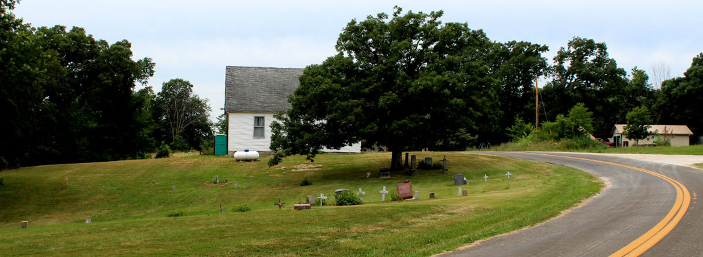
| Description | : | On Route P about 6 miles west of Hester in Marion County near the Lewis County line. Some local residents indicate a number of graves may have been destroyed when the road was first upgraded to blacktop, and that the original cemetery extended to the north side of where the road is currently situated. Attempts to locate the additional headstones, which according to this dubious rumor were "thrown in a ditch", have been unsuccessful. The cemetery is currently maintained in a reasonable manner. |
frequently asked questions (FAQ):
-
Where is Mount Sinai Cemetery?
Mount Sinai Cemetery is located at Naomi, Marion County ,Missouri ,USA.
-
Mount Sinai Cemetery cemetery's updated grave count on graveviews.com?
1 memorials
-
Where are the coordinates of the Mount Sinai Cemetery?
Latitude: 39.9436300
Longitude: -91.7074800
Nearby Cemetories:
1. Peak Cemetery
Naomi, Marion County, USA
Coordinate: 39.9427300, -91.7096700
2. Shumate Cemetery
Naomi, Marion County, USA
Coordinate: 39.9317200, -91.7151400
3. Humphrey Cemetery
Emerson, Marion County, USA
Coordinate: 39.9466610, -91.6613820
4. Waggener Cemetery
Lewis County, USA
Coordinate: 39.9806713, -91.7252778
5. Shackleford Cemetery
Lewis County, USA
Coordinate: 39.9867200, -91.7158000
6. Benbow Cemetery
Benbow, Marion County, USA
Coordinate: 39.9148600, -91.7505900
7. New Providence Presbyterian Cemetery
Benbow, Marion County, USA
Coordinate: 39.9193400, -91.7586900
8. Durham Cemetery
Durham, Lewis County, USA
Coordinate: 39.9802300, -91.6670200
9. Emerson Cemetery
Emerson, Marion County, USA
Coordinate: 39.8906600, -91.6968100
10. Briscoe Cemetery
Ewing, Lewis County, USA
Coordinate: 40.0074997, -91.6889038
11. Hebron Cemetery
Marion County, USA
Coordinate: 39.9399986, -91.6219025
12. Queen of Peace Cemetery
Ewing, Lewis County, USA
Coordinate: 40.0089600, -91.7194300
13. Ewing Memorial Cemetery
Ewing, Lewis County, USA
Coordinate: 40.0094210, -91.7202510
14. German Lutheran Cemetery
Ewing, Lewis County, USA
Coordinate: 40.0100000, -91.7205556
15. Sunrise Cemetery
Marion County, USA
Coordinate: 39.9207993, -91.6232986
16. Nelsonville Baptist Church Cemetery
Nelsonville, Marion County, USA
Coordinate: 39.9283900, -91.7960500
17. Hester Cemetery
Hester, Marion County, USA
Coordinate: 39.9108778, -91.6268255
18. Banks Cemetery
Marion County, USA
Coordinate: 39.8800011, -91.6552963
19. Mount Olivet Cemetery
Ewing, Lewis County, USA
Coordinate: 39.9914300, -91.7871100
20. Gilead Cemetery
Ewing, Lewis County, USA
Coordinate: 40.0194600, -91.6778400
21. McPike Cemetery
Marion County, USA
Coordinate: 39.8833008, -91.6380997
22. Tate Cemetery
Marion County, USA
Coordinate: 39.9001250, -91.6168886
23. Cool Spring Cemetery
Lewis County, USA
Coordinate: 40.0256004, -91.6810989
24. Sudduth Cemetery
Marion County, USA
Coordinate: 39.9211000, -91.5918400