
| Memorials | : | 0 |
| Location | : | Douglas County, USA |
| Coordinate | : | 33.5824480, -84.8953810 |
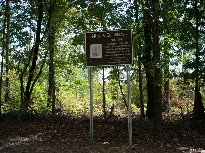
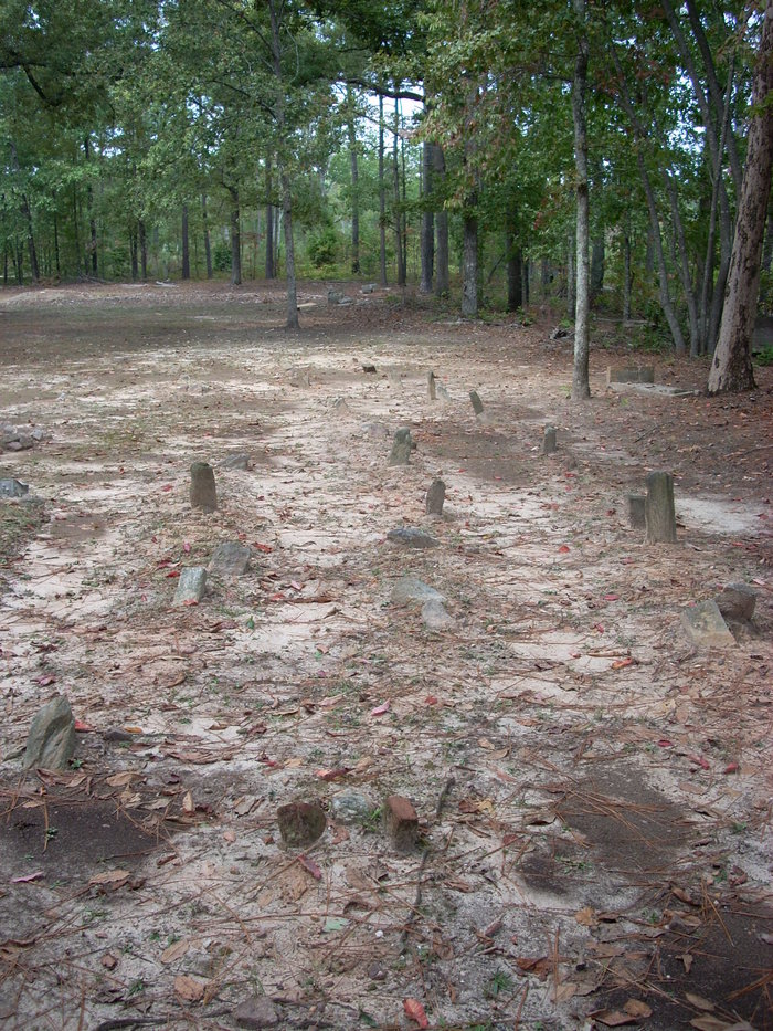
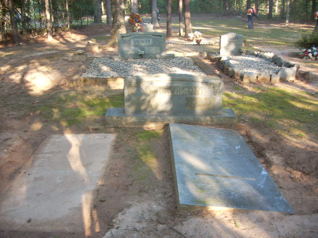
| Description | : | Mt. Sinai Church and cemetery were established in 1899, an African-American congregation. The church fell into disrepair and was finally demolished between 2005 and 2010. There are 50-60 graves, but only 15 have inscribed markers -- and 9 of those are the temporary markers provided by funeral homes at the time of burial. All other graves are marked only by fieldstone markers or obvious grave-mounding. The cemetery is still in use -- the most recent burial was in 2012. Since 2008 the cemetery has been cleaned annually by a sheriff's inmate crew under the supervision of the Douglas... Read More |
frequently asked questions (FAQ):
-
Where is Mount Sinai Church Cemetery?
Mount Sinai Church Cemetery is located at Corner of W. Carroll Rd. and 200 Rd. Douglas County ,Georgia , 30187USA.
-
Mount Sinai Church Cemetery cemetery's updated grave count on graveviews.com?
0 memorials
-
Where are the coordinates of the Mount Sinai Church Cemetery?
Latitude: 33.5824480
Longitude: -84.8953810
Nearby Cemetories:
1. Sticher Family Cemetery
Winston, Douglas County, USA
Coordinate: 33.5875000, -84.8909630
2. Dingler Family Cemetery
Winston, Douglas County, USA
Coordinate: 33.5893910, -84.8917330
3. Stovall Cemetery
Whitesburg, Carroll County, USA
Coordinate: 33.5726510, -84.8971080
4. Jones-Cook Cemetery
Carroll County, USA
Coordinate: 33.5732002, -84.8909098
5. Consolation Baptist Church Cemetery
Whitesburg, Carroll County, USA
Coordinate: 33.5731010, -84.9171982
6. Bushby Church Cemetery
Carrollton, Carroll County, USA
Coordinate: 33.5843290, -84.9204109
7. Oak Grove Cemetery
Fairplay, Douglas County, USA
Coordinate: 33.6057020, -84.8995540
8. Oak Grove Cemetery
Winston, Douglas County, USA
Coordinate: 33.6065123, -84.8992145
9. Holland Mills Cemetery
Byers Crossroads, Carroll County, USA
Coordinate: 33.5687180, -84.8654040
10. Douglas Chapel Church of God Cemetery
Douglasville, Douglas County, USA
Coordinate: 33.6125200, -84.8920520
11. Bright Star Cemetery
Carroll County, USA
Coordinate: 33.6046982, -84.9214020
12. Friendship Baptist Church Cemetery
Douglasville, Douglas County, USA
Coordinate: 33.6147910, -84.8843790
13. Saint Paul Methodist Church Cemetery
Whitesburg, Carroll County, USA
Coordinate: 33.5503006, -84.9094009
14. Mount Zion Baptist Church Cemetery
Hannah, Douglas County, USA
Coordinate: 33.5755800, -84.8531600
15. Richards Cemetery
Byers Crossroads, Carroll County, USA
Coordinate: 33.5696390, -84.8545250
16. King Cemetery
Carrollton, Carroll County, USA
Coordinate: 33.6092830, -84.9270310
17. Faith Baptist Church Cemetery
Fairplay, Douglas County, USA
Coordinate: 33.6276390, -84.8882100
18. Mars Hill Baptist Church Cemetery
Carroll County, USA
Coordinate: 33.6133003, -84.9364014
19. Hinesley Cemetery
Cross Plains, Carroll County, USA
Coordinate: 33.5675011, -84.9514008
20. Mount Avery Missionary Baptist Memory Gardens
Whitesburg, Carroll County, USA
Coordinate: 33.5317001, -84.8966980
21. Union Grove Christian Church Cemetery
Fairplay, Douglas County, USA
Coordinate: 33.6247890, -84.8596510
22. Head Family Cemetery
Whitesburg, Carroll County, USA
Coordinate: 33.5410910, -84.8566390
23. Word Cemetery
Byers Crossroads, Carroll County, USA
Coordinate: 33.5668500, -84.8338560
24. County Line Primitive Baptist Church Cemetery
Whitesburg, Carroll County, USA
Coordinate: 33.5477982, -84.8442001